| Sunday | Sunday Night | Monday | |
|---|---|---|---|
| Cloud Cover: | Overcast | Mostly Cloudy | Overcast |
| Temperatures: | 25 to 30 deg. F. | 15 to 20 deg. F. | 22 to 27 deg. F. |
| Wind Direction: | SE | N | NW |
| Wind Speed: | 5 to 5 mph, gusting to 25 mph | 10 to 15 mph, gusting to 25 mph | 5 to 15 mph, gusting to 25 mph |
| Snowfall: | 3 to 6 in. | 3 to 6 in. | 0 to 2 in. |
| Snow Line: | 2000 FT | 1000 FT | 1000 FT |
Flathead Range and Glacier National Park
How to read the forecast
Winds continue to form fresh slabs below ridgelines and on cross-loaded slopes. An incoming storm will thicken existing slabs while drifting snow onto atypical aspects. Slabs are forming on weak layers and crusts adding to their instability. As you gain elevation evaluate new snow totals, bonding with the underlying layers and look for blowing snow.

3. Considerable
?
Above 6500 ft.
2. Moderate
?
5000-6500 ft.
2. Moderate
?
3500-5000 ft.
- 1. Low
- 2. Moderate
- 3. Considerable
- 4. High
- 5. Extreme
-
Type ?
-
Aspect/Elevation ?

-
Likelihood ?CertainVery LikelyLikelyPossible
 Unlikely
 -
Size ?HistoricVery LargeLargeSmall

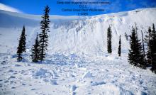
Observations yesterday from interior Glacier Park and the Flathead Range confirm fresh slab development from westerly winds. Recent snow is drifting into slabs a foot or more thick below ridgelines and on cross-loaded terrain. Winds will shift to the east today forming thin slabs on westerly aspects. As you gain elevation look for blowing snow and signs of fresh slabs such as cracking. Collapsing where a relatively dense slab overlies lower density snow is a red flag. Wind sheltered slopes will hold softer snow.
-
Type ?
-
Aspect/Elevation ?
-
Likelihood ?CertainVery LikelyLikelyPossible
 Unlikely
 -
Size ?HistoricVery LargeLargeSmall

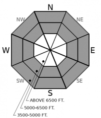
Recent snowfall of up to 8" fell on top of a widespread rain crust. Facets and surface hoar cap this crust adding to the instability of fresh slabs. We are most concerned with the middle elevations where the weak layers are more developed. An additional few inches today will thicken slabs and potentially make them more reactive to triggering. Surface hoar is notorious for surprising us with avalanches that propagate further than expected. Evaluate new snow totals and bonding with the underlying crust. Shooting cracks are an obvious red flag.
-
Type ?
-
Aspect/Elevation ?

-
Likelihood ?CertainVery LikelyLikelyPossible
 Unlikely
 -
Size ?HistoricVery LargeLargeSmall

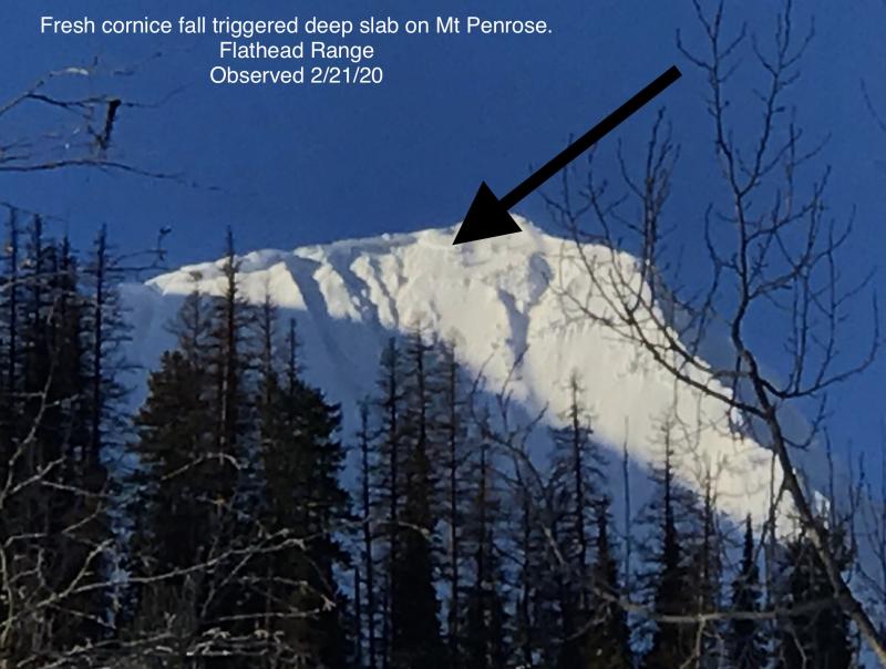
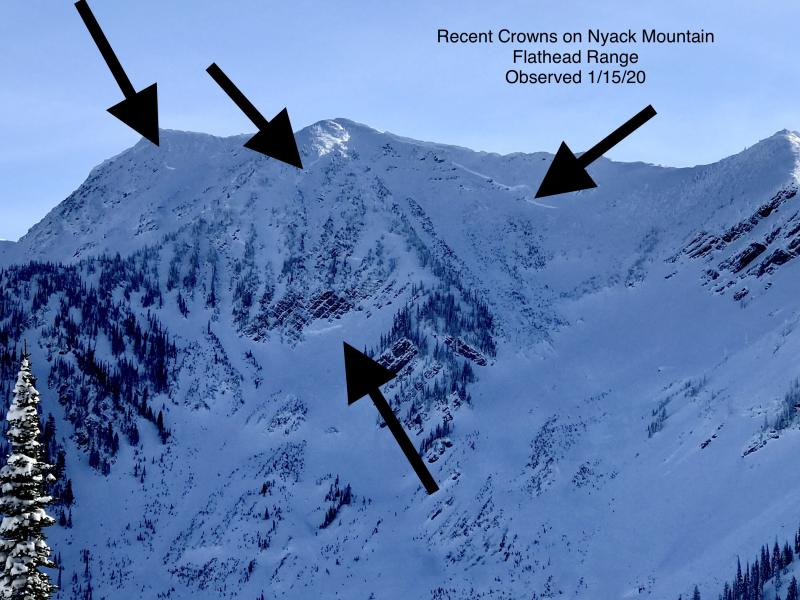
Weak faceted snow buried deeply in our snowpack remains a concern, especially during loading events. These layers can awaken naturally by loading from snowfall or wind, small slides, and cornice falls. They can also still be triggered by a rider hitting the "Not-So-Sweet" spot on a slope where the slab thins. Deep slabs surprise us with their ability to propagate above a rider and across multiple slopes. Avoidance of steep rocky areas is the answer to this complex problem. Well supported, concave slopes with a uniform snowpack are preferred.
The storm system which entered our area Thursday ended yesterday around noon. Snowfall favored the Swan Range with up to a foot of snow with other locations receiving about half of that. The storm started cold but ended warm leaving us with an inverted snow surface. Westerly winds accompanied this storm forming thin slabs. Hornet, in the northern Whitefish Range, had 18 consecutive hours of moderate winds with strong gusts. Therefore we have replaced storm slabs with wind slabs are our #1 problem in the Whitefish Range. Wind slabs remain our #1 problem in the Flathead Range and GNP where the Snowslip weather station in John F. Stevens Canyon reported moderate to strong gusts yesterday and overnight. We are keeping Storm Slabs as our #1 problem in the Swan Range due to the amount of new snow they have received.
A weather system will enter our area today producing wrap around moisture favoring the Swan Range, Flathead Range, and Glacier Park. Winds will shift to the east and load atypical aspects. Easterly aspects hold fresh snow available for transport and we expect thin wind slabs to form on westerly aspects. Slabs may form on scoured surfaces adding to their instability.
Low-pressure will enter our area today bringing slightly cooler temperatures, light snowfall, and easterly winds. Precipitation will continue tonight before dissipating by tomorrow morning.
This forecast applies only to backcountry areas outside established ski area boundaries. The forecast describes general avalanche conditions and local variations always occur. This forecast expires at midnight on the posted day unless otherwise noted. The information in this forecast is provided by the USDA Forest Service who is solely responsible for its content.


