| Saturday | Saturday Night | Sunday | |
|---|---|---|---|
| Cloud Cover: | Overcast | Mostly Cloudy | Overcast |
| Temperatures: | 30 to 35 deg. F. | 23 to 28 deg. F. | 25 to 30 deg. F. |
| Wind Direction: | SW | SW | S |
| Wind Speed: | 15 to 25 mph, gusting to 35 mph | 10 to 20 mph, gusting to 30 mph | 5 to 15 mph, gusting to 25 mph |
| Snowfall: | 2 TO 4 in. | 0 TO 2 in. | 2 TO 4 in. |
| Snow Line: | 4000 FT | 3000 FT | 3000 FT |
Swan Range
How to read the forecast
A Special Avalanche Bulletin remains in effect until this evening. New snow continues to load weak surface hoar, facets, and crusts with ever-thicker slabs. Skiers triggerd several avalanches on these fragile layers yesterday at middle elevations. Today we expect these slabs to behave in unpredictable ways – breaking further and wider across the slopes. Shooting cracks and whumpfing are red flags. We recommend avoiding avalanche terrain.

3. Considerable
?
Above 6500 ft.
4. High
?
5000-6500 ft.
3. Considerable
?
3500-5000 ft.
- 1. Low
- 2. Moderate
- 3. Considerable
- 4. High
- 5. Extreme
-
Type ?
-
Aspect/Elevation ?
-
Likelihood ?CertainVery LikelyLikelyPossible
 Unlikely
 -
Size ?HistoricVery LargeLargeSmall

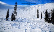
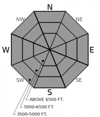
Fresh storm slabs up to 18” deep now cover fragile layers of surface hoar, faceted snow, and crusts. Riders in Jewel Basin triggered several small to large avalanches yesterday while testing this problem. These slabs have thickened overnight and may break in unexpected ways today. Cracks may propagate long distances and slabs may break on the slope above you. Avoiding avalanche terrain is the best way to stay safe today.
-
Type ?
-
Aspect/Elevation ?
-
Likelihood ?CertainVery LikelyLikelyPossible
 Unlikely
 -
Size ?HistoricVery LargeLargeSmall

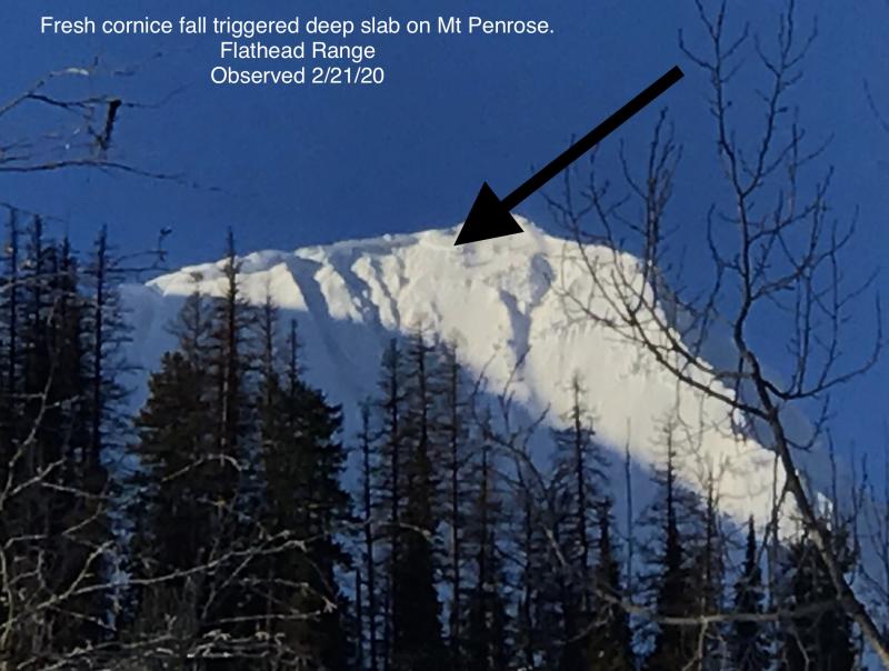
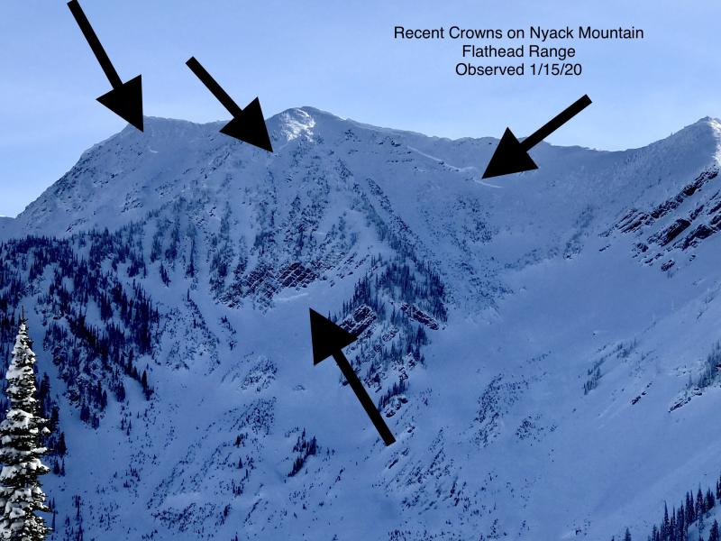
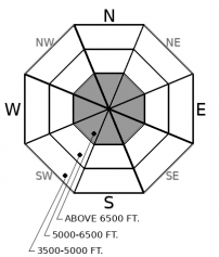
Thick slabs have broken on deeply buried weak layers with every major storm cycle this winter. The most recent was a number of very destructive slides that broke up to 5 feet deep at upper elevations in the Flathead Range and Glacier Park. These slides have been commonly triggered by cornice falls or small avalanches in the upper snowpack. As new loading continues today, with an expected uptick in avalanche activity, be extra cautious of overhead hazards from alpine start zones. Choose terrain that minimizes your exposure below steep, rocky, variable start zones.
A Special Avalanche Bulletin remains in effect through this evening. Dangerous avalanche conditions exist in parts of the forecast area. In other areas, avalanche danger is heightened at a minimum. Conservative decision making is essential for your safety this weekend.
New snow between 6 and 10” has fallen since Thursday. The Swan Range continues to receive the most new load. As showers continue throughout today, existing slabs with thicken, become more cohesive, and may break in unpredictable ways. Southwesterly winds are expected to increase near the Divide. Fragile layers of surface hoar, facets, and crusts that developed during high pressure last week are now sensitive buried weak layers. New avalanches may fail in surprising ways and be larger than expected under these conditions. Slabs can break above you on the slope. Consider overhead hazards and new loading continues to add weight to deeply buried, old weak layers at the bottom of the snowpark.
A weak disturbance pushes though the area today with a few inches of new snow, light to moderate snowfall, and gusty winds this afternoon over the Divide.
This forecast applies only to backcountry areas outside established ski area boundaries. The forecast describes general avalanche conditions and local variations always occur. This forecast expires at midnight on the posted day unless otherwise noted. The information in this forecast is provided by the USDA Forest Service who is solely responsible for its content.


