| Monday | Monday Night | Tuesday | |
|---|---|---|---|
| Cloud Cover: | 70% | 80% | 90% |
| Temperatures: | 23-28 deg. F. | 15-20 deg. F. | 25-30 deg. F. |
| Wind Direction: | South/Southwest | South/Southwest | South/Southwest |
| Wind Speed: | 10-15 mph with gusts to 30 | 10-15 mph with gusts to 30 | 15-20 mph with gusts to 40 |
| Snowfall: | 1-3 in. | 0-2 in. | 1-3 in. |
| Snow Line: | 2500 | 2500 | 1500 |
Whitefish Range
Swan Range
Flathead Range and Glacier National Park
How to read the forecast
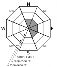
Increasing winds will form shallow slabs at upper elevations. Evaluate wind loaded terrain below ridgelines and in gulleys. Generally stable conditions are found on wind protected slopes. Sluffing remains possible in very steep terrain. Early season obstacles can increase the consequences of an avalanche.

1. Low
?
Above 6500 ft.
1. Low
?
5000-6500 ft.
1. Low
?
3500-5000 ft.
- 1. Low
- 2. Moderate
- 3. Considerable
- 4. High
- 5. Extreme
-
Type ?
-
Aspect/Elevation ?

-
Likelihood ?CertainVery LikelyLikelyPossible
 Unlikely
 -
Size ?HistoricVery LargeLargeSmall

Breezy conditions may continue forming shallow soft slabs at upper elevations. Slabs may bond poorly to the underlying weak layers. Thin snow coverage amplifies the risk of a small slide carrying you through trees and rocks. Evaluate wind loaded slopes before committing to them. Cracking in the snow surface is a sign of an unstable slab.
Observations Friday revealed instabilities in recently formed wind slabs (Example 1, Example 2). These instabilities are associated with a variety of weak layers on which the slabs are resting. Yesterday's observations found slabs had formed only in isolated locations. With increasing wind speeds overnight and breezy conditions expected today a more widespread slab development is possible. In locations harboring a loose snow surface drifting onto leeward aspects should continue. Loose surface snow is found on slopes not affected by the wind or sun. Natural and human triggered sluffing continues in these areas (Example 3, Example 4).
Today's light snowfall will not be enough to increase the avalanche danger. However, a storm system entering our area Tuesday night should change that. In sheltered locations, new snow will fall on a variety of weak surfaces that have developed during our prolonged dry cold spell. In areas affected by the wind or sun, new snow may bond poorly to the surface crust. In other locations, weak snow, such as surface hoar, is buried beneath the surface (Example 5) which may amplify the size of the avalanche. Thin snowpacks combined with cold temperatures tend to develop weak layers. Our snowpack is weaker than normal and we are anticipating avalanche activity if Tuesday's forecast verifies.
To find out more about our snowpack, weather and what's new with FAC check out Zach's recent blog post.
We appreciate the early season observations that have been submitted. If you get into the mountains, let us know what you see.
Our next Avalanche Awareness talk is Thursday, December 20th at Penco Power Products at 6:30 p.m.!
A cold front enters our area today bringing light snow and breezy conditions. A much stronger system is on tap for Tuesday night with decent snow and strong winds.
This forecast applies only to backcountry areas outside established ski area boundaries. The forecast describes general avalanche conditions and local variations always occur. This forecast expires at midnight on the posted day unless otherwise noted. The information in this forecast is provided by the USDA Forest Service who is solely responsible for its content.


