Whitefish Range
Swan Range
Flathead Range and Glacier National Park
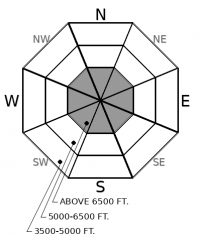
How to read the forecast
New snow and increasing winds on Friday may create persisting instabilities on higher elevation, wind drifted terrain. Early season obstacles can increase the consequences of an avalanche. The snowpack remains generally too shallow on most mid and lower elevation slopes for avalanche concerns.

No Rating
?
Above 6500 ft.
No Rating
?
5000-6500 ft.
No Rating
?
3500-5000 ft.
-
Type ?
-
Aspect/Elevation ?

-
Size ?HistoricVery LargeLargeSmall

A cold storm is forecasted to bring between 4-11” of new snow by Friday afternoon. Winds will shift from southwest to northeast as the front passes. Newly drifted snow will form on upper elevation slopes below ridgelines and in cross-loaded gullies on a variety of aspects. Beware of pillow shaped features with thicker snow in steep terrain. Wind slabs may remain sensitive where they form on top of existing weak layers.
Weather sensors around 6,000’ are showing between 15 and 23” as of Thursday. At middle and lower elevations coverage is much shallower with most stations reporting around 3” near the 4,000’ mark.
Our early observations from this season point to a right-side up snowpack at upper elevations with soft snow over denser snow and a hard crust. The recent clear weather has formed surface hoar and is decaying the snow surface into weak faceted grains. Observers noted weak layer growth on all aspects over the past week. (See these observations from the Swan and Whitefish Ranges on Tuesday and in the Flathead Range on Monday). Facets and surface hoar bond poorly to new overlying snow and can cause prolonged instabilities after a slab forms above them.
As a cold front passes through the area beginning Thursday night winds are set to increase to around 20 mph with gusts to near 50 mph. Winds will shift from southwest to north-northeast on Friday. 4-11” of snow is forecasted with this storm, with the Swan and Flathead Ranges seeing the largest amounts. The new snow will likely form drifts on upper elevation slopes increasing the wind slab hazard. The slabs could grow large enough to bury someone if we see the high end of snow and wind forecasts. Use caution in terrain with denser, rounded drifts. These often form below ridgelines or on crossloaded features at high elevations, similar to these skier triggered avalanches earlier in the week.
As high pressure builds back into the region Saturday into mid week, some of these newly formed wind slabs will begin to strengthen. But in areas where drifts have formed on top of weak layers, they may persist for longer than expected.
This is an early season snowpack update. The FAC will continue to monitor conditions and update information as conditions warrant. If you are traveling in the high country, send us an observation!
We will be producing mountain weather forecasts during our regular season operations. You can find daily backcountry specific weather forecasts from NOAA here.
This advisory applies only to backcountry areas outside established ski area boundaries. This advisory describes general avalanche conditions and local variations always occur. This advisory expires at midnight on the posted day unless otherwise noted. The information in this advisory is provided by the USDA Forest Service who is solely responsible for its content.
Call
Contact
In Partnership With

In Partnership With


