| Monday | Monday Night | Tuesday | |
|---|---|---|---|
| Cloud Cover: | Mostly sunny | Clear and cool | Continued sunny |
| Temperatures: | 35 to 40 deg. F. | 15 to 20 deg. F. | 37 to 42 deg. F. |
| Wind Direction: | SW | S | SW |
| Wind Speed: | 1to 11mph | 1 to 11 mph | 0 to 5 mph |
| Snowfall: | 0 in. | 0 in. | 0 in. |
| Snow Line: |
Whitefish Range
Swan Range
Flathead Range and Glacier National Park
How to read the forecast
This morning the avalanche danger is LOW but will rise to MODERATE with sunshine and warming. Wet avalanche activity will increase through the day on sunny aspects. Avoid cornices and use caution on sunny slopes after they soften. Safer riding conditions and better snow quality exist on shady aspects.

2. Moderate
?
Above 6500 ft.
2. Moderate
?
5000-6500 ft.
2. Moderate
?
3500-5000 ft.
- 1. Low
- 2. Moderate
- 3. Considerable
- 4. High
- 5. Extreme
-
Type ?
-
Aspect/Elevation ?
-
Likelihood ?CertainVery LikelyLikelyPossible
 Unlikely
 -
Size ?HistoricVery LargeLargeSmall

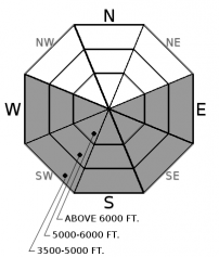
Yesterday was the second day of a multi-day wet loose avalanche cycle. Slightly warmer temperatures and less morning cloud cover contributed to natural activity at mid and upper elevations. Today, warmer temperatures with fewer clouds will cause natural activity on slopes not warmed Saturday and Sunday. Cold overnight temperatures formed a stout surface crust on sunny aspects at all elevations. This crust has strengthened the surface but will eventually break down allowing for human-triggered slides and natural activity. If you find yourself breaking through the crust and sinking into the moist incohesive snow below it is time to move to a different aspect. Avoid traveling in or above terrain traps and long-running gullies while the surface snow is moist.
-
Type ?
-
Aspect/Elevation ?
-
Likelihood ?CertainVery LikelyLikelyPossible
 Unlikely
 -
Size ?HistoricVery LargeLargeSmall

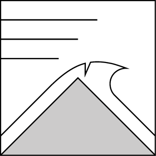
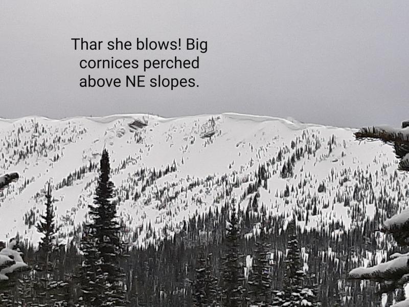
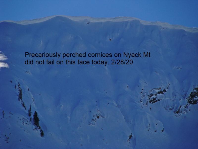
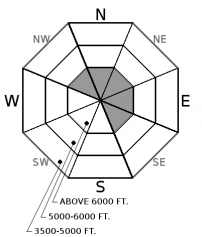
Unlike wet loose activity, cornice fall is trending toward likely as our warming event continues. Cornices around the area are HUGE and therefore take quite a bit of heat to warm and weaken. Cornices can fail without warning and may trigger deeper slab avalanches on the slopes below. Give cornices a wide berth while traveling ridgelines and recreating on the slopes below.
On Saturday, morning clouds prevented some sunny slopes from warming and producing a wet loose cycle. Yesterday, clear morning skies allowed some of those slopes to warm and shed snow but afternoon clouds limited overall activity. Today we are expecting warmer temperatures and fewer clouds which should initiate slides on upper elevation slopes that have yet to warm. After two days of warming and two nights with a hard freeze expect to find a thick strong surface crust on steep sunny slopes. Today's solar input should break this crust down forming wet loose avalanche conditions.
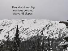
Cornices around the area are HUGE! The likelihood of a cornice failure is increasing daily with continued warming. Give cornices a wide berth; they have grown to dangerously large sizes this season and can also act as triggers for larger avalanches (photo).
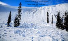
Natural and human triggered slides occurred recently on slightly wind loaded mid and upper elevation slopes (photo 1, photo 2, photo 3). Some of these slides can be attributed to a layer of surface hoar formed either March 3 or 7 and buried by the March 8/9 storm. These slides are isolated and we don't know yet if this will be a problem down the road. Currently, this surface hoar layer can be found about a foot below the surface.
Don't miss out on our final two avalanche education lectures this season at Penco Power Products in Kalispell and Whistling Andy Distillery in Bigfork. Thanks to all who participated in our avalanche education program this season and we're already planning next years line-up!
High pressure continues to build with slightly warmer temperatures and less cloud cover than yesterday. Even warmer conditions are on tap for Tuesday. Unsettled weather moves into our area Wednesday.
This advisory applies only to backcountry areas outside established ski area boundaries. This advisory describes general avalanche conditions and local variations always occur. This advisory expires at midnight on the posted day unless otherwise noted. The information in this advisory is provided by the USDA Forest Service who is solely responsible for its content.


