| Friday | Friday Night | Saturday | |
|---|---|---|---|
| Cloud Cover: | Increasing clouds during the day | Light snow | Light snow |
| Temperatures: | 15 to 20 deg. F. | 10 to 15 deg. F. | 20 to 25 deg. F. |
| Wind Direction: | SW | SW | SW |
| Wind Speed: | 5 to 10 mph | 10 to 15 mph, gusts of 25 mph | 5 to 10 mph, gusts 20 mph |
| Snowfall: | 0 in. | 1 to 3 in. | 1 to 3 in. |
| Snow Line: |
Whitefish Range
Swan Range
Flathead Range and Glacier National Park
How to read the forecast
Benign weather is consolidating and strengthening the upper snowpack forming generally safe conditions. Upper elevation wind slabs are identified by shooting cracks or collapses. LOW danger doesn’t mean NO danger. Use safe travel protocols including only exposing one person to a slope at a time.

1. Low
?
Above 6500 ft.
1. Low
?
5000-6500 ft.
1. Low
?
3500-5000 ft.
- 1. Low
- 2. Moderate
- 3. Considerable
- 4. High
- 5. Extreme
-
Type ?
-
Aspect/Elevation ?
-
Likelihood ?CertainVery LikelyLikelyPossible
 Unlikely
 -
Size ?HistoricVery LargeLargeSmall

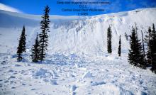
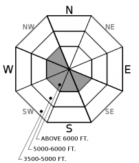
Thick, dense slabs and lens shaped pillows are most likely found on leeward slopes and cross-loaded terrain at upper elevations in atypical locations from last weekend’s northeast winds. Yesterday, professional observers in the JFS Canyon reported wind slabs being unreactive to ski cuts, stomping, and “dishwasher” sized cornice falls and other observations suggested only minor loose snow movement in steeper terrain. Avoid pillow shaped drifts of thicker snow and look for cracking in the snow surface.
-
Type ?
-
Aspect/Elevation ?
-
Likelihood ?CertainVery LikelyLikelyPossible
 Unlikely
 -
Size ?HistoricVery LargeLargeSmall

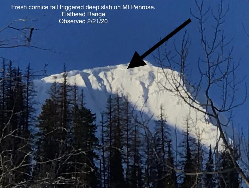
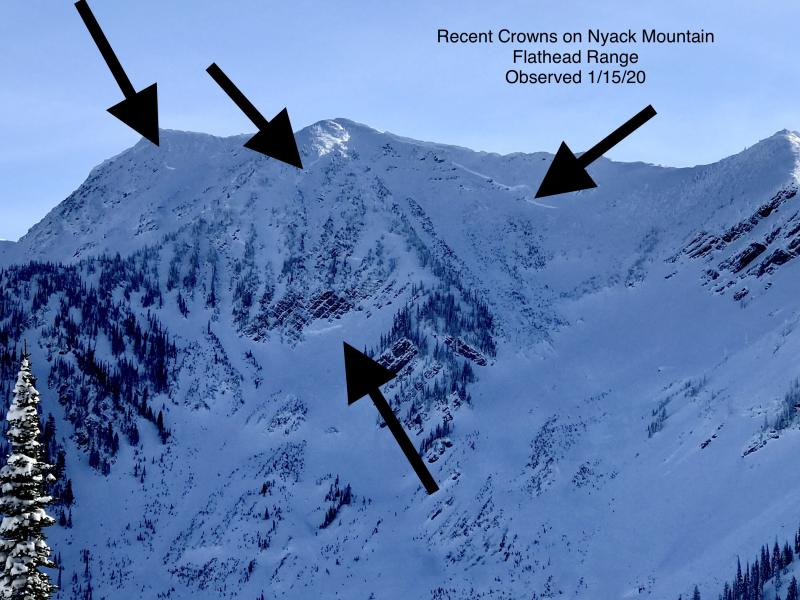
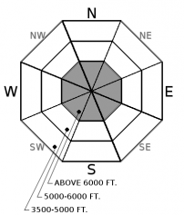
Deep slabs remain a low likelihood, high consequence problem. We have limited observations of deep slabs failing naturally during the last storm cycle and confined to the Flathead Range. These large and deadly avalanches are becoming more stubborn to human triggers as snow depths increase. Deep slabs are most likely triggered from shallow, rocky terrain or cornice falls in alpine terrain. Choose slopes well anchored by trees or supported by concave terrain features along with deep, uniform snow cover at higher elevations. This blog post provides more insight into the problem.
Do you remember where you were on December 14, 2017? I do. I was sitting in the same seat writing about isolated areas of unstable, loose dry snow or point releases along with generally safe riding conditions. That was also the last day we were able to use LOW danger at all elevations and mountain ranges in our advisory area. Since then, our snowpack has experienced many changes including continued snowfall, multiple rain on snow events, battling airmasses, strong wind events, and multiple large natural avalanche cycles.
The benign weather over the past 5 days is allowing the upper snowpack to consolidate and gain strength. No wind loading or snow since Sunday along with no signs of instability or avalanche activity reported since Monday has allowed us to trend the danger to LOW. Wind slabs that formed from strong northeast winds are becoming more stubborn to human triggering and larger cornice falls and identified by shooting cracks and collapses. Plentiful snowfall this winter has formed a deep snowpack in many locations making human triggering of deep slab unlikely, but the Thanksgiving facet/ crust combo remains making it a high consequence problem demanding respect. You can avoid our deep slab problem by avoiding steep, rocky terrain or unsupported slopes at higher elevations.
LOW danger doesn’t mean NO danger and a holistic approach should be taken when evaluating slope specific stability. When assessing slope stability, don’t rely on just one piece of information but look at the bigger picture. Hunt for wind-sheltered slopes with the best riding conditions and safest skiing or riding. Good habits lead to positive outcomes so make a plan, expose only one person at a time on the slope, and don’t linger in runout zones.
Light southwest flow is being observed over northwest Montana this morning. A series of storm systems begin to move into our region later today with increasing clouds and winds by this evening. Each passing system is expected to bring light to moderate snow accumulations with highest snowfall totals staying to our south. The active weather pattern continues through the weekend and into next week.
This advisory applies only to backcountry areas outside established ski area boundaries. This advisory describes general avalanche conditions and local variations always occur. This advisory expires at midnight on the posted day unless otherwise noted. The information in this advisory is provided by the USDA Forest Service who is solely responsible for its content.


