| Wednesday | Wednesday Night | Thursday | |
|---|---|---|---|
| Cloud Cover: | Partly cloudy and temperatures moderating | Frigid | Mostly cloudy and temperatures warming |
| Temperatures: | 12 to 17 deg. F. | -10 to -5 deg. F. | 17 to 22 deg. F. |
| Wind Direction: | SW | SW | E |
| Wind Speed: | 0 to 10 | 0 to 10 | 0 to 10 |
| Snowfall: | 0 in. | 0 in. | 0 in. |
| Snow Line: |
Whitefish Range
Swan Range
Flathead Range and Glacier National Park
How to read the forecast
Wind slabs still linger in lee features at higher elevations. Watch for signs of locally unstable snow, such as whumping and shooting cracks. Wind sheltered terrain offers the safest snow and best riding conditions.

2. Moderate
?
Above 6500 ft.
1. Low
?
5000-6500 ft.
1. Low
?
3500-5000 ft.
- 1. Low
- 2. Moderate
- 3. Considerable
- 4. High
- 5. Extreme
-
Type ?
-
Aspect/Elevation ?
-
Likelihood ?CertainVery LikelyLikelyPossible
 Unlikely
 -
Size ?HistoricVery LargeLargeSmall

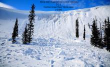
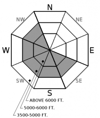
Strong winds over the weekend drifted snow into thick slabs on leeward and cross-loaded terrain features, most commonly at higher elevations. Recent observations of collapses and shooting cracks highlight the potential for human triggering (Example A, Example B). Pay attention to the snow surface and avoid pillow shaped drifts of thicker snow. Wind slabs exist in atypical locations from unusual northeast winds.
-
Type ?
-
Aspect/Elevation ?
-
Likelihood ?CertainVery LikelyLikelyPossible
 Unlikely
 -
Size ?HistoricVery LargeLargeSmall

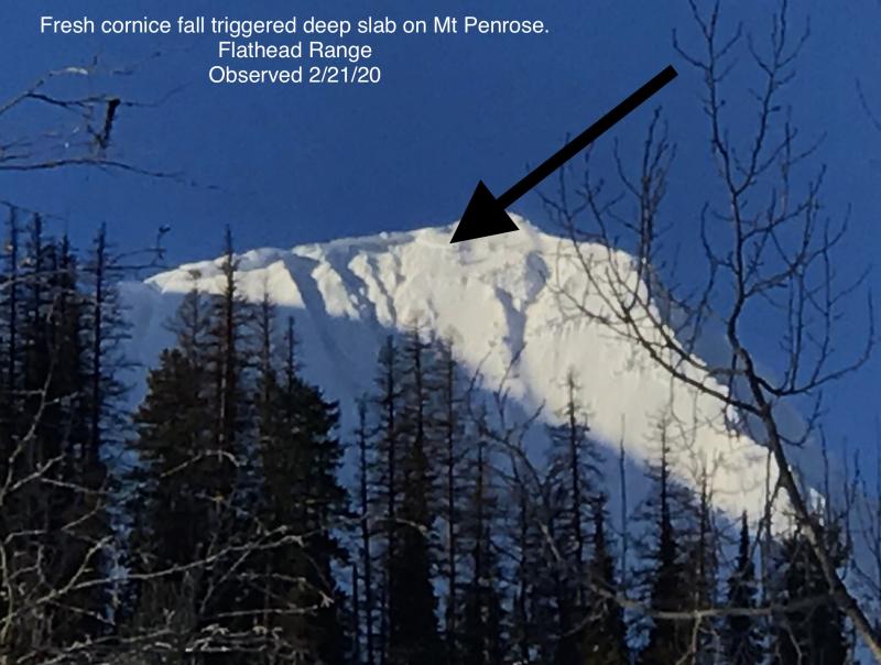
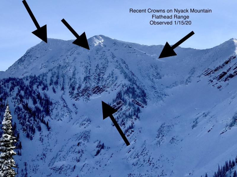
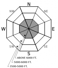
Several deep, hard slabs failed during last weekend's storm in the Flathead Range (Example A). Deep slabs are stubborn to human triggers today, but the severe consequences of a slide failing on weak layers near the ground demands your attention. Deep slabs are most likely to be triggered from shallow, rocky areas or cornice falls in alpine terrain. At higher elevations, choose well-supported slopes with deep, uniform snow coverage. This blog post provides more insight into the problem.
Observers yesterday reported improving stability compared to earlier in the week. We've dropped storm slabs from the list today. In wind sheltered terrain, our observations suggest that last week's snow is finding a nice equilibrium over the faceted crust layer buried 1 to 2 feet deep. Be alert for isolated exceptions; low danger does not mean no danger. Wind slabs are also gradually mending, but they are slower to heal. Cold temperatures delay strengthening within the snowpack. The problem compounds where wind drifts formed over a faceted crust - a persistent weak layer. The snow is softer in wind sheltered terrain; hunt out the best snow quality and you've also found the safest skiing or riding. Dense, firm, or grabby snow is a sign you've found the wind slab problem. This is most common above 6,000 feet, but mixes into some mid and lower elevation areas that got hit hard by the winds.
I was hoping we'd sneak through this last storm without any deep slab activity, but alas, the Thanksgiving crust/facet layer at the bottom of our snowpack remains active. Observers spotted very destructive deep slabs that ran off the SE face of Mt. Adams and SW face of Great Northern. It should come as no surprise to our regular subscribers that these slides failed from high, alpine slopes. Under the calm weather this week, natural and human triggered deep slab avalanches are unlikely, but not impossible. We haven't had any human triggered deep slabs this winter (apart from an intentional cornice triggered slide), but history tells us that you can initiate a failure if you find the wrong spot on the wrong slope. I'm still avoiding those rocky or unsupported alpine terrain features for now. Spring will come soon enough. Besides, there is soft powder to be enjoyed elsewhere.
Mountain temperatures are hovering in the negative single digits this morning under calm winds, a pleasant warmup from yesterday's lows. This gradual warming trend continues into tomorrow as a weak disturbance misses us to the south. An active weather pattern kicks off on Friday evening. bringing snowfall through the weekend.
This advisory applies only to backcountry areas outside established ski area boundaries. This advisory describes general avalanche conditions and local variations always occur. This advisory expires at midnight on the posted day unless otherwise noted. The information in this advisory is provided by the USDA Forest Service who is solely responsible for its content.


