| Tuesday | Tuesday Night | Wednesday | |
|---|---|---|---|
| Cloud Cover: | Light snow showers | Light snow showers | Light snow showers |
| Temperatures: | 22 to 27 deg. F. | 21 to 26 deg. F. | 28 to 33 deg. F. |
| Wind Direction: | West | Southwest | Southwest |
| Wind Speed: | 0 to 10 | 2 to 12 | 2 to 12 |
| Snowfall: | 0 to 2 in. | 1 to 2 in. | 2 to 3 in. |
| Snow Line: |
Whitefish Range
Swan Range
Flathead Range and Glacier National Park
How to read the forecast
The avalanche danger is trending down after a large storm that peaked on Sunday night. Lingering storm instabilities can be human triggered at mid and upper elevations. Deep slabs still lurk in alpine terrain, with the potential to run full track. Carefully evaluate the snowpack and overhead hazards before traveling in avalanche terrain.

2. Moderate
?
Above 6500 ft.
2. Moderate
?
5000-6500 ft.
1. Low
?
3500-5000 ft.
- 1. Low
- 2. Moderate
- 3. Considerable
- 4. High
- 5. Extreme
-
Type ?
-
Aspect/Elevation ?

-
Likelihood ?CertainVery LikelyLikelyPossible
 Unlikely
 -
Size ?HistoricVery LargeLargeSmall

2 to 3 feet of snow accumulated in the past week over a variety of crusts and low-density snow layers. Several human-triggered and natural storm slab avalanches failed over the weekend above 5,000'. As the snowpack settles, human triggering remains a possibility. Instabilities will be most common behind leeward terrain features or on steep, unsupported rollovers. Shooting cracks, collapses, or propagating test results are signs of unstable snow.
-
Type ?
-
Aspect/Elevation ?
-
Likelihood ?CertainVery LikelyLikelyPossible
 Unlikely
 -
Size ?HistoricVery LargeLargeSmall

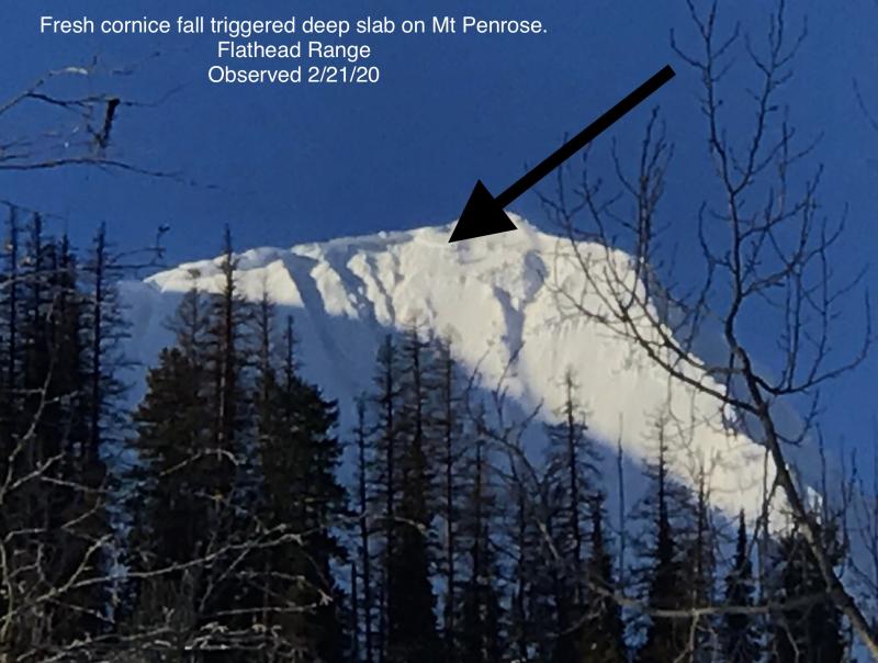
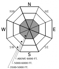
Another major loading event, with upwards of 6" of SWE, just ended on Monday morning. Deep slabs, now in excess of 8 feet thick, have reared their ugly face with every storm cycle this year. Last week's skier/cornice triggered deep slab is a reminder that these unsurvivable avalanches can be triggered well after the storm ends. Weak layers near the ground have been most reactive on rocky, high elevation slopes with variable snow coverage. Avoid this type of terrain. Cornice falls are the most likely triggers for deep slabs. Reduce your exposure in the runouts of alpine start zones with large, overhanging cornices.
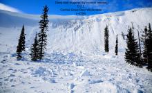
A few more inches of snow fell overnight, up to 0.5" of SWE in the past 24 hours, under light to moderate wind speeds. The brunt of a significant loading event ended Monday morning. Observers from the Flathead Range and Southern GNP spotted several shallow storm slabs that failed during the peak of the storm. Continued settling overnight is allowing storm instabilities to gain strength (see video) yet, every slope recovers at a different pace. Higher elevations and leeward slopes are typically slower to heal. There are some low-density layers within the storm snow capable of producing a surprisingly large storm slab today. An observer yesterday near Wahoo Creek found one of these layers was producing clean failures 2 feet deep. You should also monitor for fresh wind drifting overnight and shallow loose snow avalanches.
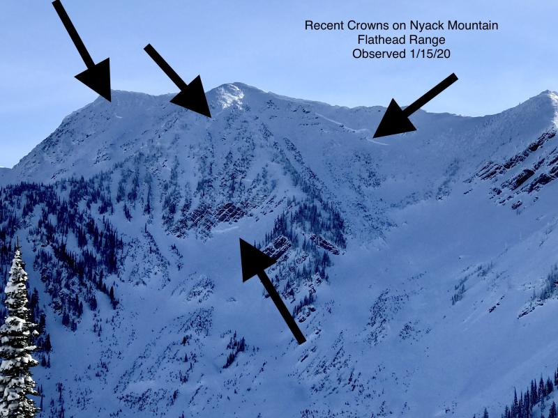
We have had 5 major storm cycles this winter, the last of which culminated on Monday morning. With each of the previous four loading events, avalanches broke on the Thanksgiving crust/ facet layer near the ground. See this blog post from a couple of weeks ago, which describes the evolution of our deep slab problem. The frequency is going down, but the size is going up. A recent slide just north of our area took out mature timber and widened the historical runout. We have yet to get a good look at our terrain since this last storm - let us know if you see any very large debris piles. One recent and important change is that winds have built larger cornices during the past two storms. Natural avalanches are generally unlikely under today's benign weather, but all bets are off if a Volkswagen van decides to roll down the slope. Cornices tend to fall more often during warm, windy, and stormy weather, but their behavior is unpredictable. Choose routes that reduce your exposure to overhead hazards, even in low elevation runout zones.
Northwest flow will bring relatively quiet weather over the next few days. Light snow showers and light to moderate winds prevail through Wednesday. Temperatures are in the low 20s this morning, and will rise to upper 20s today and near freezing tomorrow. The arctic airmass makes a triumphant return on Thursday, bringing strong winds, heavy snowfall, and dropping temperatures. Stay tuned.
This advisory applies only to backcountry areas outside established ski area boundaries. This advisory describes general avalanche conditions and local variations always occur. This advisory expires at midnight on the posted day unless otherwise noted. The information in this advisory is provided by the USDA Forest Service who is solely responsible for its content.


