| Sunday | Sunday Night | Monday | |
|---|---|---|---|
| Cloud Cover: | Snow developing in the afternoon | Snow | Snow |
| Temperatures: | 28 to 33 deg. F. | 12 to 17 deg. F. | 22 to 27 deg. F. |
| Wind Direction: | SW | West | East-Northeast |
| Wind Speed: | 1 to 11 | 1 to 11 | 5 to 15 |
| Snowfall: | 2 to 4 in. | 4 to 6 in. | 1 to 3 in. |
| Snow Line: |
Flathead Range and Glacier National Park
How to read the forecast
Dangerous avalanche conditions exist from continued snowfall, strong winds, and fluctuating temperatures. Storm slabs have thickened on all aspects at mid and upper elevations and may be more reactive than yesterday. Another surge of moisture this afternoon/overnight will elevate the hazard if it arrives sooner than forecast. Continued loading will stress deeply buried weak layers which may result in a very large destructive avalanche. Practice safe travel techniques, seek out lower angle sheltered terrain and stay away from runout zones.

3. Considerable
?
Above 6500 ft.
3. Considerable
?
5000-6500 ft.
2. Moderate
?
3500-5000 ft.
- 1. Low
- 2. Moderate
- 3. Considerable
- 4. High
- 5. Extreme
-
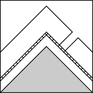
Type ?
-
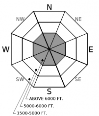
Aspect/Elevation ?
-
Likelihood ?CertainVery LikelyLikelyPossible
 Unlikely
 -
Size ?HistoricVery LargeLargeSmall

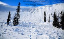
Recent dense snow, wind and warm temperatures have left us with a stiff storm slab resting on low-density snow. Yesterday, this slab cracked underfoot, found to be stubborn to most ski tests while snowpit stability results showed reactivity without propagation. Observations were limited and should be taken with a grain of salt. This slab is generally a foot thick and up to 3 feet thick on leeward terrain below ridgelines. Gusty erratic winds have likely created an unusual distribution with this slab. Cracking under your feet or machine is an obvious sign of instability.
-
Type ?
-
Aspect/Elevation ?

-
Likelihood ?CertainVery LikelyLikelyPossible
 Unlikely
 -
Size ?HistoricVery LargeLargeSmall

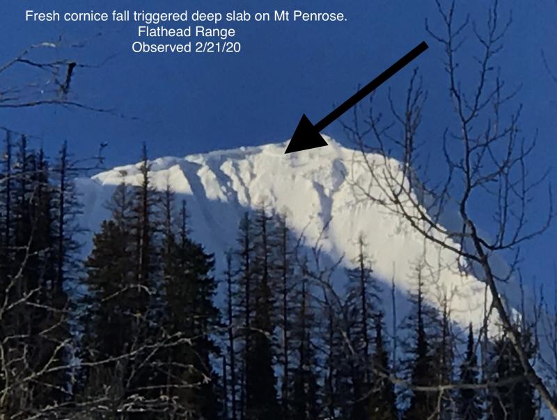
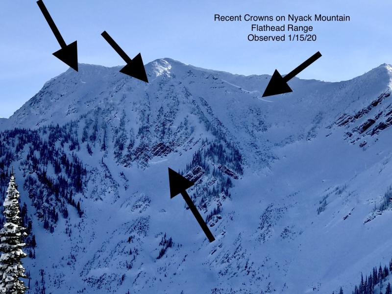
Our deep slab avalanche problem is comprised of several weak layers underneath a thick slab of snow. The Thanksgiving crust/facet combo is located near the bottom of the pack and is our greatest concern with several very large destructive avalanches recently failing on this layer in the Flathead and Swan Range (observation 1, observation 2, observation 3, observation 4). These slides initiated at upper elevations in rocky terrain where the slab depth was not uniform. Several January rain crusts and a surface hoar layer are found in our mid-pack and remain a concern at both mid and upper elevations. As the overlying slab of snow thickens and strengthens these layers are becoming more difficult to trigger with cornice failure and heavy loading events reactivating these weak layers. Terrain is the answer with deeply buried weak layers while avoiding steep, un-supported slopes and convexities are recommended.
24-hour snowfall totals range from 3-5”/ 0.3-0.53” SWE in the Whitefish Range, 1”/ 0.2” at Noisy Basin, 8-10” in Essex and 5”/ 0.8” at Flattop in GNP. Cold arctic air infiltrated into John F. Stevens Canyon yesterday morning and progressed west producing cold temperatures at most locations except for Noisy Basin and Stahl Peak. Fortunately, this was short lived and temperatures have warmed this morning except for the valley floor of John F. Stevens where temperatures are just below 0º F. Moderate winds with strong gusts were recorded for 31 consecutive hours at Hornet before tapering off late last night.
The danger remains elevated in the Flathead Range and southern Glacier Park where continued snowfall, rapidly rising temperatures, and erratic gusty winds have created dangerous avalanche conditions. The Swan and Whitefish Range have seen less snowfall and wind along with more consistent temperatures which have allowed the snow surface stability to improve. Avalanches failing on deeper buried layers in our snowpack remain a concern throughout our advisory area.
Gradual warming temperatures are expected today as the arctic front retreats back to the east. Light southwest to west winds will usher in the next round of precipitation expected to start later this afternoon. Heavy snow is on tap for tonight with another arctic air mass poised to move into our area tomorrow with continuing snowfall.
This advisory applies only to backcountry areas outside established ski area boundaries. This advisory describes general avalanche conditions and local variations always occur. This advisory expires at midnight on the posted day unless otherwise noted. The information in this advisory is provided by the USDA Forest Service who is solely responsible for its content.


