| Saturday | Saturday Night | Sunday | |
|---|---|---|---|
| Cloud Cover: | Rain/Snow | Snow | Snow |
| Temperatures: | 30 to 35 deg. F. | 0 to 10 deg. F. | 25 to 30 deg. F. |
| Wind Direction: | SW | East | SW |
| Wind Speed: | 10 to 15 mph, gusting to 25 mph | 10 to 15 mph, gusting to 25 mph | 15 to 20 mph, gusting to 30 mph |
| Snowfall: | 1 to 3 in. | 3 to 5 in. | 3 to 5 in. |
| Snow Line: |
Whitefish Range
Swan Range
Flathead Range and Glacier National Park
How to read the forecast
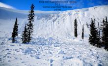
Warm temperatures, wind, rain and dense snow created dangerous avalanche conditions. Fresh storm slabs will be sensitive to human triggering and thicken throughout the day at mid and upper elevations. Natural and human triggered wet loose slides are a concern at low and mid elevations. Continued loading will stress deeply buried weak layers which may result in a very large destructive avalanche. Today's a great day to seek out lower angle terrain while practicing cautious route-finding and conservative decision making.

3. Considerable
?
Above 6500 ft.
3. Considerable
?
5000-6500 ft.
2. Moderate
?
3500-5000 ft.
- 1. Low
- 2. Moderate
- 3. Considerable
- 4. High
- 5. Extreme
-
Type ?
-
Aspect/Elevation ?

-
Likelihood ?CertainVery LikelyLikelyPossible
 Unlikely
 -
Size ?HistoricVery LargeLargeSmall

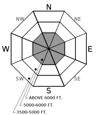
Yesterday's warm wet system deposited up to 1.1" of SWE and 14" of snow accompanied by moderate to strong southwest winds. Warm temperatures, dense snow, and windy conditions are the perfect recipe for storm slab development. Slabs are forming on lower density snow and will be sensitive to human triggering with resulting slides traveling long distances due to underlying crusts. Slab thickness will increase on leeward terrain underneath ridgelines and in gulleys. Cracking under your feet or machine is an obvious sign of instability.
-
Type ?
-
Aspect/Elevation ?
-
Likelihood ?CertainVery LikelyLikelyPossible
 Unlikely
 -
Size ?HistoricVery LargeLargeSmall

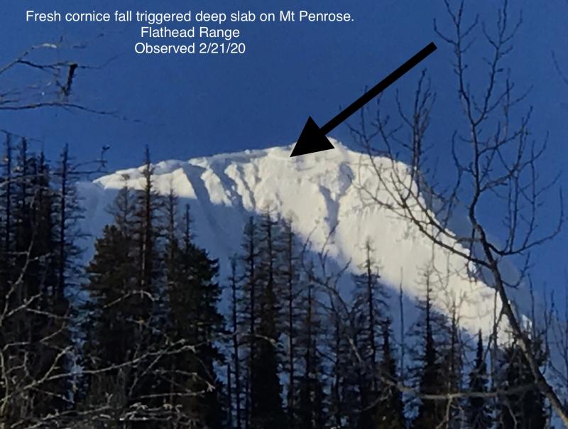
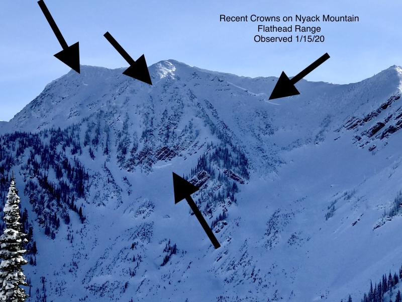
Our deep slab avalanche problem is comprised of several weak layers underneath a thick slab of snow. The Thanksgiving crust/facet combo is located near the bottom of the pack and is our greatest concern with several very large destructive avalanches recently failing on this layer in the Flathead and Swan Range (observation 1, observation 2, observation 3, observation 4). These slides initiated at upper elevations in rocky terrain where the slab depth was not uniform. Several January rain crusts and a surface hoar layer are found in our mid-pack and remain a concern at both mid and upper elevations. As the overlying slab of snow thickens and strengthens these layers are becoming more difficult to trigger with cornice failure and heavy loading events reactivating these weak layers. Terrain is the answer with deeply buried weak layers while avoiding steep, un-supported slopes and convexities are recommended.
-
Type ?
-
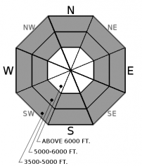
Aspect/Elevation ?
-
Likelihood ?CertainVery LikelyLikelyPossible
 Unlikely
 -
Size ?HistoricVery LargeLargeSmall

Rain, dense snow and warm temperatures entered our area yesterday and remain with us through today. Widespread natural rollerball activity was observed at low elevations yesterday with human-triggered activity easily initiated at mid elevations. Natural and human triggered wet loose avalanche activity should be expected on all aspects at low and mid elevations with activity occurring at upper elevations if temperatures warm more than expected. These slides could travel long distances due to the underlying crust. Avoid steep convex slopes, traveling above terrain traps and lingering beneath steep slopes.
24-hour snowfall totals range from 3-5”/ 0.5-0.87” SWE in Whitefish Range, 5”/ 1.1” at Noisy Basin, 14” at upper elevations in John F. Stevens Canyon and 5”/ 1.1” at Flattop in GNP. Warm air temperatures have tempered snowfall depths with moderate to strong Southwest winds at Hornet, in the northern Whitefish Range and Snowslip in John F. Stevens Canyon. New snow is dense (27% in Essex yesterday) with a rain snow mix at mid elevations and all rain at low elevations.
If you like avalanche activity we have quite the variety of problems to keep you entertained today. Recent snow is some of the densest of the season forming a storm slab problem above the rain line. Below the snow line a wet loose problem exists on all aspects. Loading is stressing buried weak layers in the snowpack that have the ability to create a very large destructive avalanche. Warming temperatures are weakening recently formed large cornices. Do I need to say more? Today is a great day to seek out low angle terrain, avoid convexities while staying away from runout zones.
Warm, wet and windy conditions should be expected through most of the day with freezing levels around 5000' or higher. This afternoon a cold arctic air mass will lower snow levels to the valley floor with copious precipitation expected overnight into tomorrow.
This advisory applies only to backcountry areas outside established ski area boundaries. This advisory describes general avalanche conditions and local variations always occur. This advisory expires at midnight on the posted day unless otherwise noted. The information in this advisory is provided by the USDA Forest Service who is solely responsible for its content.


