| Tuesday | Tuesday Night | Wednesday | |
|---|---|---|---|
| Cloud Cover: | Snow showers and windy | Snow showers | Snow showers |
| Temperatures: | 28 to 33 deg. F. | 18 to 23 deg. F. | 24 to 29 deg. F. |
| Wind Direction: | West | West | West |
| Wind Speed: | 20 to 30, G40 | 10 to 20, G30 | 0 to 10 |
| Snowfall: | 0 to 1 in. | 2 to 4 in. | 1 to 3 in. |
| Snow Line: |
Whitefish Range
How to read the forecast
The snowpack continues to consolidate after last week's storm, but intense winds overnight and a variable distribution of buried weak layers warrants attentive terrain selection and snowpack assessments. Avoid wind loaded terrain and be cautious of open, unsupported slopes.

2. Moderate
?
Above 6500 ft.
2. Moderate
?
5000-6500 ft.
1. Low
?
3500-5000 ft.
- 1. Low
- 2. Moderate
- 3. Considerable
- 4. High
- 5. Extreme
-
Type ?
-
Aspect/Elevation ?
-
Likelihood ?CertainVery LikelyLikelyPossible
 Unlikely
 -
Size ?HistoricVery LargeLargeSmall

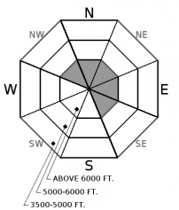
A few inches of new snow fell overnight, accompanied by strong to extreme southwesterly winds which will continue to drift snow through the day. Fresh wind slabs will be sensitive to human triggers on leeward or crossloaded slopes, and these could be large enough to injure or bury you in larger terrain features. Avoid getting tangled up in a wind slab today by sticking to sheltered or windward slopes, and away from blowing snow or thicker lenses of drifted snow.
-
Type ?
-
Aspect/Elevation ?
-
Likelihood ?CertainVery LikelyLikelyPossible
 Unlikely
 -
Size ?HistoricVery LargeLargeSmall

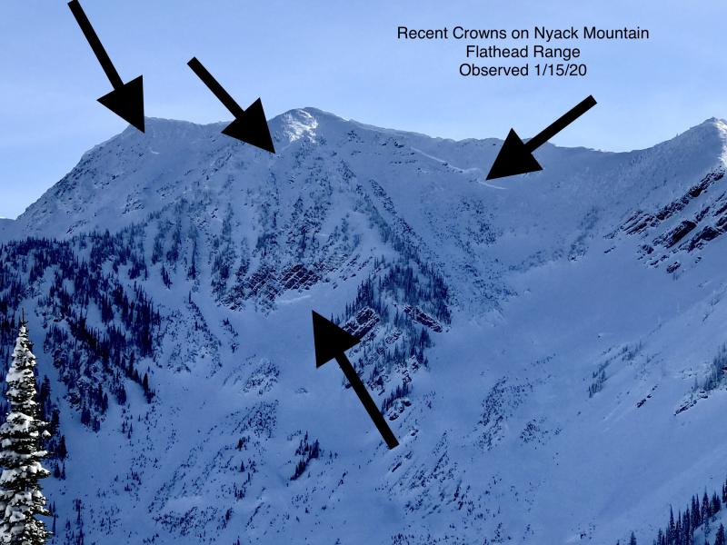
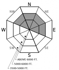
Some slopes harbor surface hoar or faceted crusts 3 to 5'+ feet deep. Recent evidence of this spatially variable but consequential persistent slab concern comes from several destructive natural avalanches observed recently in the Flathead Range, a large collapse observed in the Whitefish Range, and propagating test results in all 3 ranges. These problems have been more reactive on shadier and leeward aspects, and they are most likely to be triggered on steep and open convexities or from shallow trigger points. You can avoid the problem by choosing lower angle, well supported terrain.
-
Type ?
-
Aspect/Elevation ?
-
Likelihood ?CertainVery LikelyLikelyPossible
 Unlikely
 -
Size ?HistoricVery LargeLargeSmall

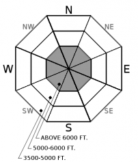
Deep, hard slabs in excess of 5' thick remain a low likelihood but very high consequence concern at higher elevations in the Flathead and Northern Whitefish Range. Faceted crust layers near the ground are difficult to assess and forecast for; conservative terrain selection is the best way to manage the problem. Choose slopes with deep and consistent snow coverage; deep slabs are most likely to be triggered in shallow and rocky terrain.
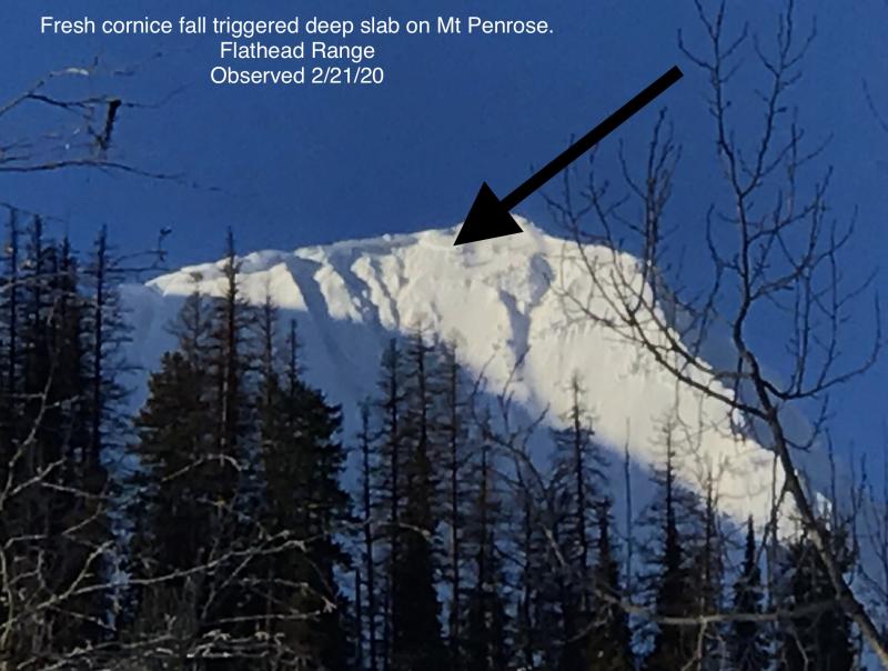
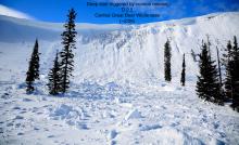
Yesterday's warm and dry weather offered the snowpack a brief respite and chance to settle from the prolonged loading period that ended Sunday night. We recieved one report of a fresh slab avalanche in the Flathead Range that appeared to be triggered by a cornice fall and fail about 4 feet deep on a steep, rocky slope above treeline. We are back into a loading pattern again with increased wind speeds overnight. Mountain weather stations are showing winds steadily blowing from 20 to 40 mph, with some gusts reaching near 75 mph. The northern SNOTELS in our forecast area were favored by precipitation last night; Stahl Peak and Flattop both picked up a few inches of very dense snow (0.5" of SWE). Leeward slopes, especially those with large fetches, will continue to see fresh wind slabs growing in size through the day, with winds shifting to a more westerly direction as the day progresses. I'd be wary of the continued threat of natural avalanche activity below heavily windloaded or corniced slopes, especially in more alpine terrain like the Flathead Range and Glacier National Park.
Mountain temperatures are near or above freezing this morning. A cold front is passing overhead and freezing levels should lower through the day to 2500'. The front is bringing extreme wind speeds and some light snow showers. Winds have been blasting from 20-50 mph overnight, with gusts near 75 mph. We'll see winds ease a little through the day and shift towards the west. Cooler temps and light snow continue through Thursday.
This advisory applies only to backcountry areas outside established ski area boundaries. This advisory describes general avalanche conditions and local variations always occur. This advisory expires at midnight on the posted day unless otherwise noted. The information in this advisory is provided by the USDA Forest Service who is solely responsible for its content.


