| Tuesday | Tuesday Night | Wednesday | |
|---|---|---|---|
| Cloud Cover: | Light snow showers taper early, and resume in the afternoon. | Snow becomes more widespread and increase in intensity late. | Continued snow with rising snow level. |
| Temperatures: | 25-30 deg. F. | 20-25 deg. F. | 31-36 deg. F. |
| Wind Direction: | W/SW | SW | SW |
| Wind Speed: | 5-10 mph with gusts to 25 | 5-15 with gusts to 25 | 5-15 with gusts to 30 |
| Snowfall: | 0-1 in. | 3-5 in. | 4-6 in. |
| Snow Line: |
Whitefish Range
Flathead Range and Glacier National Park
How to read the forecast
Snow pack conditions are highly variable across the advisory area. Recently observed instabilities include: near surface crust/facet combinations, isolated buried surface hoar, lingering windslabs, and in some areas deep instabilities formed early in the season. Our variable and tricky snow pack warrants careful, slope-specific evaluation before skiing or riding on it.

2. Moderate
?
Above 6500 ft.
2. Moderate
?
5000-6500 ft.
1. Low
?
3500-5000 ft.
- 1. Low
- 2. Moderate
- 3. Considerable
- 4. High
- 5. Extreme
-
Type ?
-
Aspect/Elevation ?

-
Likelihood ?CertainVery LikelyLikelyPossible
 Unlikely
 -
Size ?HistoricVery LargeLargeSmall

A series of near-surface crusts and associated weak snow formed throughout the month exist in most areas. Recent observations suggest that weak snow around the January 9 rain crust found 2-3 feet deep in the snowpack is gaining strength, but should not be written off. Yesterday we were in the Apgar Range to assess the reactivity of these crusts and found that they did not exist in this location, instead we found a reactive layer of buried surface hoar (video). Given the variability of our snow pack it is important to dig into the snow and test the reactivity of suspected weak layers. Where you find them stick to simple, low angle terrain, and avoid the areas where you are more likely trigger them like steep, rocky slopes and areas with relatively shallow snow.
-
Type ?
-
Aspect/Elevation ?
-
Likelihood ?CertainVery LikelyLikelyPossible
 Unlikely
 -
Size ?HistoricVery LargeLargeSmall

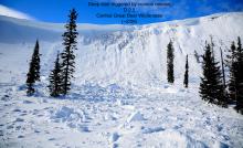
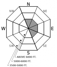
Wind speeds moderated overnight, but pay attention to lingering instability in windslabs formed from the strong winds over the past 48 hours. These slabs are formed on top of a variety of surfaces including sun and rain crusts along with low density snow. This problem is easily identified by looking for pillows of snow and lens shaped features in gullies or along ridgelines. Signs of instability include cracking in the surface snow under your skis or machine.
-
Type ?
-
Aspect/Elevation ?
-
Likelihood ?CertainVery LikelyLikelyPossible
 Unlikely
 -
Size ?HistoricVery LargeLargeSmall

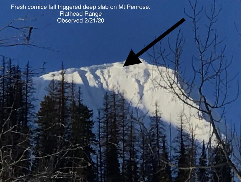
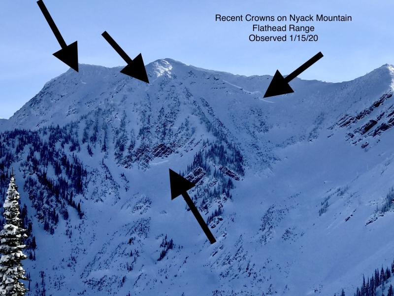
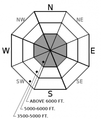
Our deep slab avalanche problem seems confined to upper elevation terrain in the Flathead and northern Whitefish Range along with southern Glacier Park involving the Thanksgiving/December 17 rain crusts and associated faceted layers. Last Thursday, in southern Glacier Park, the BNSF avalanche safety team was able to get propagation on this faceted layer (see this observation). In many locations this crust/facet layer is buried 4-6' deep with human triggering unlikely (see this observation). Unfortunately, the overlying thick slab is not uniform and areas where this slab thins or is interrupted by rock outcroppings is where human triggering may occur and have devastating consequences. These slabs can be remotely triggered from shallower, weaker areas and from adjacent slopes or below steep terrain. Snowpack assessment for deep weak layers is challenging; careful terrain selection is very important in managing the erratic/ unpredictable nature of a deep slab problem.
The winter rollercoaster of storm events and freezing/snow levels left us with a complex and tricky snowpack. The biggest problem with managing persistent slab and particularly deep slab instabilities is that as time passes they offer us fewer obvious signs like recent avalanche activity, whumphing, and cracking. As the likelihood of triggering one of these deeper instabilities decreases it's easy to let your guard down and get lulled into a sense of complacency. Remember that the consequenses of triggering a deep or persistent slab avalanche remains the same. Given the observed variability in our snow pack its important to carefully evaluate each slope you intend to ski or ride. Dig into the snow and do a stability test to see what is going on beneath your feet or machine. Where you find reactive weak layers stick to simple, low angle terrain. Keep in mind that you are most likely trigger a deeper instability where the snowpack is notoriously thin like around rock outcrops or previously wind scoured slopes.
This seasons fluctuating weather patterns have left us with fluctuating snowpack stability and variable riding conditions. This is not your straight forward NW MT snowpack that is deep, warm and strong but instead has touches of Coastal Mountains (rain) and Colorado (persistent slab). This is a good year to dig into the pack and see these unique problems... in hopes that we won't see them again for awhile. This is also a good year to practice your rescue skills while waiting for our snowpack to strengthen. FAC is hosting a companion rescue clinic with an evening session at RMO February 9 and a field day at the Hungry Horse Ranger Station February 10. Check out this link for the info. This is a great class to learn what to do if something goes wrong. Guaranteed you will walk away much more confident of your rescue skills after this session!
Ladies Avalanche Awareness Talk - Kalispell Brewing Company - January 30 Join us at Kalispell Brewing Company, at 6:30 pm for a free, engaging, and entertaining 1 hour avalanche awareness presentation with FAC Education Coordinator Jenny Cloutier. The presentation is a great way to refresh your avalanche knowledge or a great introduction to avalanche safety. The class includes general information about avalanche hazard, how to avoid it, and proper equipment for traveling in avalanche terrain.
Light snow showers will taper this morning as a weak ridge of high pressure builds across the area. Light snow showers resume late in the afternoon, and become more widespread with increased intensity late tonight. Tomorrow should see continued moderate snowfall with rising snow levels.
This advisory applies only to backcountry areas outside established ski area boundaries. This advisory describes general avalanche conditions and local variations always occur. This advisory expires at midnight on the posted day unless otherwise noted. The information in this advisory is provided by the USDA Forest Service who is solely responsible for its content.


