| Sunday | Sunday Night | Monday | |
|---|---|---|---|
| Cloud Cover: | Partial clearing | Snow returns | Snow and breezy |
| Temperatures: | 25 to 30 deg. F. | 18 to 23 deg. F. | 26 to 31 deg. F. |
| Wind Direction: | SW | SW | SW |
| Wind Speed: | 1 to 11 mph | 5 to 15 mph with gusts to 25 | 10 to 20 mph,gusting to 30 in the Flathead/Swan |
| Snowfall: | 0 to 1 in. | 1 to 3 in. | 2 to 4 in. |
| Snow Line: |
Whitefish Range
Flathead Range and Glacier National Park
How to read the forecast
Light to moderate southwest winds have formed thin wind slabs on top of crusts at upper elevations. Several buried weak layers remain a concern and require evaluation before committing to consequential terrain. A human triggered avalanche remains possible and exposing only one person on the slope at a time is imperative.

2. Moderate
?
Above 6500 ft.
2. Moderate
?
5000-6500 ft.
1. Low
?
3500-5000 ft.
- 1. Low
- 2. Moderate
- 3. Considerable
- 4. High
- 5. Extreme
-
Type ?
-
Aspect/Elevation ?
-
Likelihood ?CertainVery LikelyLikelyPossible
 Unlikely
 -
Size ?HistoricVery LargeLargeSmall

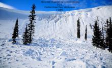
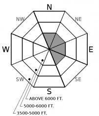
Over the past 72 hours, up to 14" of low density snowfall has been redistributed by light to moderate southwest winds forming windslabs up to 18" on leeward aspects. This snow has fallen on a variety of surfaces including sun and rain crusts which may act as a slippery bed surface. This is a surface problem and is easily identified by hand pits and cracking in the surface snow under your skis or machine. Look for pillows of snow and lens shaped features in gullies or below ridgelines. Test small slopes before committing to larger terrain and use caution around convexities (rollovers) and terrain traps.
-
Type ?
-
Aspect/Elevation ?

-
Likelihood ?CertainVery LikelyLikelyPossible
 Unlikely
 -
Size ?HistoricVery LargeLargeSmall

Incremental snowfall is slowly burying the January 9 rain crust and it is now found 2-3'+ below the surface. Earlier this week this layer was reactive in stability tests in southern Glacier Park due to a layer of facets that had formed on top of the crust (see this observation). Friday, in the Rescue Creek area of the Flathead Range, I could not get this layer to budge (see this observation) and Chris had similar results in the Disbrow Creek area of the Flathead Range yesterday (see this observation). There have also been observations of a surface hoar layer, buried 2-3' deep, found to be reactive in parts of our area (see this observation). Both of these problems can be identified by a small amount of digging into the snow. These layers will be most susceptible to human triggering where the overlying slab is thinnest and/or associated with rock outcrops. Be alert for warning signs of instability such as shooting cracks and audible collapses. When in doubt, stick to lower angle slopes with less consequential terrain.
-
Type ?
-
Aspect/Elevation ?
-
Likelihood ?CertainVery LikelyLikelyPossible
 Unlikely
 -
Size ?HistoricVery LargeLargeSmall

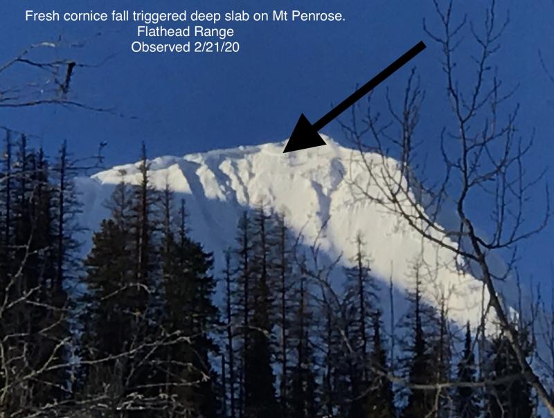
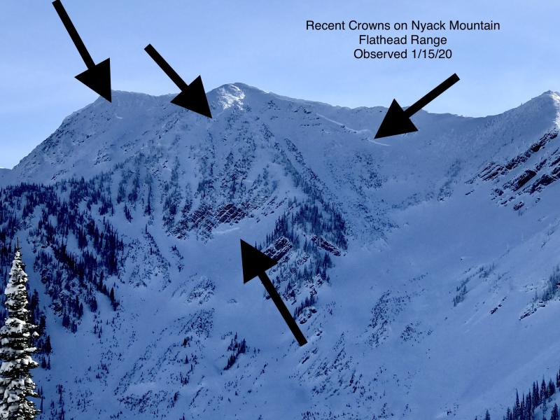
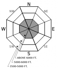
Our deep slab avalanche problem is confined to upper elevation terrain in the Flathead and northern Whitefish Range along with southern Glacier Park involving the Thanksgiving/December 17 rain crusts and associated faceted layers. On Thursday, in southern Glacier Park, the BNSF avalanche safety team was able to get propagation on this faceted layer (see this observation). In many locations this crust/facet layer is buried 4-6' deep with human triggering unlikely (see this observation). Unfortunately, the overlying thick slab is not uniform and areas where this slab thins or is interrupted by rock outcroppings is where human triggering may occur. These slabs can be remotely triggered from shallower, weaker areas and from adjacent slopes or below steep terrain. Snowpack assessment for deep weak layers is challenging; careful terrain selection is very important in managing the erratic/ unpredictable behavior of a deep slab problem.
Light precipitation was recorded in the past 24 hours: 1”/ 0.26” at Big Mountain, 3”/0.3” SWE at Stahl Peak, 4"/0.4" SWE at Noisy Basin, 2"/0.2" SWE at Flattop with the remainder of the weather stations reporting only trace amounts. The big news is the freezing rain crust that formed in the southern Whitefish Range and at Spider Bowl on the west side of the Swan. This crust extends from the valley floor to the ridgeline (~7000') and varied from 1/8" thick at Spider Bowl to >1/2" thick and knife hard in the southern Whitefish Range. Observations from the Flathead Range did not mention this crust and we do not know it's distribution throughout the rest of our area yet. Not only did it ruin some nice powder skiing but it may become another problematic layer in our snowpack. Moderate snow returns to our area tonight and may have a difficult time bonding to this crust, especially on steep terrain. Down the road this layer has the potential to develop facets around it and become a persistent slab problem.
This seasons fluctuating weather patterns have left us with fluctuating snowpack stability and variable riding conditions. This is not your straight forward NW MT snowpack that is deep, warm and strong but instead has touches of Coastal Mountains (rain) and Colorado (persistent slab). This is a good year to dig into the pack and see these unique problems... in hopes that we won't see them again for awhile. This is also a good year to practice your rescue skills while waiting for our snowpack to strengthen. FAC is hosting a companion rescue clinic with an evening session at RMO February 9 and a field day at Blacktail February 10. Check out this link for the info. This is a great class to learn what to do if something goes wrong. Guaranteed you will walk away much more confident of your rescue skills after this session!
Ladies Avalanche Awareness Talk - Kalispell Brewing Company - January 30 Join us at Kalispell Brewing Company, at 6:30 pm for a free, engaging, and entertaining 1 hour avalanche awareness presentation with FAC Education Coordinator Jenny Cloutier. The presentation is a great way to refresh your avalanche knowledge or a great introduction to avalanche safety. The class includes general information about avalanche hazard, how to avoid it, and proper equipment for traveling in avalanche terrain.
Motorized Introduction to Avalanches The classroom portion of the course on Thursday, February 1, 2018 will begin at 6:00 pm and last until 9:00 pm. It will take place at Flathead Community College. The field portion of the course on Saturday, February 3, 2018 and will take place in Canyon Creek, on the Flathead National Forest. Cost for both the classroom and field session is $45.
This class is offered by Flathead Avalanche Center in partnership with Flathead Valley Community College (FVCC).
Register via their website:https://ace.fvcc.edu/CourseStatus.awp?&course=18SHPER1207A
Today, lingering light snow showers will give way to brief high pressure and warmer conditions. Tonight, moderate snow and breezy conditions return through Monday with a dry day on tap for Tuesday.
This advisory applies only to backcountry areas outside established ski area boundaries. This advisory describes general avalanche conditions and local variations always occur. This advisory expires at midnight on the posted day unless otherwise noted. The information in this advisory is provided by the USDA Forest Service who is solely responsible for its content.


