| Friday | Friday Night | Saturday | |
|---|---|---|---|
| Cloud Cover: | Light snowfall | Snow | Snowfall ending by the afternoon |
| Temperatures: | 25 to 30 deg. F. | 18 to 23 deg. F. | 30 to 35 deg. F. |
| Wind Direction: | W | W | NW |
| Wind Speed: | 5 to 10 mph | 5 to 10 mph | 5 to 15 mph with gusts of 20 mph |
| Snowfall: | 1 to 2 in. | 1 to 2 in. | 0 in. |
| Snow Line: |
Swan Range
How to read the forecast
Dangerous avalanche conditions exist as snowfall continues to thicken sensitive storm slabs while adding additional load to buried weak layers. Natural or human triggering storm slabs will be most likely on slopes steeper than 35 degrees at upper elevations. The snowpack is safer at lower elevations where snowfall totals have been modest.

3. Considerable
?
Above 6500 ft.
3. Considerable
?
5000-6500 ft.
2. Moderate
?
3500-5000 ft.
- 1. Low
- 2. Moderate
- 3. Considerable
- 4. High
- 5. Extreme
-
Type ?
-
Aspect/Elevation ?

-
Likelihood ?CertainVery LikelyLikelyPossible
 Unlikely
 -
Size ?HistoricVery LargeLargeSmall

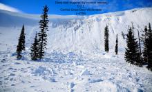
24-hour snowfall totals have been modest across our forecast area (0.25 – 0.4” SWE) with Noisy Basin coming in as the big winner at 7”/ 1.1” SWE. Over the past few days, observers have spotted several storm slab avalanches that released naturally. Human triggering storm slabs remains likely today with continued snowfall and anticipate distribution to increase at upper elevations while exerting caution as you travel down in elevation. Most avalanches occur during or immediately after a storm so evaluate storm slabs on small slopes before committing to bigger, steeper terrain and watch out for cracking or collapsing in the new snow. Use caution around terrain traps, steep rollovers, or in isolated wind-loaded slopes or gullies.
-
Type ?
-
Aspect/Elevation ?

-
Likelihood ?CertainVery LikelyLikelyPossible
 Unlikely
 -
Size ?HistoricVery LargeLargeSmall

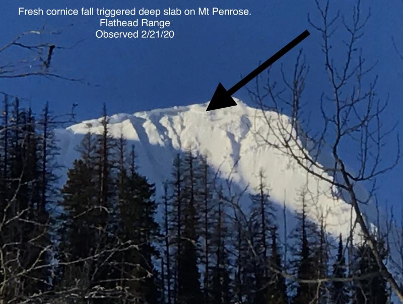
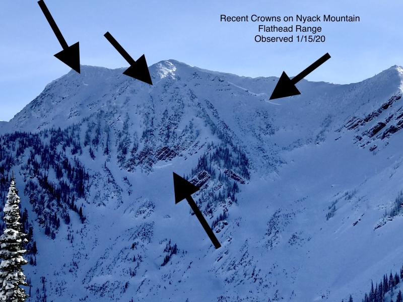
Despite evidence of recent avalanche activity, deep persistent slabs remain a low likelihood/ high consequence concern on a few slopes due to additional loading and a poor snowpack structure. These weak layers will be easiest to trigger near rock outcrops and where snow depth is shallow. Allow for a wide margin of error when assessing this problem and choosing terrain.
Some storms are "big" winners while others coming in at second place are just first place losers. Storm totals haven't materialized as forecasted but none-the-less, more snowfall and additional loading continue. 24-hour snowfall amounts range from 0.25" SWE in the southern Whitefish Range to 0.1" SWE in the northern Whitefish Range, 7"/ 1.1" SWE at Noisy Basin, and 0.2-0.4" SWE in the Flathead Range and southern Glacier National Park. Additional snowfall continues to keep storm slabs as our primary problem for today as they continue to thicken and distribution increases at upper elevations. Use caution when traveling down in elevation as isolated, deeper pockets could exist sitting on top of a stout rain crust. Evaluate new snow bonding to the old snow surface and look for signs of instability such as surface cracking, collapsing, and avoid wind-loaded pillows on the leeward side of ridgelines and gullies.
Imagine that, our persistent slab problem continues to persist. We don’t have a lot of evidence that recent loading events have “waken” our persistent slab problem, but our poor snowpack structure remains in some areas. As long as a poor snowpack structure lingers, it is still possible to trigger a dangerous persistent slab avalanche that can kill you. Zach found this poor structure in the northern Whitefish Range yesterday where snow depths are the shallowest in our advisory area. Slopes with depths less than 4’ should be treated as suspect and given a wide buffer around steeper terrain. If your wondering what’s below your feet, take the time to investigate because sleeper weak layers exist within our snowpack on some slopes like I found in the Flathead Range yesterday. Remember that persistent slabs can be triggered from below or on adjacent slopes. Be diligent with snowpack evaluations, practice cautious route-finding, and conservative decision-making is essential when managing the uncertainty around this problem.
At 4 am, a stationary front is located southwest of the forecast area with northwest flow aloft. Moisture bulls-eye from our current storm system is now forecasted to stay to our south with the Swan Range receiving the deepest snowfall amounts. For today, a Low-pressure system transitions southeast through Montana and a High-pressure ridge begins to build over the northern Rockies by Saturday afternoon with light northwest flow in its wake. We can expect an additional 2-4” in the northern zones and 6-10” in the southern zones by tomorrow morning.
This advisory applies only to backcountry areas outside established ski area boundaries. This advisory describes general avalanche conditions and local variations always occur. This advisory expires at midnight on the posted day unless otherwise noted. The information in this advisory is provided by the USDA Forest Service who is solely responsible for its content.


