| Thursday | Thursday Night | Friday | |
|---|---|---|---|
| Cloud Cover: | Inversion under stratus clouds | Valley inversions | Stratus clouds and flurries |
| Temperatures: | 24 to 29 deg. F. | 18 to 23 deg. F. | 28 to 32 deg. F. |
| Wind Direction: | SW | Southwest | Southwest |
| Wind Speed: | 0 to 10 | 0 to 10 | 0 to 10 |
| Snowfall: | 0 in. | 0 in. | 0 to 1 in. |
| Snow Line: |
Swan Range
How to read the forecast
The avalanche danger continues to trend down following a significant storm and avalanche cycle that ended over the holiday weekend. Stay alert for obvious signs of instability like shooting cracks or collapses. Although avalanches are becoming harder to trigger, the resulting size could be very destructive.

2. Moderate
?
Above 6500 ft.
2. Moderate
?
5000-6500 ft.
1. Low
?
3500-5000 ft.
- 1. Low
- 2. Moderate
- 3. Considerable
- 4. High
- 5. Extreme
-
Type ?
-
Aspect/Elevation ?

-
Likelihood ?CertainVery LikelyLikelyPossible
 Unlikely
 -
Size ?HistoricVery LargeLargeSmall

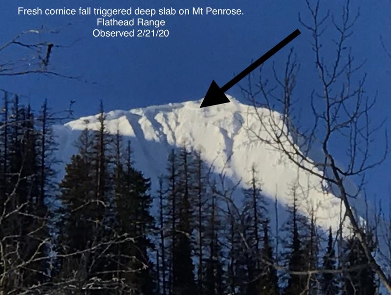
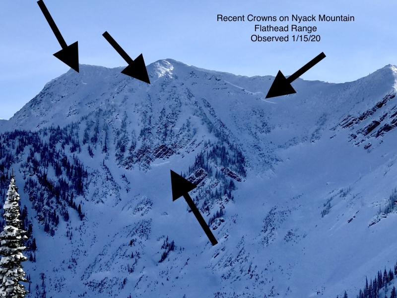
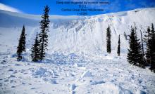
Deep persistent slabs up to 4 or 5 feet thick exist on some slopes, overlying faceted crusts near the bottom of the snowpack. Triggering one of these stubborn avalanches may require a large load, such as a cornice fall or snow-machine, but the resulting avalanche will be surprisingly destructive (See this video). These types of avalanches are most commonly triggered from shallow spots on the slope or convex rollovers. Identify and avoid steep slopes with variable slab thickness. If your partner's sled gets stuck on a slope that connects to avalanche terrain, let him or her dig out on their own.
With slightly warmer temperatures and more sun in the forecast today, stay alert for the potential for small loose snow avalanches initiating from very steep gullies or faces. Look for sluffing snow or rollerballs to indicate decreasing stability.
If you look through a broader lens at avalanche conditions in the Northwest, stretching from Montana to Southern BC to Idaho and Wyoming, there is a common theme. We all experienced an unusually prolonged drought in early December, which caused a problematic facet layer to form. Since mid-December, we have been in an active loading pattern which culminated during last weekend's storm. Now with clearing skies and gradually improving stability, people are venturing into more aggressive terrain and getting suprised by persistent slab avalanches. There were two avalanche fatalities this week from northern Wyoming (article) and Southwestern Montana (article), and a flurry of near misses across the region. We aren't dealing with a run-of-the-mill storm instability, but rather a buried weak layer that continues to surprise backcountry travelers. Even though the traffic light is no longer blinking red, yellow does not mean hit the gas. It means you should slow down, take your time, and make careful snowpack and terrain assessments.
The Flathead Avalanche Center presents two engaging and free one-hour Avalanche Awareness talks this week. Join us at at Stumptown Snowboards in Whitefish on Wednesday, January 3, from 7 PM - 8 PM ro Stonefly Lounge in Coram on Thursday, January 4, from 7 PM - 8 PM. The class includes general information about avalanche hazard, how to avoid it, and proper equipment for traveling in avalanche terrain. . Contact [email protected] with any questions.
The high pressure ridge broadens across the Western US, making for mostly sunny skies and warming temperatures above the inversion today. Temperatures will be warmer closer to the Continental Divide, rising to near freezing. The ridge starts to flatten and evolve into a small trough on Friday, opening the doors to our next Pacifiic storm. A preliminary glance looks like 5" to 8" of snow through the weekend.
This advisory applies only to backcountry areas outside established ski area boundaries. This advisory describes general avalanche conditions and local variations always occur. This advisory expires at midnight on the posted day unless otherwise noted. The information in this advisory is provided by the USDA Forest Service who is solely responsible for its content.


