| Wednesday | Wednesday Night | Thursday | |
|---|---|---|---|
| Cloud Cover: | Snow flurries | Decreasing clouds, inversion developing. | Mild and sunny |
| Temperatures: | 23 to 28 deg. F. | 1 to 6 deg. F. | 25 to 30 deg. F. |
| Wind Direction: | West | Southwest | Southwest |
| Wind Speed: | 0 to 10 | 0 to 10 | 0 to 10 |
| Snowfall: | 0 to 1 in. | 0 in. | 0 in. |
| Snow Line: |
Swan Range
How to read the forecast
The avalanche danger continues to trend down following a significant storm and avalanche cycle that ended over the holiday weekend. Stay alert for obvious signs of instability like shooting cracks or collapses. Although avalanches are becoming harder to trigger, the resulting size could be very destructive.

2. Moderate
?
Above 6500 ft.
2. Moderate
?
5000-6500 ft.
1. Low
?
3500-5000 ft.
- 1. Low
- 2. Moderate
- 3. Considerable
- 4. High
- 5. Extreme
-
Type ?
-
Aspect/Elevation ?

-
Likelihood ?CertainVery LikelyLikelyPossible
 Unlikely
 -
Size ?HistoricVery LargeLargeSmall

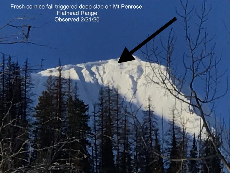
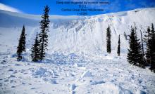
Deep persistent slabs up to 4 or 5 feet thick exist on some slopes, overlying faceted crusts near the bottom of the snowpack. Triggering one of these stubborn avalanches may require a large load, such as a cornice fall or snow-machine, but the resulting avalanche will be surprisingly destructive (See this video). These types of avalanches are most commonly triggered from shallow spots on the slope or convex rollovers. Identify and avoid steep slopes with variable slab thickness. If your partner's sled gets stuck on a slope that connects to avalanche terrain, let him or her dig out on their own.
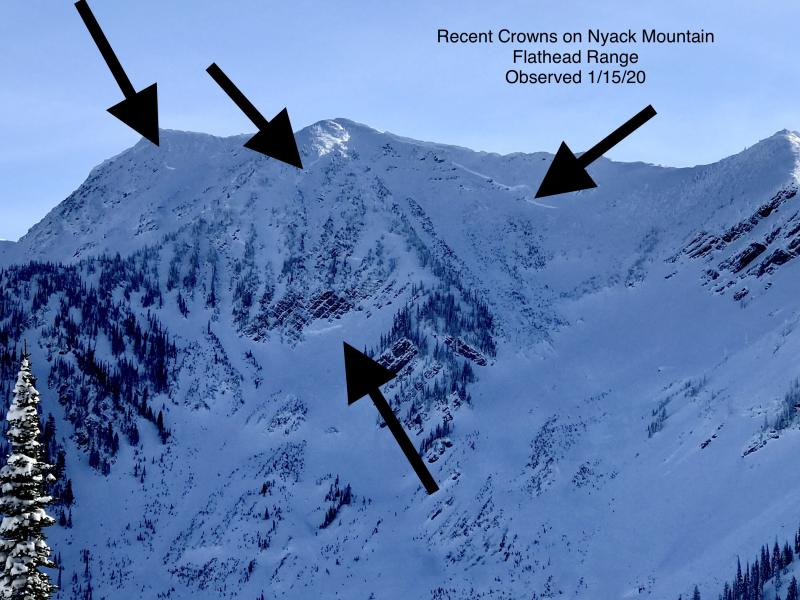
Our last storm and avalanche cycle ended on December 30th. Storm instabilities are gradually mending, and we removed storm slabs from the problem list today. Keep an eye for isolated exceptions, evidenced by cracking snow. Look for and avoid recent wind drifting at higher elevations, especially in the Flathead Range which has seen gustier winds.
The main avalanche problem concern today stems from the facets or faceted crusts that were buried in mid December following our prolonged drought. Skiers in the John F Stevens Canyon reported several collapses yesterday and snowmobilers in the Northern Whitefish Range triggered a number of persistent slab avalanches on Monday, one of which resulted in a partial burial. Our weak layers were widespread, especially at mid and upper elevations, prior to our December storm cycles (Remember this video?) Subtleties in storm totals, previous avalanche activity, wind loading, temperatures, and a freezing rain event have now created a complicated pattern of which slopes remain problematic. Noisy Basin in the Swan Range has the deepest, warmest, and strongest snowpack. In general, the further you migrate north or east of this bullseye, the shallower and more reactive the persistent slab problems are, but there is a lot of uncertainty and slope to slope variability to this general pattern. When the snowpack is the question, terrain is the answer. You can always default to simpler terrain to manage uncertainty regarding this potentially destructive avalanche concern. Simpler terrain means lower slope angles, shorter vertical relief, more slope support or anchors, and/or fewer terrain traps.
The tree well fatality over the weekend is a tragic reminder to maintain visual or voice contact with your partners while riding in the deep, unconsolidated powder conditions this week.
The Flathead Avalanche Center presents two engaging and free one-hour Avalanche Awareness talks this week. Join us at at Stumptown Snowboards in Whitefish on Wednesday, January 3, from 7 PM - 8 PM ro Stonefly Lounge in Coram on Thursday, January 4, from 7 PM - 8 PM. The class includes general information about avalanche hazard, how to avoid it, and proper equipment for traveling in avalanche terrain. . Contact [email protected] with any questions.
A weak shortwave embedded in a high pressure ridge will bring a few snow flurries today. A warming trend continues with temperatures rising from the teens into the upper 20s today under light winds. The ridge continues its eastward migration on Thursday, bringing our final day of mild, sunny weather before a Pacific storm makes landfall on Friday.
This advisory applies only to backcountry areas outside established ski area boundaries. This advisory describes general avalanche conditions and local variations always occur. This advisory expires at midnight on the posted day unless otherwise noted. The information in this advisory is provided by the USDA Forest Service who is solely responsible for its content.


