| Tuesday | Tuesday Night | Wednesday | |
|---|---|---|---|
| Cloud Cover: | Partly cloudy and dry. | Partly cloudy and dry. | Increasing clouds and snow flurries |
| Temperatures: | 18 to 23 deg. F. | 11 to 16 deg. F. | 26 to 31 deg. F. |
| Wind Direction: | West | Southwest | Southwest |
| Wind Speed: | 0 to 10 | 0 to 10 | 0 to 10 |
| Snowfall: | 0 in. | 0 in. | 0 to 1 in. |
| Snow Line: |
Whitefish Range
How to read the forecast
Dangerous avalanche conditions exist in the wake of a significant storm that ended last weekend. Numerous large and dangerous persistent slab avalanches were triggered yesterday in the Whitefish Range, including a partial burial. Look for shooting cracks or collapses to help identify instabilities, and use conservative terrain choices to manage deeper instabilities.

3. Considerable
?
Above 6500 ft.
3. Considerable
?
5000-6500 ft.
2. Moderate
?
3500-5000 ft.
- 1. Low
- 2. Moderate
- 3. Considerable
- 4. High
- 5. Extreme
-
Type ?
-
Aspect/Elevation ?
-
Likelihood ?CertainVery LikelyLikelyPossible
 Unlikely
 -
Size ?HistoricVery LargeLargeSmall

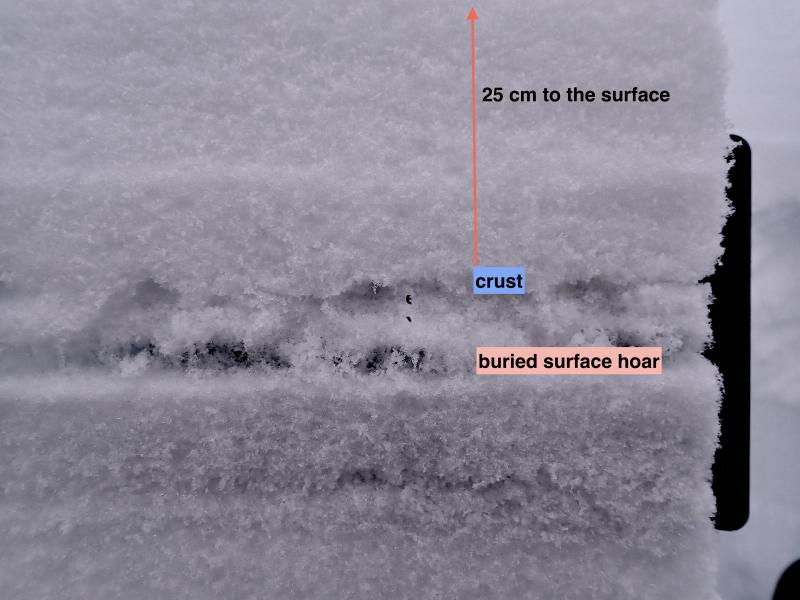
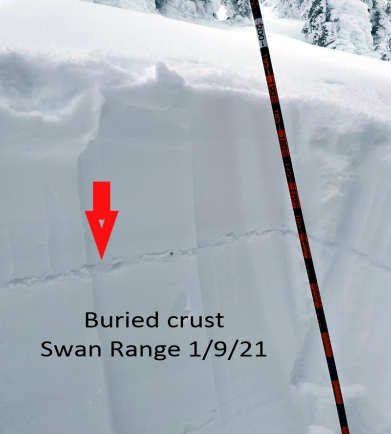
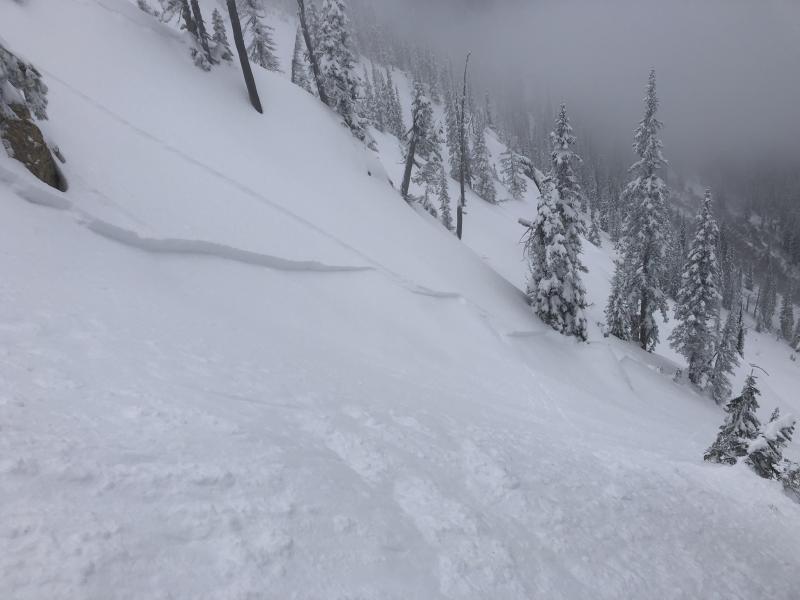
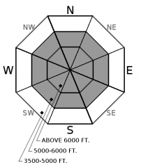
Yesterday's avalanche burial in the Northern Whitefish Range exemplifies our persistent slab avalanche problem. Persistent slabs from 2 to 4 feet thick over weak facets or faceted crusts lurk on some slopes, specifically those that didn't shed during our recent avalanche cycles. These slabs have been reactive to human triggers following our most recent storm, evidenced by several reports of a collapsing snowpack and human triggered slides. This consequential problem warrants conservative terrain management. Avoid traveling on or directly below slopes harboring poor snowpack structure (as demonstrated in this video) because this type of avalanche can be remotely from below or adjacent to a connected slope. Shooting cracks or collapses are clear indicators of unstable conditions.
-
Type ?
-
Aspect/Elevation ?
-
Likelihood ?CertainVery LikelyLikelyPossible
 Unlikely
 -
Size ?HistoricVery LargeLargeSmall

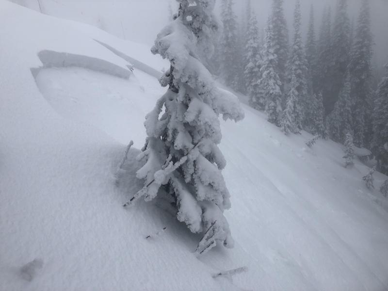
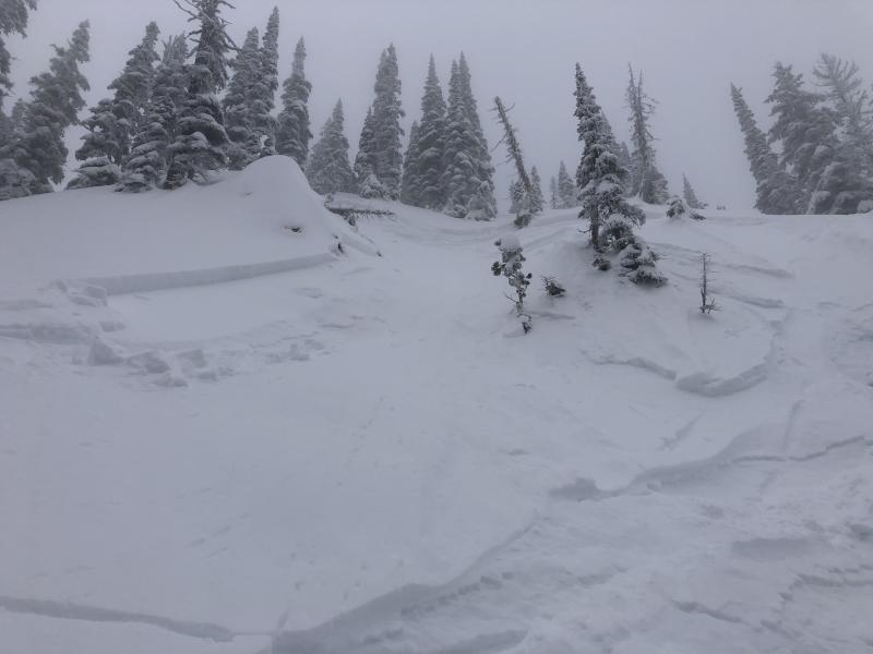
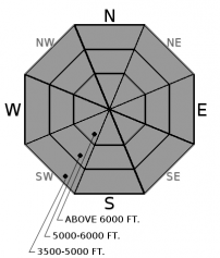
Soft slabs of recent snow and/or windblown snow can be triggered in steep terrain on all aspects and elevations. These slabs could be large enough to bury you or drag you into a terrain trap. Look for shooting cracks and use small, steep test slopes (like this observation yesterday) to identify instabilities. You are most likely to trigger a storm slab on a steep rollover or below a leeward terrain feature, especially at higher elevations.
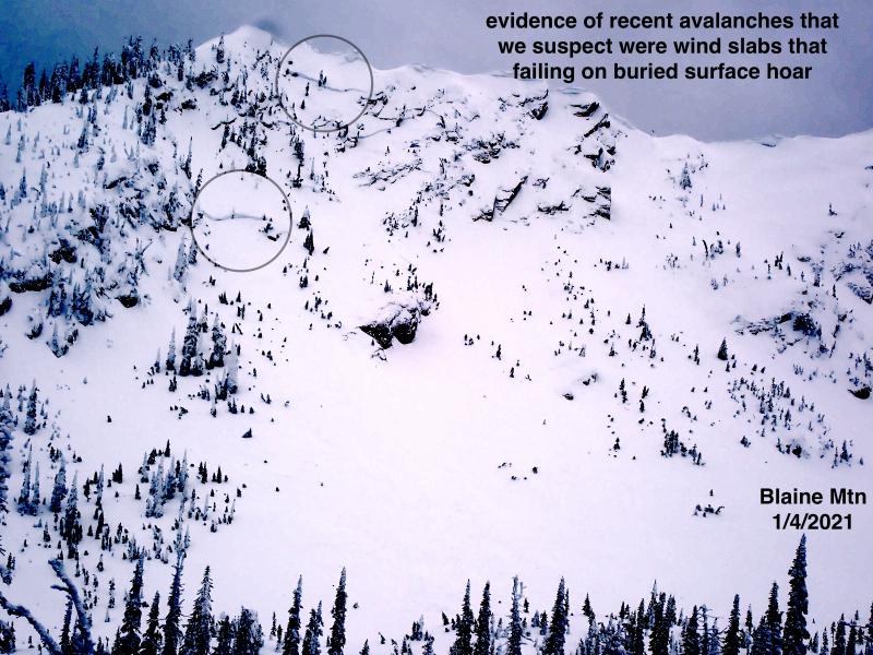
The likelihood of triggering a storm slab continues to trend down in the wake of last weekend's storm and widespread avalanche cycle, which is well documented in our observations page. In general, winds at the tail end of the storm and in the subsequent days of dry weather have been fairly tame, epecially in the Swan and Whitefish Ranges. However, winds increased yesterday and overnight closer to the Continental Divide. Observers near Mt. Nyack noted a fresh generation of small and easily triggered wind slabs yesterday. Slopes with recent wind loading should be identified and avoided.
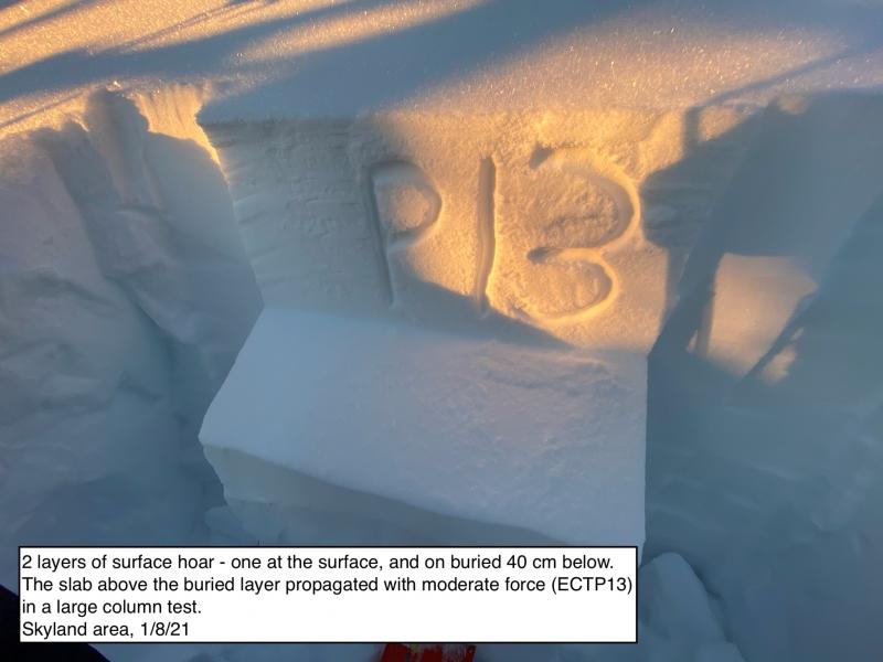
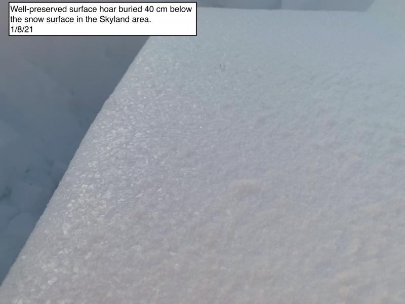
As we continue to collect more data on our persistent slab problem, we can begin to paint a general pattern. The Swan Range is holding the deepest and strongest snowpack. Our buried rain crusts/ facet layers are now more than 4 or 5 feet deep and stability tests from a few locations suggest these layers are strengthening and becoming stubborn or unreactive (See this video). The Flathead Range along the Middle Fork corridor has seen the most extensive avalanche activity during the past two cycles. On the few slopes that didn't shed these layers, our December facets are now 4 or 5 feet deep, and again, stubborn or unreactive to human triggers. As you move closer to the Continental Divide and Marias Pass, the snowpack is slightly shallower and weaker and we have observed more signs of a reactive persisent slab problem, both from recent avalanche activity and reports of collapses. The Whitefish Range has been exhibiting the shallowest and and most reactive persistent slab structure. Observers near Mt. Werner reported widespread collapsing on Saturday, and yesterday, snowmobiles triggered several persistent slab avalanches and shooting cracks in Grave Creek. Our forecasters continue to find propagating test results in the snowpack tests (Example A, Example B) in the Whitefish Range. Forecasting for this complex problem, and assessing it on a slope by slopes basis, often carries a large amount of uncertainty. When the snowpack is the question, terrain is the answer. You can always default to simpler terrain to manage uncertainty regarding this potentially destructive avalanche concern. Simpler terrain means lower slope angles, shorter vertical relief, more slope support or anchors, and/or fewer terrain traps.
The tree well fatality over the weekend is a tragic reminder to maintain visual or voice contact with your partners while riding in the deep, unconsolidated powder conditions this week.
Northwest Montana is on the front end of a high pressure ridge is developing over the West Coast today. This will bring dry conditions, temperatures rising from the teens into the 20s, and gusty winds near the Contintental Divide. An embedded shortwave brings a weak disturbance and a few snow flurries tomorrow.
This advisory applies only to backcountry areas outside established ski area boundaries. This advisory describes general avalanche conditions and local variations always occur. This advisory expires at midnight on the posted day unless otherwise noted. The information in this advisory is provided by the USDA Forest Service who is solely responsible for its content.


