| Sunday | Sunday Night | Monday | |
|---|---|---|---|
| Cloud Cover: | Continued cloudy conditions with cool air trapped below the cloud deck | Mostly cloudy with no precipitation and little fluctuation in temperatures. | Continued cloudy conditions with cool air trapped below the cloud deck |
| Temperatures: | 25 to 30 deg. F. | 22 to 27 deg. F. | 25 to 30 deg. F. |
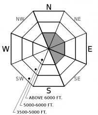
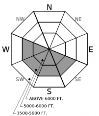
| Wind Direction: | West | West | Southwest |
| Wind Speed: | 1 to 11 mph | 1 to 11 mph | 1 to 11 mph |
| Snowfall: | 0 in. | 0 in. | 0 in. |
| Snow Line: |
Whitefish Range
Swan Range
Flathead Range and Glacier National Park
How to read the forecast
The avalanche danger is LOW on all slopes due to a lack of recent snow. Isolated wind slabs exist on upper elevation slopes favored by wind loading. Look for rounded pillows of snow and obvious signs of instability like cracking and collapsing. Warm sunny conditions are weakening the surface snow on sunny aspects creating a wet loose problem. Evaluate the moisture content of the surface snow along with all wind loaded terrain before committing to a slope.

1. Low
?
Above 6500 ft.
1. Low
?
5000-6500 ft.
1. Low
?
3500-5000 ft.
- 1. Low
- 2. Moderate
- 3. Considerable
- 4. High
- 5. Extreme
-
Type ?
-
Aspect/Elevation ?

-
Likelihood ?CertainVery LikelyLikelyPossible
 Unlikely
 -
Size ?HistoricVery LargeLargeSmall

Despite a lack of recent activity wind slabs remain on our radar. Slabs of windblown snow up to 12" in depth can be found on upper elevation leeward and crossloaded slopes (see this photo). These slabs are mostly shallow and small but in favored wind locations they may be larger. All of these slabs were deposited on top of the Thanksgiving rain crust which could act as a slippery bed surface (see this photo). Most of these features were formed nearly a week ago, and are becoming stubborn to trigger, but lingering instabilities remain in locations where a thin layer of weak snow sits on top of the crust (see this photo). In favored windy locations in alpine terrain more recently formed wind slabs may be found. Getting caught in even a small slide could have significant consequences due to the thin snowpack and numerous exposed hazards. Look for rounded pillows of snow near ridgelines and recognize signs of instability such as cracking or collapsing in the surface snow.
-
Type ?
-
Aspect/Elevation ?

-
Likelihood ?CertainVery LikelyLikelyPossible
 Unlikely
 -
Size ?HistoricVery LargeLargeSmall

In many locations, a 6-10" layer of low density surface snow sits on top of the slippery Thanksgiving rain crust resulting in a poor bond between the two layers. Yesterday's warm sunny weather was responsible for both natural slides and a human triggered wet loose slide. With another sunny warm day on tap today expect a wet loose avalanche problem on sunny aspects at middle and upper elevations. This problem will become more likely this afternoon with warming temperatures in areas not exposed to the wind. As the day progresses evaluate the moisture content of the new snow and be wary of skiing above terrain traps and in larger consequential terrain.
During the past work week a thick layer of Stratus clouds parked itself over our upper elevation terrain. That cloud deck has descended in elevation leaving us with a classic Flathead Valley inversion of cloudy cool conditions in the valley floor and sunny warm conditions above the clouds. This weather is affecting our surface snowpack through the production of surface hoar and near surface faceted snow which will become a concern when stormy weather returns to our area. In the meantime this warm sunny weather is warming the dry snow surface and increasing the wet loose avalanche problem on sunny aspects at mid and upper elevation slopes. Yesterday, a skier triggered wet loose slide was reported from the southern Whitefish Range (see this observation) along with natural activity reported from Glacier Park (see this observation). This warm weather is also decreasing the cohesion of the surface snow on shaded aspects and triggering a dry loose slide is possible on steep slopes. Currently most mountain weather stations are reporting temperatures in the mid 20 's but these temperatures will spike as the day progresses. At upper elevations winds prior to the Stratus intrusion deposited wind slabs up to 12" thick on the Thanksgiving crust on leeward and cross loaded terrain. Despite no recent wind slab avalanche activity isolated wind slabs remain on our radar. They resemble pillows or lens shaped snow just below ridgelines and in gully features.
We encourage all of you to submit observations to help improve the quality of our product. Thanks.
The strong ridge of high pressure continues to influence our weather trapping cold air in the valleys with an associated layer of low clouds which will last for several more days. Due to persistent cloud cover, temperatures in the valleys will fluctuate little and remain in the mid to upper 20's. Above the cloud deck the middle and upper elevations will enjoy abundant sunshine and warm temperatures climbing into the upper 30's with light west winds and no precipitation.
This advisory applies only to backcountry areas outside established ski area boundaries. This advisory describes general avalanche conditions and local variations always occur. This advisory expires at midnight on the posted day unless otherwise noted. The information in this advisory is provided by the USDA Forest Service who is solely responsible for its content.


