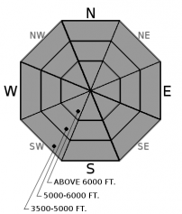
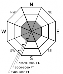
Friday | Friday Night | Saturday | |
---|---|---|---|
Cloud Cover: | Light rain | Light rain/snow | Light rain showers. |
Temperatures: | 38-52 deg. F. | 21-30 deg. F. | 35-49 deg. F. |
Wind Direction: | South -Southwest | Southwest | Southwest |
Wind Speed: | 12-14 gusts 28-36 | 12-14 gusts 29-31 | 6-7 gusts 21 |
Snowfall: | 0 in. | 0-3 in. | 0 in. |
Snow Line: |
Whitefish Range
Swan Range
Flathead Range and Glacier National Park
How to read the forecast
Heightened wet avalanche concerns exist due to continued warm temperatures and rain on recent, unconsolidated snow. The avalanche danger is MODERATE above 6000 feet where human triggered avalanches are possible. Pay attention to changing weather conditions today. More rain than anticipated could result in deeper instabilities and increase the potential for larger wet avalanches. Below 6000 feet the danger is LOW.

2. Moderate
?
Above 6500 ft.
1. Low
?
5000-6500 ft.
1. Low
?
3500-5000 ft.
- 1. Low
- 2. Moderate
- 3. Considerable
- 4. High
- 5. Extreme
-
Type ?
-
Aspect/Elevation ?
-
Likelihood ?CertainVery LikelyLikelyPossibleUnlikely
-
Size ?HistoricVery LargeLargeSmall
The potential for loose, wet avalanches exist due to continued warm temperatures and rain on recent unconsolidated snow. Snow sticking to your skis/skins and snowmobiles are signs that the snow surface is starting to become unstable. If you start seeing rollerballs and/or natural wet loose avalanche activity, move to less steep terrain. Keep in mind that the effects of small, loose, wet avalanches can be amplified by terrain traps like narrow gullies, trees, and cliffs.
-
Type ?
-
Aspect/Elevation ?
-
Likelihood ?CertainVery LikelyLikelyPossibleUnlikely
-
Size ?HistoricVery LargeLargeSmall
Large cornices still exist along many of the ridgelines across the advisory area. Warming temperatures and rain will weaken these features and it is best to give them a wide berth. Be aware that cornices can break farther back on the ridge than you might expect. Also keep in mind that falling cornices can trigger avalanches on the slopes beneath them. Avoid traveling on slopes underneath cornices.
Thursday: Going to the Sun Avalanche Program toured on Mount Cannon in Glacier National Park. They found generally wet snow conditions and 5 cm of recent, wet snow above 5800 feet. They noted evidence of small, loose, wet avalanche activity likely to have occurred due to warm temperatures on Tuesday (4/4). Skiers east of the advisory in southern Glacier National Park noted above freezing temperatures and variable surface conditions. They observed debris from a recent slab avalanche triggered by cornice fall.
Tuesday: FAC Staff toured the Skookaleel Ridge area in the Southern Whitefish Range. Sunshine was abundant and warming the 1 to 2 inches of new snow above the crust on solar aspects. The surface snow in shaded areas and non-solar aspects was not impacted. The crust at the surface varied considerably in strength and thickness. Stronger and thicker on slopes exposed to the sun and thinner and weaker on non-solar aspects. Skiers on Gunsight Mountain in Glacier National Park (outside the advisory area) reported 1 to 10 inches of new snow from Monday and small but sensitive wind slabs.
See below for all observations this season.
Yesterday's temperatures climbed to the upper 40s above 6000 feet. Light rain moved into the area in the afternoon and continued overnight. Currently, mountain temperatures range from 33-37º F, and winds are out the southwest at 5-10 mph. Today should bring mostly cloudy skies with temperatures in the mid-40s. Lingering light to moderate rain is expected to taper mid-day and resume overnight.
0600 temperature: | 33-37 deg. F. |
Max. temperature in the last 24 hours: | 39-50 deg. F. |
Average wind direction during the last 24 hours: | Southwest |
Average wind speed during the last 24 hours: | 5-10 mph |
Maximum wind gust in the last 24 hours: | 15-25 mph |
New snowfall in the last 24 hours: | 0 inches |
Total snow depth: | 82-121 inches |
This advisory applies only to backcountry areas outside established ski area boundaries. This advisory describes general avalanche conditions and local variations always occur. This advisory expires at midnight on the posted day unless otherwise noted. The information in this advisory is provided by the USDA Forest Service who is solely responsible for its content.