


For 5000 ft. to 7000 ft.
| Sunday | Sunday Night | Monday | |
|---|---|---|---|
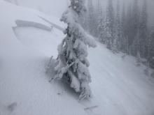
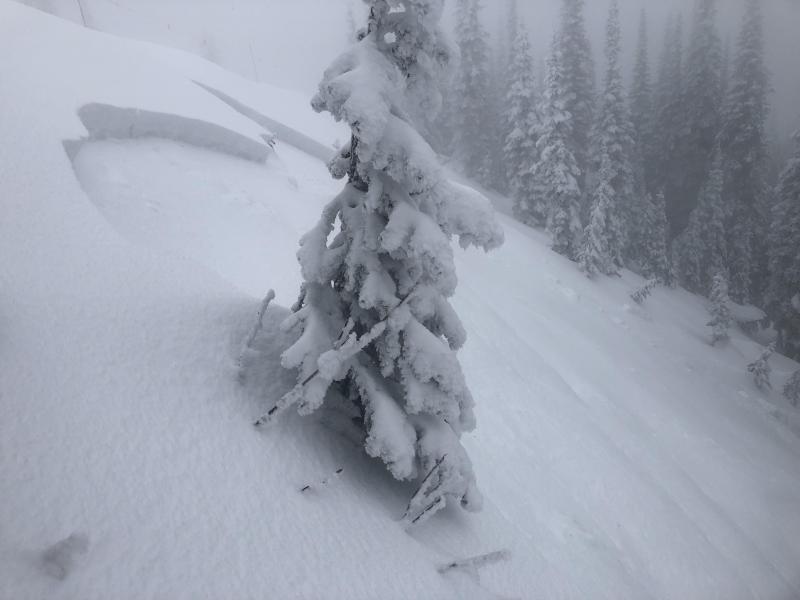
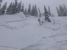
| Cloud Cover: | Continued snow with light winds. | Light snow with cold temperatures. | Continued light snow with cool temperatures. |
| Temperatures: | 16-28 deg. F. | 2-13 deg. F. | 18-27 deg. F. |
| Wind Direction: | South-east | East | South |
| Wind Speed: | 7-8 mph with gusts to 20 | 8-13 mph with gusts to 28 | 5-7 mph |
| Snowfall: | 4-10 in. | 2-5 in. | 2-5 in. |
| Snow Line: |


