| Friday | Friday Night | Saturday | |
|---|---|---|---|
| Cloud Cover: | Partly cloudy, becoming mostly cloudy. | Mostly cloudy and cold. | Mostly cloudy with scattered snow showers. |
| Temperatures: | 20-29 deg. F. | 1-13 deg. F. | 19-28 deg. F. |
| Wind Direction: | west | southwest | southwest |
| Wind Speed: | 3-4 | 3-5 | 11-16 gusts 25-37 |
| Snowfall: | 0 in. | 0-2 in. | 0 in. |
| Snow Line: |
Whitefish Range
Swan Range
Flathead Range and Glacier National Park
How to read the forecast
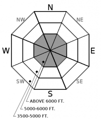
The avalanche danger is MODERATE above 6000 feet due to lingering storm instabilities that exist at upper elevations. Carefully evaluate the terrain you intend to ski or ride before committing to any slope. Below 6000 feet the danger is LOW. Pay attention to isolated terrain that harbors unstable snow, and practice safe back country travel technique.

2. Moderate
?
Above 6500 ft.
1. Low
?
5000-6500 ft.
1. Low
?
3500-5000 ft.
- 1. Low
- 2. Moderate
- 3. Considerable
- 4. High
- 5. Extreme
-
Type ?
-
Aspect/Elevation ?
-
Likelihood ?CertainVery LikelyLikelyPossible
 Unlikely
 -
Size ?HistoricVery LargeLargeSmall

Since the recent storm exited the area on Wednesday morning we observed decreasing, but still lingering signs of instability in the upper snow pack. As the storm snow settles and strengthens it may not offer the obvious signs of instability like collapsing or shooting cracks. This makes it increasingly important to dig into the snow and evaluate the structure. In areas where you question the strength of the recent snow simply choose less complex terrain to recreate in.
With the slight increase in wind speed over the past 24 hours watch for soft wind slab development that should be confined to exposed leeward ridgelines. Where present, I don't expect these to be the thick, reactive slabs that we have dealt with for a lot of the winter, but also not as obvious to recognize.
Remember low danger does not mean no danger. We removed persistent slab from the problem list due to the time that passed since avalanches associated with these layers were observed or reported (nearly two weeks). Also, due to the more stubborn results in stability testing. It is important to keep in mind that there are locations at all elevations in the advisory area where a weak snow pack structure still exists. The most commonly observed deeper instabilities are weak snow surrounding the Jan 19th crust and depth hoar near the ground. Because these weak layers do not always present obvious signs of instability, digging into the snowpack is the best way to determine their location and reactivity. Where you find a poor structure terrain selection is important. You are more likely to trigger a deeper weak layer in an area with shallow snow (where weak layer is closer to the surface) like steep, rocky terrain and areas that are prone to being wind scoured.
Keep those observations coming! We really appreciate all of you that have taken the time at the end of your day to drop us a line. Also, there are only 4 days left to get entered to win a $50 gift certificate. If you didn't hear about the drawing yet see the details here.
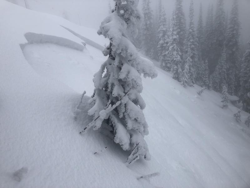
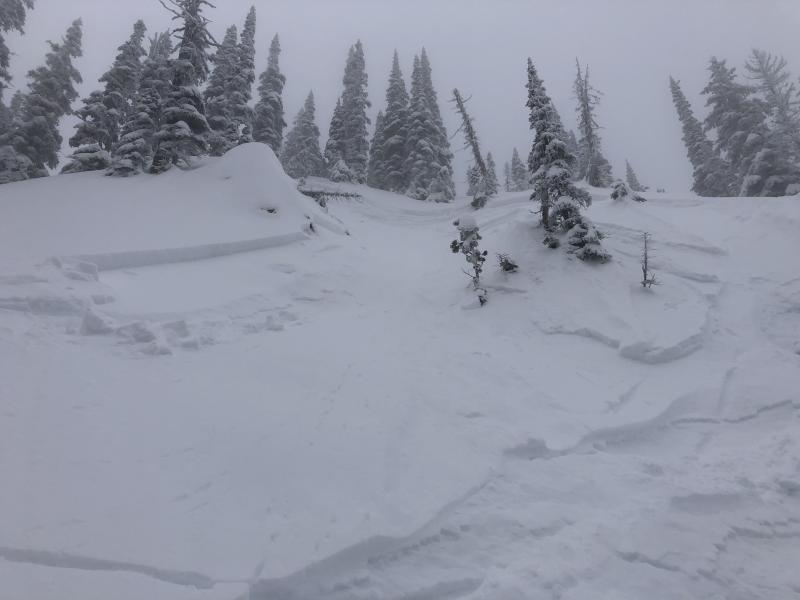
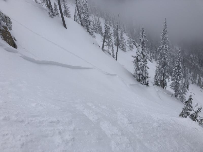
Thursday: We were in the Jewel Basin in the Swan Range. On our ascent we noted new large surface hoar crystals developing. We observed some cracking in the surface snow while traveling across short, steep terrain features. We also observed a skier triggered avalanche that appeared to have occurred in the previous 48 hours. The thin storm/wind slab was triggered on a steep slope and ran through a chute. When the snow came out of the narrow chute it propagated about 50 feet in both directions across the apron. Maximum crown height was estimated at 1 foot. Snowboarders in Rescue Creek in the Flathead Range found 40 cm of recent snow on top of the Feb. 10th rain crust and had minimal results in stability tests.
Wednesday: Snowboarders in the Red Meadow Pass Area in the Nothern Whitefish Range found unstable conditions in the storm snow. They intentionally triggered an avalanche from a ridge line. Then unitentionally triggered another avalanche on a short pitch during their descent (observation). Skiers on the ridge that divides First and Second Creeks in the southern Whitefish Range found just over a foot of recent snow on top of the Feb. 10th crust. This new snow fractured and propagated on the crust with moderate force in an Extended Column Test. They noted roller balls forming on steep, sunny slopes in the afternoon. Skiers in the Ghoulies area, also in the southern Whitefish Range observed roller balls and small, loose wet avalanches on sunny slopes. They found a thin Feb. 10th crust and had several fractures without propagation in Extended Column Tests.
Tuesday: Erich and Adam were in the Skiumah/Rescue Drainages in the Flathead Range where they found about 40 cm of snow on top of the Feb. 10 crust. In stability tests fractures occurred within the new snow that did not propagate. On their descent they easily triggered thin (3-6 inch) storm slabs on steep slopes. Skiers on Skookoleel Ridge in the southern Whitefish Range found lingering instability within recent storm snow. They were also able to affect deep weak layers (110cm from the surface) using hard force in stability tests.
See below for all observations this season.
High temperatures were in the mid-upper 20s yesterday, and we got a dusting of snow. Winds shifted again and returned to a westerly pattern with a slight spike in wind speeds. Currently, temperatures above 6000 feet range from 9-17º F, and winds are west-west southwest at 5-15 mph. For today, expect partly cloudy skies becoming mostly cloudy late afternoon. Temperatures should remain in the low-mid 20s with west winds at 5-10 mph and 20 mph gusts this afternoon.
| 0600 temperature: | 8-17 deg. F. |
| Max. temperature in the last 24 hours: | 21-29 deg. F. |
| Average wind direction during the last 24 hours: | ENE shift to W |
| Average wind speed during the last 24 hours: | 5-15 mph |
| Maximum wind gust in the last 24 hours: | 12-20 mph |
| New snowfall in the last 24 hours: | 0-1 inches |
| Total snow depth: | 81-106 inches |
This advisory applies only to backcountry areas outside established ski area boundaries. This advisory describes general avalanche conditions and local variations always occur. This advisory expires at midnight on the posted day unless otherwise noted. The information in this advisory is provided by the USDA Forest Service who is solely responsible for its content.


