| Thursday | Thursday Night | Friday | |
|---|---|---|---|
| Cloud Cover: | Mostly/partly cloudy with cooler temperatures and isolated light snow showers. | Partly cloudy and cold. | Partly cloudy, cool, and calm. |
| Temperatures: | 21-32 deg. F. | 0-11 deg. F. | 19-28 deg. F. |
| Wind Direction: | northeast | variable | west |
| Wind Speed: | 4-7 | 4-5 | 4-5 |
| Snowfall: | 0-1 in. | 0-1 in. | 0-1 in. |
| Snow Line: |
Whitefish Range
Swan Range
Flathead Range and Glacier National Park
How to read the forecast
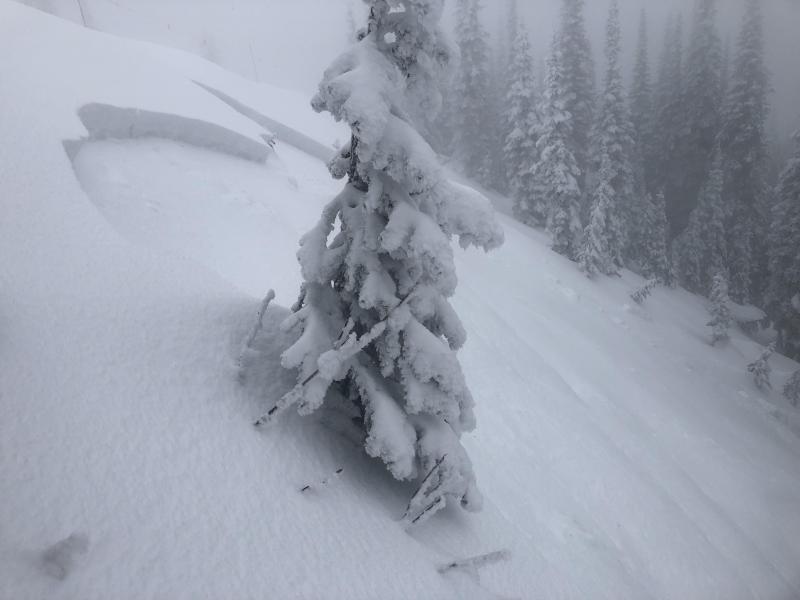
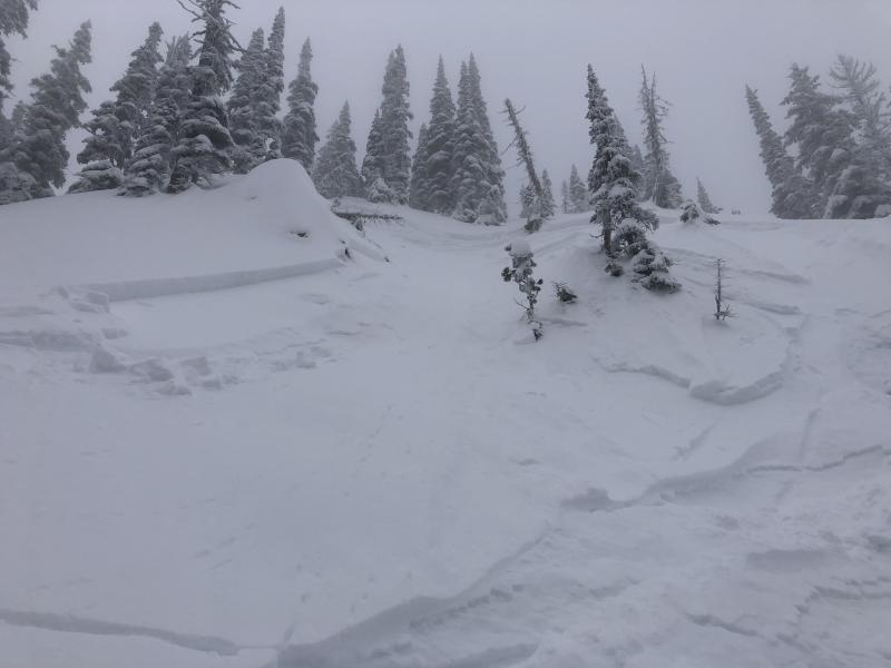
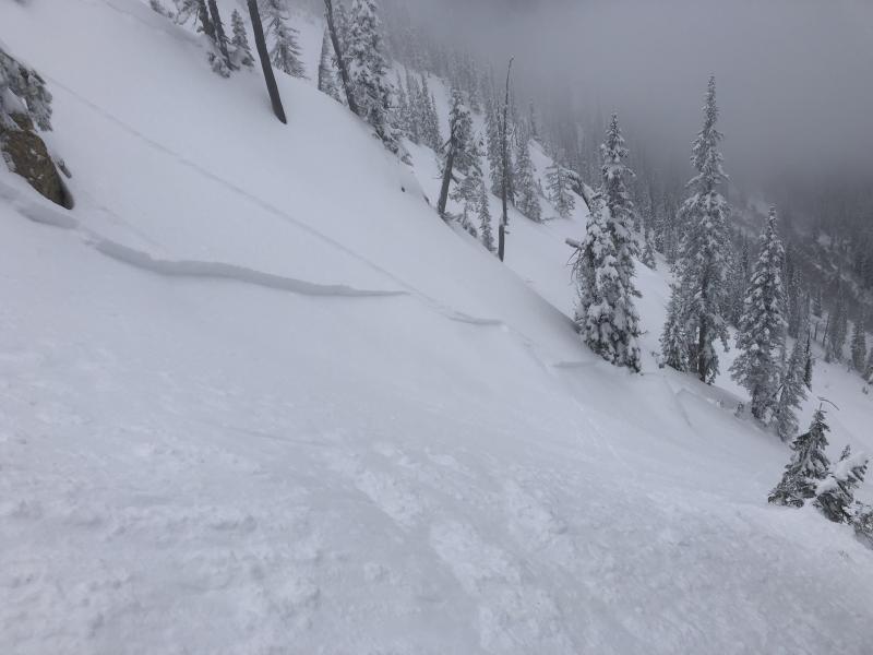
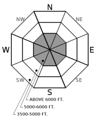
Storm slabs that formed during the abundant snow-fall early in the week sit on a thick, smooth crust that can prolong the time it takes them to settle and strengthen. The avalanche danger is MODERATE above 6000 feet where human triggered avalanches are possible. Below 6000 feet the danger is LOW. Remember that LOW danger does not mean NO danger. Continue to practice safe back country travel technique and look for the isolated areas with unstable snow.

2. Moderate
?
Above 6500 ft.
1. Low
?
5000-6500 ft.
1. Low
?
3500-5000 ft.
- 1. Low
- 2. Moderate
- 3. Considerable
- 4. High
- 5. Extreme
-
Type ?
-
Aspect/Elevation ?
-
Likelihood ?CertainVery LikelyLikelyPossible
 Unlikely
 -
Size ?HistoricVery LargeLargeSmall

The storm is over, but we got a lot of snow in a relatively short period of time. In most locations 30-60 cm (12-24 inches) of snow sits on top of a smooth sliding surface that is the Feb. 10 rain crust. Settlement due to precipitation intensity during the storm and relatively warm temperatures formed a cohesive slab where instability may linger. Pay attention to obvious signs of instability like cracking or collapsing, and avoid steep, convex rollovers while giving these recent slabs time to adjust.
Remember low danger does not mean no danger. We removed persistent slab from the problem list due to the time that passed since avalanches associated with these layers were observed or reported (nearly two weeks). Also, due to the more stubborn results in stability testing. It is important to keep in mind that there are locations in the advisory area where a weak snow pack structure still exists. The most commonly observed deeper instabilities are weak snow surrounding the Jan 19th crust and depth hoar near the ground. Because these weak layers do not always present obvious signs of instability, digging into the snowpack is the best way to determine their location and reactivity. Where you find a poor structure terrain selection is important. You are more likely to trigger a deeper weak layer in an area with shallow snow (where weak layer is closer to the surface) like steep, rocky terrain and areas that are prone to being wind scoured.
Keep those observations coming! We really appreciate all of you that have taken the time at the end of your day to drop us a line. Also, there are only 5 days left to get entered to win a $50 gift certificate. If you didn't hear about the drawing yet see the details here.
Wednesday: Skiers on the ridge that divides First and Second Creeks in the southern Whitefish Range found just over a foot of recent snow on top of the Feb. 10th crust. This new snow fractured and propagated on the crust with moderate force in an Extended Column Test. They noted roller balls forming on steep, sunny slopes in the afternoon. Skiers in the Ghoulies area, also in the southern Whitefish Range observed roller balls and small, loose wet avalanches on sunny slopes. They found a thin Feb. 10th crust and had several fractures without propagation in Extended Column Tests.
Tuesday: Erich and Adam were in the Skiumah/Rescue Drainages in the Flathead Range where they found about 40 cm of snow on top of the Feb. 10 crust. In stability tests fractures occurred within the new snow that did not propagate. On their descent they easily triggered thin (3-6 inch) storm slabs on steep slopes. Skiers on Skookoleel Ridge in the southern Whitefish Range found lingering instability within recent storm snow. They were also able to affect deep weak layers (110cm from the surface) using hard force in stability tests.
Monday: Guy and Jenny were in Doris Creek in the Swan Range. They found about 20 inches of snow above the most recent rain crust. In a snow pit at 6300 feet on an east aspect they had fractures within the most recent storm snow but no propagation. They did not observe any recent avalanche activity. BNSF Avalanche Safety was out in John F Stevens Canyon in southern Glacier Park. They observed no avalanche activity, no wind-loading, and no propagation in a snowpit at 6400 feet on a south aspect.
See below for all observations this season.
Yesterday brought cooler temperatures, and a light breeze. Isolated light snow showers only amounted to 1-2 inches of snow accumulation. Winds shifted overnight and are blowing at 2-7 mph with gusts from 10-14 mph out of the north and northeast. Currently, mountain temperatures range from 12-20º F. Today should see partly/mostly cloudy skies with isolated light snow showers and winds continuing to blow out of the northeast at 5-10 mph.
| 0600 temperature: | 12-20 deg. F. |
| Max. temperature in the last 24 hours: | 23-29 deg. F. |
| Average wind direction during the last 24 hours: | SW shift to N/NE |
| Average wind speed during the last 24 hours: | 3-8 mph |
| Maximum wind gust in the last 24 hours: | 11-24 mph |
| New snowfall in the last 24 hours: | 0-2 inches |
| Total snow depth: | 82-107 inches |
This advisory applies only to backcountry areas outside established ski area boundaries. This advisory describes general avalanche conditions and local variations always occur. This advisory expires at midnight on the posted day unless otherwise noted. The information in this advisory is provided by the USDA Forest Service who is solely responsible for its content.


