| Thursday | Thursday Night | Friday | |
|---|---|---|---|
| Cloud Cover: | Warming temperatures, strong winds, and moderate to heavy rain/snow. | Gradually cooling temperature. Continued mountain light-moderate snow. | Cooling trend and tapering showers. |
| Temperatures: | 33-41 deg. F. | 26-33 deg. F. | 30-39 deg. F. |
| Wind Direction: | South-Southwest | Southwest | West-Southwest |
| Wind Speed: | 15-22 gusts 41-44 | 22-24 gusts 45 | 20-22 gusts 39-41 |
| Snowfall: | 6-21 in. | 1-5 in. | 2-4 in. |
| Snow Line: |
Whitefish Range
Swan Range
Flathead Range and Glacier National Park
How to read the forecast
An AVALANCHE WARNING is in effect. A relatively warm, wet system moved into the area late yesterday and brought substantial precipitation to the mountains. Today should see strong winds, continued heavy rain/snow, and warming temperatures that will likely tip the scale on a snowpack that was still recovering from last weekend's enormous stress. Natural and human triggered avalanches are likely. The avalanche danger is HIGH, travel in avalanche terrain and run-out zones is not recommended.

4. High
?
Above 6500 ft.
4. High
?
5000-6500 ft.
4. High
?
3500-5000 ft.
- 1. Low
- 2. Moderate
- 3. Considerable
- 4. High
- 5. Extreme
-
Type ?
-
Aspect/Elevation ?

-
Likelihood ?CertainVery LikelyLikelyPossible
 Unlikely
 -
Size ?HistoricVery LargeLargeSmall

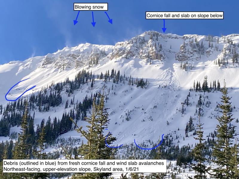
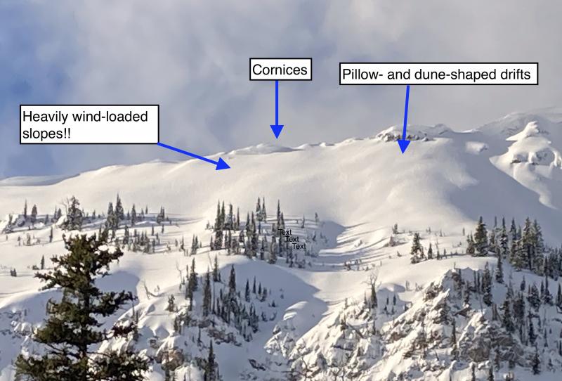
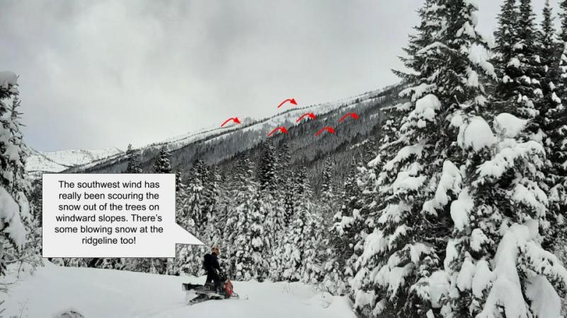
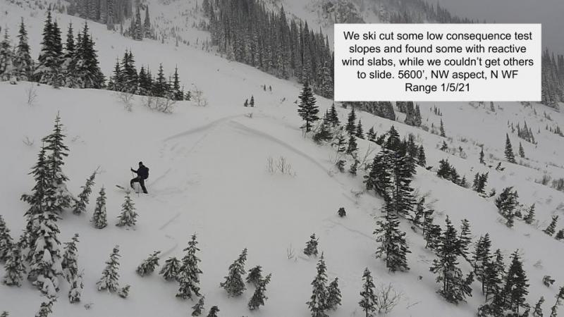
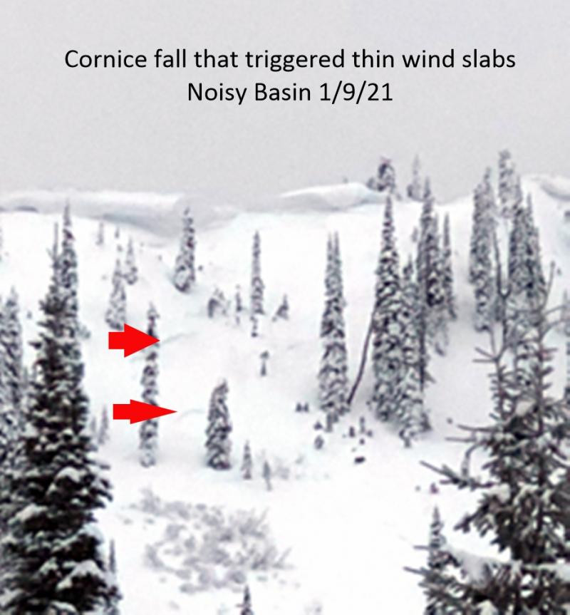
Wind slabs that formed over the past week will continue to thicken today. Heavy precipitation combined with strong winds will rapidly create new, thick, and very unstable windslabs. Expect to find wind slabs on any aspect at both mid and upper elevations. The likelihood of seeing natural wind slab avalanches will increase as the day progresses.
-
Type ?
-
Aspect/Elevation ?

-
Likelihood ?CertainVery LikelyLikelyPossible
 Unlikely
 -
Size ?HistoricVery LargeLargeSmall

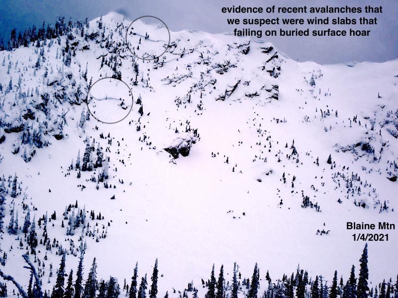
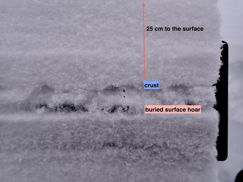
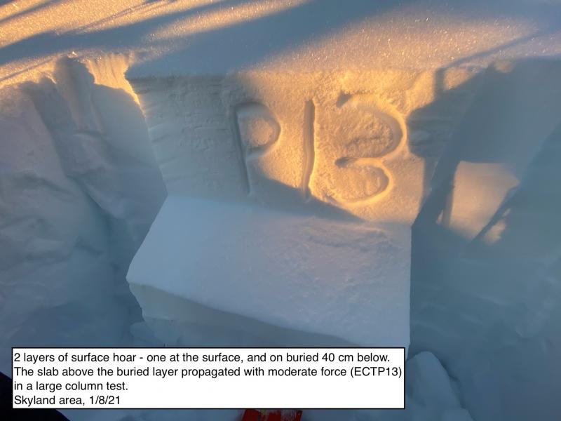
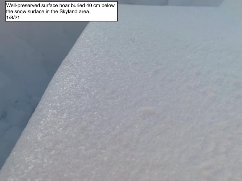
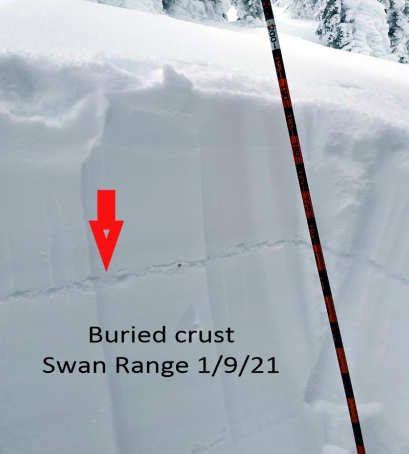
It's only been two full days since the last wallop on our snow pack that was 3.5 to over 5 inches of water in a 72 hour period. Given the recent conditions, we stuck to simple no-consequence terrain over the past week. That said, there is a lot of uncertainty about reactivity of deeper weak layers in the alpine with the recent load. What we know: Weak snow surrounding the Jan. 19 rain crust is still proving reactive in stability tests, and a lot of avalanche activity associated with this interface occurred in the past week. In isolated areas 2-3 feet of snow fell on top of a layer (or multiple layers) of buried surface hoar. Finally, in some locations we continue to find mature depth hoar near the ground. Whumfing sounds (collapsing) of the snow pack while traveling across the snow is an obvious sign of instability.
Dangerous conditions exist at low and mid-elevation terrain as well as upper elevations. The snow structure is weak and was not a previous concern before this storm due to the lack of a cohesive slab. Now we have a thick slab above this layer. Pay attention to sneaky slopes, steep pitches, and cut banks well below the tree-line.
-
Type ?
-
Aspect/Elevation ?

-
Likelihood ?CertainVery LikelyLikelyPossible
 Unlikely
 -
Size ?HistoricVery LargeLargeSmall

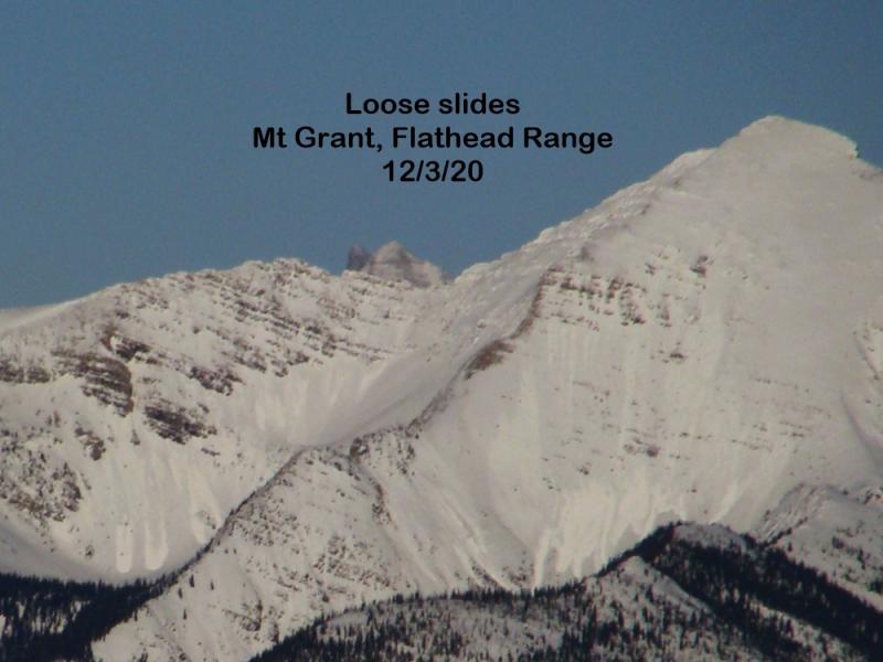
Early this morning warm air is already moving into the area. With a potent storm on tap and rising temperatures we could see a rain-on-snow event reach into the mid-elevation band. The abundant, unconsolidated snow could produce large, loose wet avalanches on steep slopes. Avoid traveling in avalanche terrain or run-out zones if snow transitions to rain today.
Ladies, are you interested in refreshing your avalanche knowledge or looking for a great introduction to avalanche safety? If so, join us at The White Room Mountain Shop, in Whitefish, on Thursday, February 16th at 6:30 pm for a free, engaging, and entertaining 1 hour avalanche awareness presentation. The class includes general information about avalanche hazard, how to avoid it, and proper equipment for traveling in avalanche terrain.
Today: BNSF Avalanche Safety Team reported natural avalanche activity in John F. Stevens Canyon in southern Glacier Park. One large magnitude avalanche deposited 6-8 feet of debris that was 150 feet wide on the railway, and it also reached the highway. The powder blast from the avalanche was evident 25 feet up a power pole.
Wednesday: Erich and Todd traveled to McGinnis Creek in the southern Whitefish Range to assess stability in the low to mid elevation snow pack. The snow pack was shallow (100 -165 cm) and we found depth hoar near the ground in both snow pits. We experienced a whumpf (collapse) in the snow pack as we approached a test slope. Two Extended Column Tests on an east aspect resulted in column failure upon isolation. On a west aspect the column fractured and propagated with moderate force on the Jan. 19 rain crust. 85 cm from the surface (ECTP18). Snow bikers in the Stryker area also in the Whitefish Range found a deep, upside down snow pack at lower elevations and noted one recent natural avalanche on an east facing slope at about 6000 feet.
Tuesday: Seth ventured to Skookaleel Ridge in the Southern Whitefish Range and observed previous natural avalanche activity of small size and sensitive wind slabs on top of the January 19 crust. A public observation from the Central Apgar Range reported failure and propagation with moderate force in stability tests. Early Tuesday morning a large and destructive natural avalanche was reported by BNSF Avalanche Safety in the Wahoo drainage in the Flathead Range. The avalanche was estimated as a size 3 (D3) on the destructive scale. It left a debris pile about 50 yards wide and 5 feet deep on the railroad tracks.
See below for all observations this season.
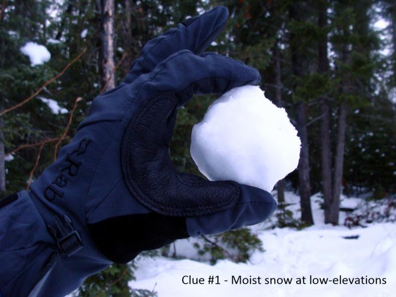
In the past 24 hours SNOTEL sites and Remote Weathers Stations only reported 1-6 inches of new snow, but 0.5-1.00 inch of snow water equivalent. This means that as temperatures began to rise overnight the snow that came in is wet, and heavy. Currently, temperatures above 6000 feet are at the 24 hour high ranging from 23-32ºF. Winds are out of the southwest from 7-12 mph with gusts from 11-19 mph. Today there is some uncertainty about the timing of warm air moving into the area, but we know it's going to be wet. Expect periods of heavy snow/rain with substantial accumulations up high. Winds will be out of the south-southwest at 15-25 mph with gusts in the 60s.
| 0600 temperature: | 23-32 deg. F. |
| Max. temperature in the last 24 hours: | 23-32 deg. F. |
| Average wind direction during the last 24 hours: | South/Southwest |
| Average wind speed during the last 24 hours: | 5-15 mph |
| Maximum wind gust in the last 24 hours: | 11-26 mph |
| New snowfall in the last 24 hours: | 1-6 inches |
| Total snow depth: | 75-111 inches |
This advisory applies only to backcountry areas outside established ski area boundaries. This advisory describes general avalanche conditions and local variations always occur. This advisory expires at midnight on the posted day unless otherwise noted. The information in this advisory is provided by the USDA Forest Service who is solely responsible for its content.


