| Monday | Monday Night | Tuesday | |
|---|---|---|---|
| Cloud Cover: | Partly cloudy with snow showers. | Light snow showers. | Lingering snow showers. |
| Temperatures: | 21-30 deg. F. | 5-14 deg. F. | 19-26 deg. F. |
| Wind Direction: | East-Northeast | East | West-Southwest |
| Wind Speed: | 7-8 mph with gusts to 17 | 5-6 mph | 3-4 mph |
| Snowfall: | 1 in. | 0-1 in. | 0-1 in. |
| Snow Line: |
Whitefish Range
Swan Range
Flathead Range and Glacier National Park
How to read the forecast
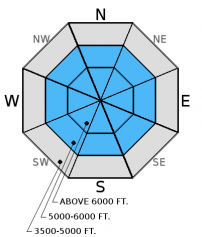
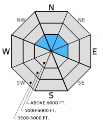
The avalanche danger is MODERATE above 5000 feet. Human triggered avalanches are possible on buried weak layers in our pack. Avoid areas with a shallow snowpack, like steep rocky terrain, where you can more easily affect these weak layers. In alpine terrain, the possibility of a human triggered avalanche involving lingering wind slab instabilities remains. Assess wind loaded slopes before committing to them.

2. Moderate
?
Above 6500 ft.
2. Moderate
?
5000-6500 ft.
1. Low
?
3500-5000 ft.
- 1. Low
- 2. Moderate
- 3. Considerable
- 4. High
- 5. Extreme
-
Type ?
-
Aspect/Elevation ?
-
Likelihood ?CertainVery LikelyLikelyPossible
 Unlikely
 -
Size ?HistoricVery LargeLargeSmall

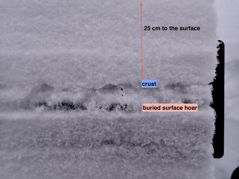
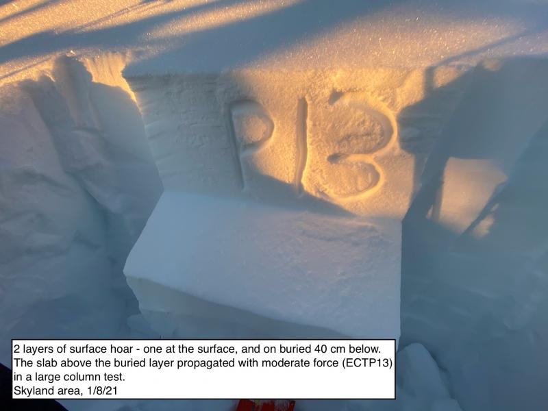
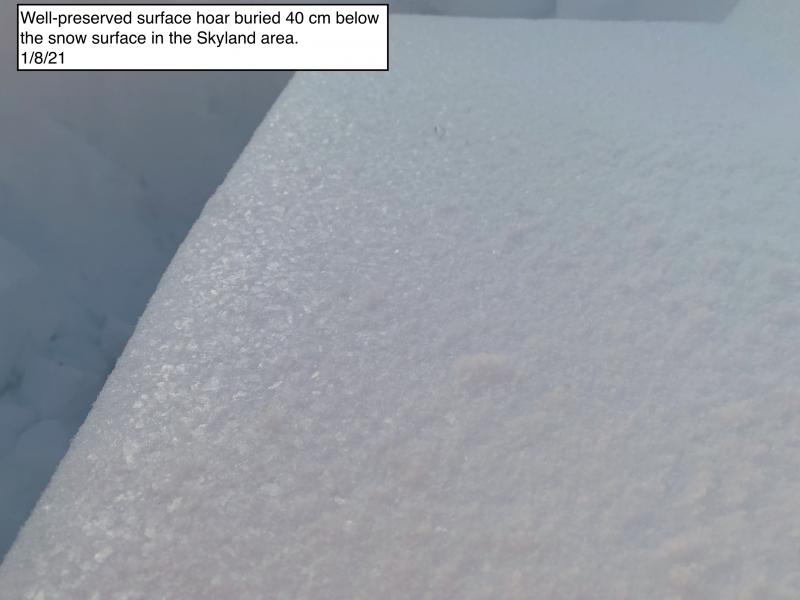
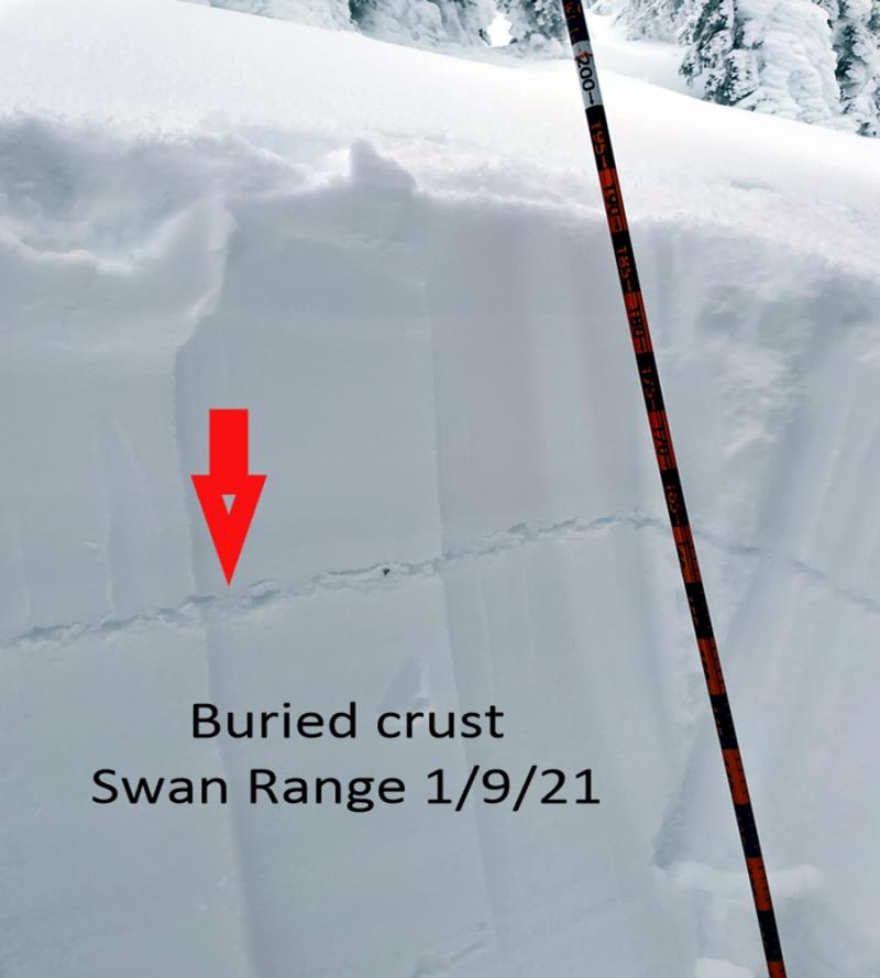
Don't let the recent mild weather lull you into complacency. Yes, this weeks relatively warm temperatures are slowly strengthening our snowpack, but we need to remember that strengthening of buried weak layers is a very slow process. Weak layers in the mid pack and bottom of the pack are still weak and will be for some time. These layers may awaken when tested by the "right" trigger. Therefore, avoid areas where you are more likely to trigger them like steep, rocky terrain. Digging in the snowpack is the only way to know if these layers exist where you are recreating.
-
Type ?
-
Aspect/Elevation ?
-
Likelihood ?CertainVery LikelyLikelyPossible
 Unlikely
 -
Size ?HistoricVery LargeLargeSmall

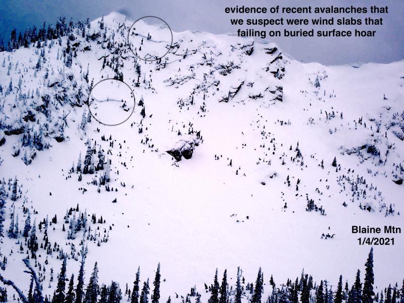
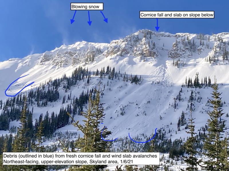
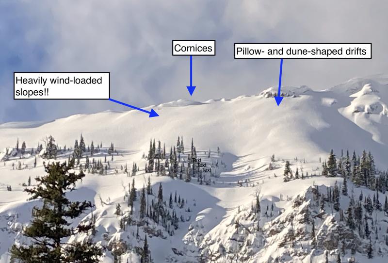
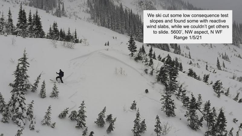
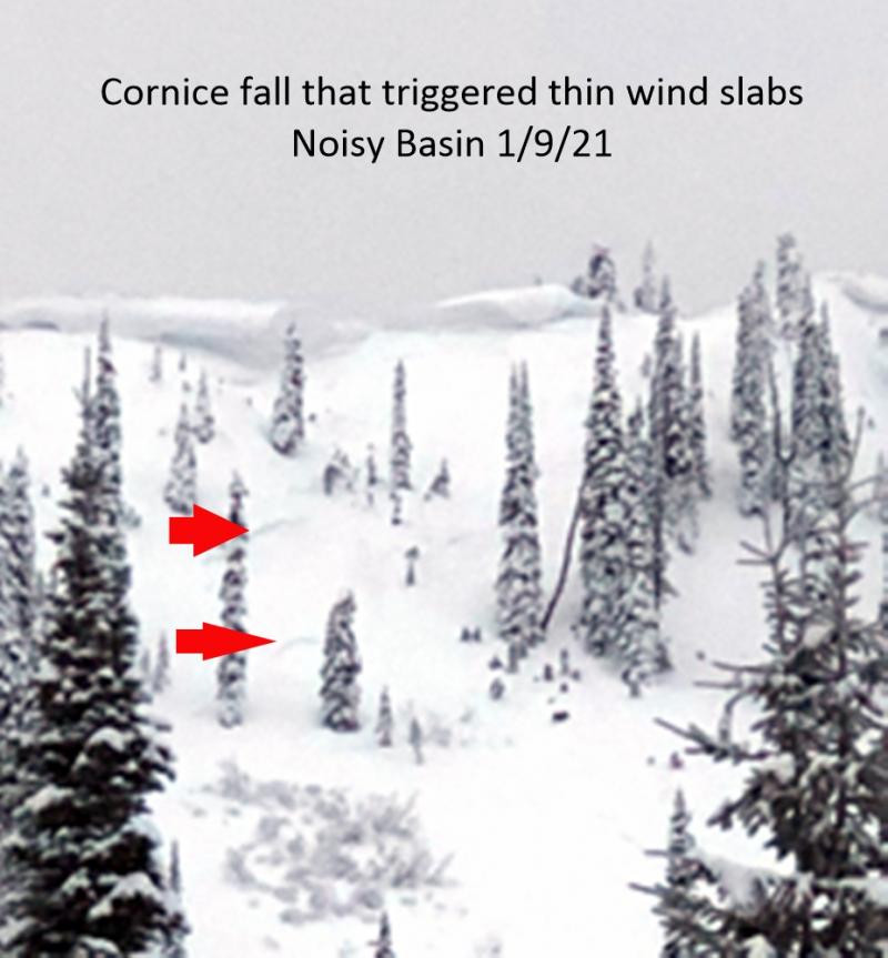
Continued mild conditions has helped to strengthen wind slabs formed earlier in the week. Unfortunately, due to the current variable surface conditions, we have had few observations from the true alpine area of our region. Therefore, wind slabs found in these high elevation locations should still be approached with caution. Wind slabs can be identified by smooth rounded pillows on the surface near ridgelines. Avoid steep, exposed slopes in the alpine that harbor these recent slabs. Also, keep in mind that even a small avalanche can trigger deeper instabilities resulting in a larger, more destructive slide.
Sunday: Zach was east of WMR in the Flathead Range where he found buried surface hoar 15 cm below the surface. This layer was reactive in his stability tests but did not propagate.
Saturday: FAC staff were at WMR, in the Whitefish Range, teaching an avalanche class where they noted new surface hoar growth on all aspects at upper elevations. We also noted an overall weak snowpack structure. Skiers east of the ski area boundary noted a 3 cm thick rain crust.
Friday: Mark traveled to Rescue Creek in the Flathead Range where he saw evidence of a low elevation wet loose avalanche cycle that had occurred from the rain and warming event on Wednesday. We also noted a rain crust at all elevations and substantial brush that is still exposed at low and mid elevations. FAC staff (Guy, Adam and Zach) were in the Lost Johnny area of the Swan Range where they saw no evidence of recent avalanche activity. They did find buried surface hoar that was minimally reactive in their stability tests. Skiers in the Flathead Range near Essex reported a rain crust that existed up to 6600'. They also noted evidence of a wet loose avalanche cycle from Wednesday's rain.
Tuesday: Seth was in the Flathead Range on Scalplock Mountain above Essex in GNP. where he observed no obvious signs of instability and little results in stability tests on NE and SE aspects. Poor structure to the snow pack with considerable depth hoar and other weak layers in the snow pack and widespread, sometimes very large surface hoar.
See below for all observations this season.
Our area enjoyed another mild day yesterday with light winds and periods of sun. As of 5:00 a.m. temperatures above 6000 feet range from 11-16º F. Winds changed direction and increased in speed mid day yesterday and are currently out of the north-northeast at 5-10 mph with gusts from 10-17 mph. Light snow arrived overnight leaving us with 0-3" of new snow. For today, expect partly cloudy skies, light winds and a few light snow showers. Note: Snotel sites across our area are down and have not recorded since 4:00 p.m. yesterday.
| 0600 temperature: | 11-16 deg. F. |
| Max. temperature in the last 24 hours: | 24-40 deg. F. |
| Average wind direction during the last 24 hours: | Northeast |
| Average wind speed during the last 24 hours: | 5-15 mph |
| Maximum wind gust in the last 24 hours: | 14-27 mph |
| New snowfall in the last 24 hours: | 0-3 inches |
| Total snow depth: | 50-69 inches |
This advisory applies only to backcountry areas outside established ski area boundaries. This advisory describes general avalanche conditions and local variations always occur. This advisory expires at midnight on the posted day unless otherwise noted. The information in this advisory is provided by the USDA Forest Service who is solely responsible for its content.


