| Tuesday | Tuesday Night | Wednesday | |
|---|---|---|---|
| Cloud Cover: | Snow and strong winds. | Tapering snowfall and continued strong winds. | Brief break in precipitation. Partly to mostly cloudy. |
| Temperatures: | 26 to 35 deg. F. | 14 to 22 deg. F. | 22 to 30 deg. F. |
| Wind Direction: | Southwest | Southwest | Southwest |
| Wind Speed: | 18-21 mph with gusts to 65 mph. | 17 -21 with gusts to 45 mph. | 5-15 mph with gusts to 25 mph. |
| Snowfall: | 4-7 in. | 2-6 in. | 0 in. |
| Snow Line: |
Whitefish Range
Swan Range
Flathead Range and Glacier National Park
How to read the forecast
Continued new snow, strong winds, and rising temperatures over the past 48 hours created dangerous avalanche conditions. Natural and human triggered avalanches are likely at upper elevations. Heavier, new snow buries much lighter snow and weak layers that developed over the last week of colder weather. The danger will rise to HIGH above 6000 feet by this afternoon and CONSIDERABLE below this elevation. Travel in avalanche terrain is not recommended today.

4. High
?
Above 6500 ft.
3. Considerable
?
5000-6500 ft.
2. Moderate
?
3500-5000 ft.
- 1. Low
- 2. Moderate
- 3. Considerable
- 4. High
- 5. Extreme
-
Type ?
-
Aspect/Elevation ?

-
Likelihood ?CertainVery LikelyLikelyPossible
 Unlikely
 -
Size ?HistoricVery LargeLargeSmall

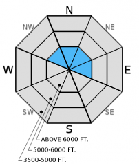
Strong southwest winds combined with over a foot of new snow over the past 48 hours, and more expected today, created sensitive wind slabs. These wind slabs were small, but sensitive, yesterday (video). I expect both natural and human triggered wind slabs to be much larger today. Such strong winds can deposit snow lower in the starting zone than usual. Look for smooth rounded pillows of snow as well as cracking and collapsing in the snowpack. Given the current conditions, it is best to avoid wind loaded slopes today.
-
Type ?
-
Aspect/Elevation ?

-
Likelihood ?CertainVery LikelyLikelyPossible
 Unlikely
 -
Size ?HistoricVery LargeLargeSmall

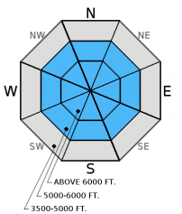
Yesterday, nearly a foot of light snow accumulated throughout the advisory area with another 6 to 12 inches expected today. This storm is much warmer than the previous storms over the past week, and the snow is much heavier. This creates an upside-down snowpack. The lighter layer beneath is unable to support the weight of the new snow. Natural and human triggered storm slab avalanches will become likely as the day progresses on all aspects at mid- to upper elevations and possible at lower elevations as well. Avoid avalanche terrain today, including flat runout zones below avalanche paths.
-
Type ?
-
Aspect/Elevation ?

-
Likelihood ?CertainVery LikelyLikelyPossible
 Unlikely
 -
Size ?HistoricVery LargeLargeSmall

This problem is more isolated across the advisory area. In some locations , we continue to find buried weak snow (facets) and weak snow around crusts. The load from this storm could awaken these deeper weak layers and cause large avalanches in these locations. These layers exist 1.5 to 3.5 feet from the snow surface now. Prior to this storm, stability tests indicated the potential for these deeper weak layers to fracture and propagate across the slope, but this was becoming less common. However, it is certainly more common in areas closer to the Continental Divide (like Skyland and John F. Stevens Canyon) where the snowpack is much shallower (video). Allow these deeper weak layers to adjust (or not) to this new load and give it some time.
Yesterday, my partner and I traveled in the Marion Lake/Dickey Creek area outside of Essex in the Flathead Range. We were able to easily trigger soft wind slabs on leeward aspects (video). Guy was in the backcountry adjacent to Whitefish Mountain Resort (WMR) and observed wind slab development near the ridges in the Canyon Creek area (image). Whitefish Mountain Resort Ski Patrol noted wind slabs becoming more cohesive as the day progressed yesterday. Sunday, WMR ski patrol observed no propagation in a pit dug within the ski area, but reported several layers that partially fractured within a foot from the snow surface.
Over the past 24 hours, 5 to 9 inches of snow has fallen across our advisory area with southwest winds at 15-30 mph with gusts to 47 mph. Currently, temperatures above 6000 feet range from 19º to 26º F, and winds are out of the south-southwest at 10-20 mph. Today, temperatures will range from 25º to 35º F with southwest winds of 20-30 mph and gusts to 70 mph. Expect another 6-12 inches of snow through tonight.
Storm totals of snowfall and snow water equivalent (SWE) (since Sunday morning 12/18):
Stahl Peak: 12 inches snow, 0.9 inches SWE
Big Mountain Summit: 15 inches snow, (precipitation sensor not reporting)
Noisy Basin: 11 inches snow, 0.8 inches SWE
Flattop Moutain (in GNP): 13 inches snow, 1.4 inches SWE
Pike Creek (near Marias Pass): 13 inches snow, 1.4 inches SWE
| 0600 temperature: | 19-27 deg. F. |
| Max. temperature in the last 24 hours: | 19-27 deg. F. |
| Average wind direction during the last 24 hours: | Southwest |
| Average wind speed during the last 24 hours: | 10-20 mph |
| Maximum wind gust in the last 24 hours: | 25 to 47 mph |
| New snowfall in the last 24 hours: | 3-9 inches |
| Total snow depth: | 51-64 inches |
This advisory applies only to backcountry areas outside established ski area boundaries. This advisory describes general avalanche conditions and local variations always occur. This advisory expires at midnight on the posted day unless otherwise noted. The information in this advisory is provided by the USDA Forest Service who is solely responsible for its content.


