| Monday | Monday Night | Tuesday | |
|---|---|---|---|
| Cloud Cover: | Snow showers. | Snow showers. | Snow showers. |
| Temperatures: | 29-41 deg. F. | 19-26 deg. F. | 29-39 deg. F. |
| Wind Direction: | W-SW | W-SW | W |
| Wind Speed: | 19-22 gusts 33-41 | 15-19 gusts 32-39 | 12-17 gusts 23-32 |
| Snowfall: | 1-2 in. | 1-4 in. | 2-5 in. |
| Snow Line: |
Whitefish Range
Swan Range
Flathead Range and Glacier National Park
How to read the forecast
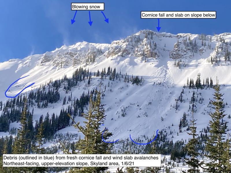
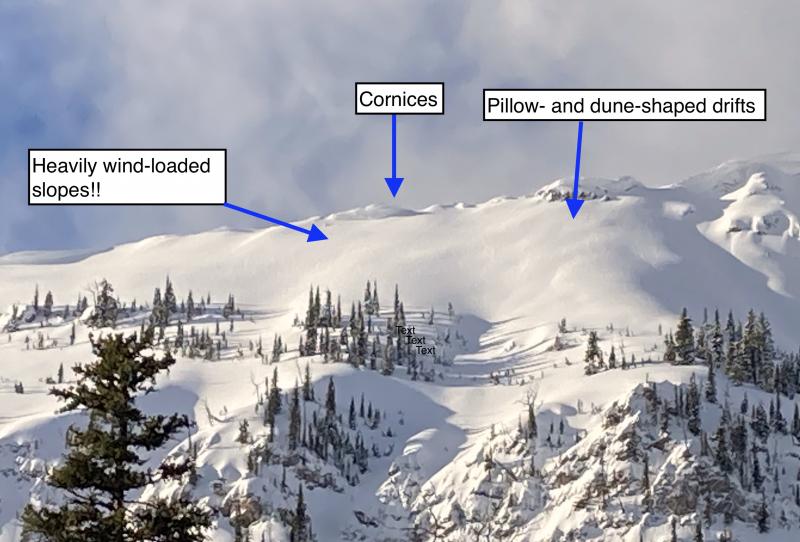
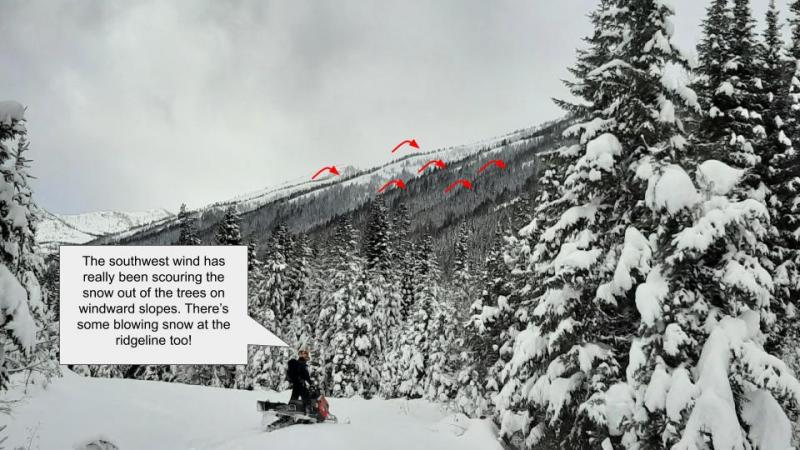
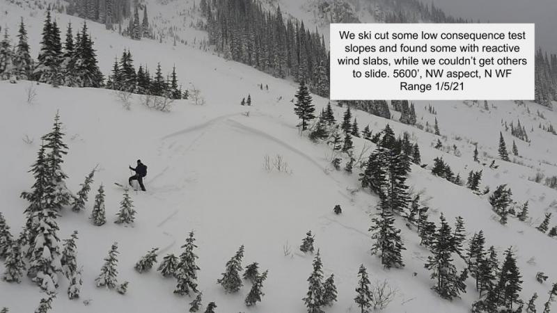
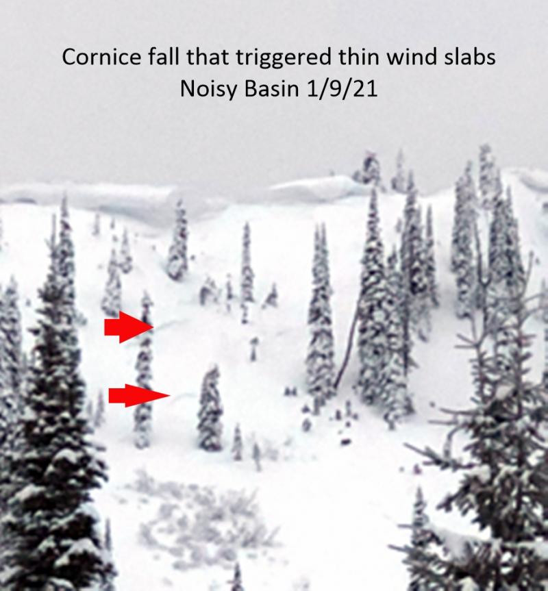
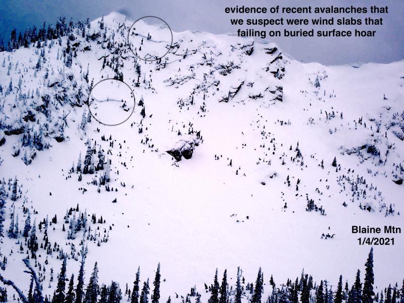
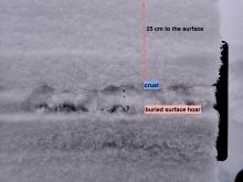
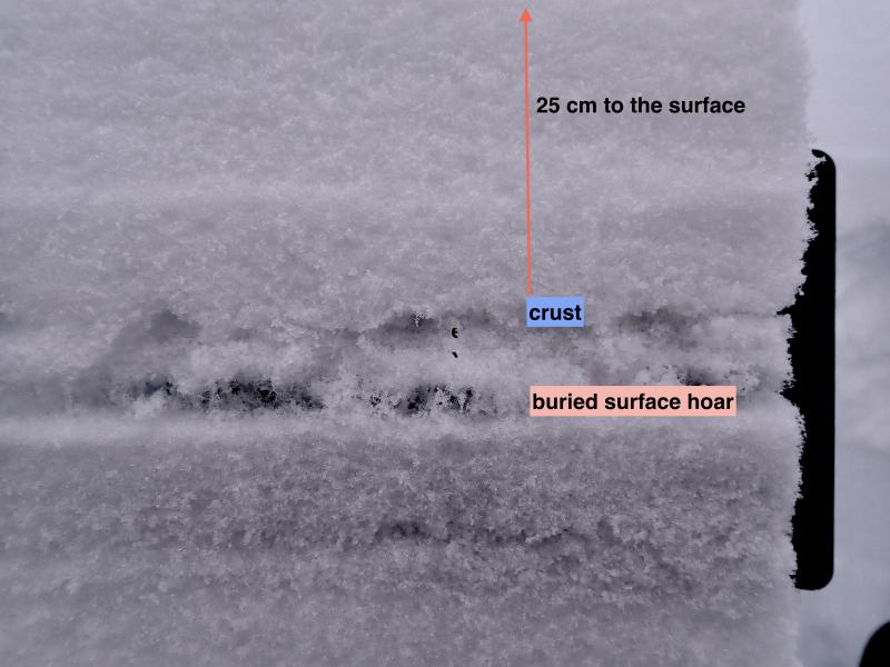
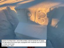
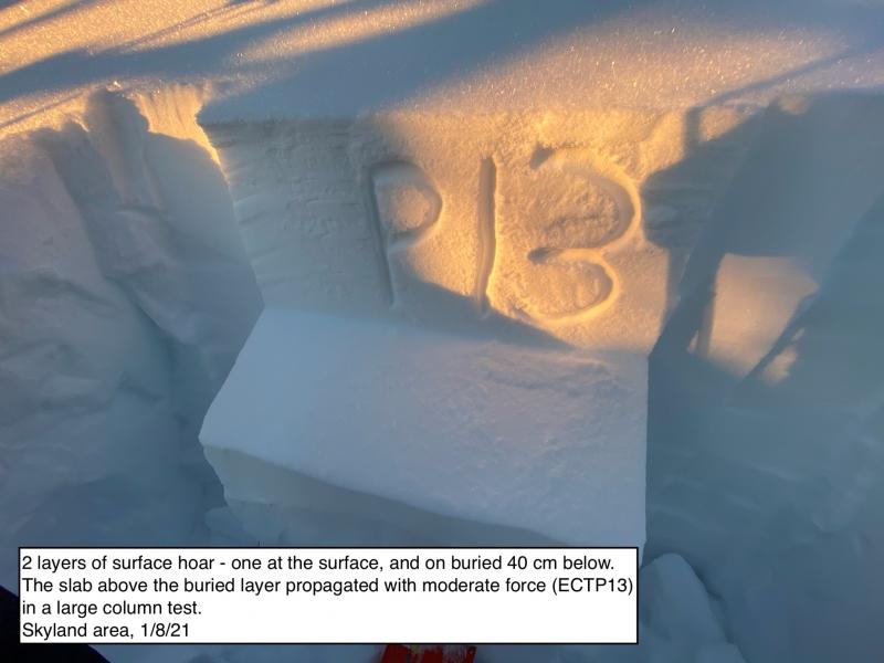
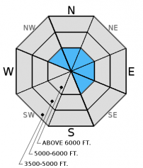
Strong ridge top winds continue to drift the new snow and create new, thin slabs and thicken existing slabs. Continue to assess windloaded areas before committing to a slope. A layer of buried surface hoar exists 1.5 to 2.5 feet deep in the snowpack in some areas. There is uncertainty in the distribution of this layer, which warrants careful site specific snowpack evaluation. The avalanche danger is MODERATE above 5000 feet.

2. Moderate
?
Above 6500 ft.
2. Moderate
?
5000-6500 ft.
1. Low
?
3500-5000 ft.
- 1. Low
- 2. Moderate
- 3. Considerable
- 4. High
- 5. Extreme
-
Type ?
-
Aspect/Elevation ?
-
Likelihood ?CertainVery LikelyLikelyPossible
 Unlikely
 -
Size ?HistoricVery LargeLargeSmall

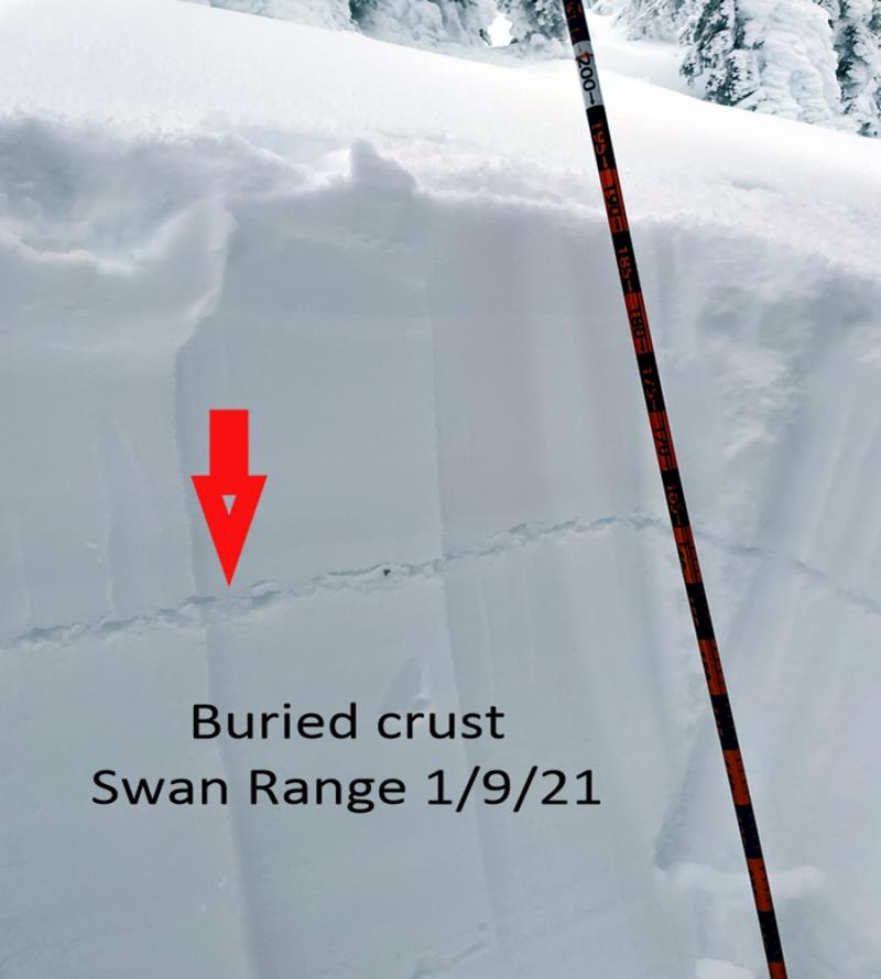
Another shot of snow coupled with continued moderate to strong winds created new slabs and added depth to existing slabs. In some areas wind slabs were deposited on crusts that will provide a smooth surface to slide on. Look for smooth, rounded features on the snow surface along leeward ridgelines. Carefully evaluate wind-loaded terrain before skiing or riding on a slope.
-
Type ?
-
Aspect/Elevation ?
-
Likelihood ?CertainVery LikelyLikelyPossible
 Unlikely
 -
Size ?HistoricVery LargeLargeSmall

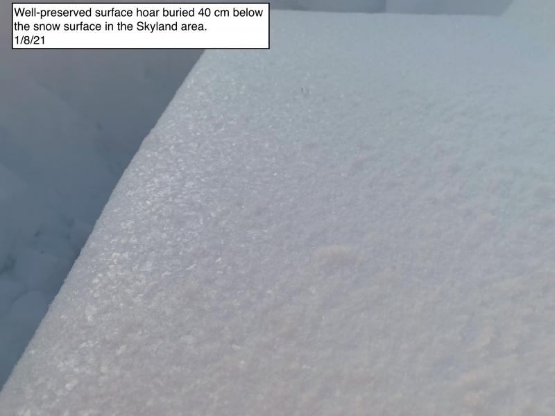
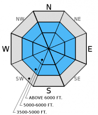
The buried surface hoar formed in late February seems to be most prevalent in the Whitefish Range, but while it was still on the surface it was observed in all ranges and should not be written off. Though less reactive, we also recently found this layer in the Flathead Range. Where this layer exists it will be 1.5-2.5 feet from the surface and it remains important to dig into the snow and look for it before skiing or riding on a slope. In other recent observations from the Flathead Range skiers noted weak, faceted snow around more recent crusts in the upper snowpack that proved reactive in stability tests. Keep in mind that while we have not put a large rapid load on these layers the incremental snowfall will add stress and may cause them to become more reactive.
Additional Concerns: Also, as we approach spring and daily maximum temperatures rise above freezing on a more regular basis, cornices will likely become more sensitive and glide cracks could begin to fail. Cornices can trigger slab avalanches on the slopes below making the consequences more severe. Give cornices a wide berth while traveling along ridges and limit your exposure time when traveling below them.
As the days become longer and the sun becomes more intense the potential for the snow surface to rapidly warm increases. Pay attention to the affect prolongued periods of sun exposure has on the snow surface. Early signs of instability are melting of surface crusts and pin wheels/roller balls forming on steep slopes indicating that it is time to move to more shaded terrain.
Avalanche Danger Scale: The National Avalanche Center developed a great video for helping backcountry users visually understand the avalanche danger scale (video).
We are saddened to hear about a fellow avalanche professional being killed in an avalanche on March 8 in the Wallowa Mountains in Oregon. Our thoughts are with the family and friends of Kip Rand and those at the Wallowa Avalanche Center (info).
Sunday: Skiers in the Tranquil Basin/Mt. Furlong area in the Flathead Range found a breakable crust below 5500 feet. At upper elevations they noted multiple crusts within the top 16 inches of the snowpack with weak, facets between them. Their stability tests produced fractures with propagation in this weak snow using hard force (observation).
Saturday: Mark and I rode up to Hash Mountain in the Swan Range. On the ride through the Lost Johnny drainage we observed 2 small, recent slab avalanches (observation). The rain transitioned to wet, heavy snow at about 6000 feet. We found 3-5 cm of new snow on top of the most recent crust and noted lots of roller ball activity in the new snow (observation). Guy was on Paola Ridge in the Flathead Range yesterday. He found small, decomposing surface hoar buried 14 inches from the surface. This layer fractured with easy force in compression tests (observation).
Thursday: Erich and I traveled along a safe ridge outside the ski area boundary yesterday and remotely triggered a small storm slab avalanche from the ridge (observation 1) and observed widespread shooting cracks and a collapse (observation 2). We also found buried surface hoar 1.5 to 2 feet from the surface to fracture and propagate in our stability test with moderate force (video). Whitefish Mountain Resort Ski Patrol also reported very reactive storm and wind slabs during their avalanche mitigation work Thursday morning (observation).
Wednesday: Erich traveled to Red Meadow Peak in the northern Whitefish Range where we found up to 5 inches of low density snow sitting atop a firm rain crust all the way to 7500 feet. We also found buried surface hoar up to 2 feet from the surface that fractured and propagated in stability tests (observation, video). We noted wet, loose avalanche debris from the weekend, but no new avalanche activity.
Visit our Observations page and our You Tube channel for more observations from the entire season.
Thanks to everyone for submitting observations. They are extremely useful and could help save lives.
HOW TO SUBMIT OBSERVATIONS:
Email: [email protected]
Call and leave a message: 406.387.3821
You can also submit quick observations via text: 406.241.4571 (FAC mobile)
OR
Submit Snowpack Observations: http://www.flatheadavalanche.org/node/add/snowobs
Submit Avalanche Observations: http://www.flatheadavalanche.org/node/add/avyobs
The weather rollercoaster continued yesterday with a relatively dry day becoming increasingly showery in the evening. We picked up an additional 2-4 inches of snow overnight. Currently, temperatures above 6000 feet range from 22º-29º F, and winds are out of the southwest at 5-22 mph with gusts from 10-32 mph. Today should bring more snow showers and a few breaks in the clouds. Temperatures are expected to rise to the upper-20s to low-30s, and winds will continue out of the southwest at 10-20 mph with gusts in the 30s.
| 0600 temperature: | 22-29 deg. F. |
| Max. temperature in the last 24 hours: | 27-36 deg. F. |
| Average wind direction during the last 24 hours: | SW |
| Average wind speed during the last 24 hours: | 10-20 mph |
| Maximum wind gust in the last 24 hours: | 23-48 mph |
| New snowfall in the last 24 hours: | 2-4 inches |
| Total snow depth: | 77-107 inches |
This advisory applies only to backcountry areas outside established ski area boundaries. This advisory describes general avalanche conditions and local variations always occur. This advisory expires at midnight on the posted day unless otherwise noted. The information in this advisory is provided by the USDA Forest Service who is solely responsible for its content.


