| Monday | Monday Night | Tuesday | |
|---|---|---|---|
| Cloud Cover: | Light snow showers with moderate winds and strong gusts | Diminishing showers and wind | High pressure building |
| Temperatures: | 28-39 deg. F. | 15-23 deg. F. | 29-38 deg. F. |
| Wind Direction: | W | W | SW |
| Wind Speed: | 12-16 gusts 21-32 | 8-10 gusts 12-21 | 5-7 |
| Snowfall: | 0-1 in. | 0 in. | 0 in. |
| Snow Line: |
Whitefish Range
Swan Range
Flathead Range and Glacier National Park
How to read the forecast
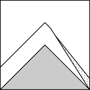
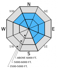
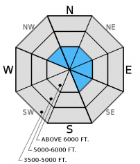
Increasing winds formed fresh wind slabs and today's winds will add to this problem. The avalanche danger is CONSIDERABLE on wind loaded aspects above 6000 feet. Human triggered avalanches are likely and careful snowpack evaluation is essential. All other slopes above 6000 feet are rated as MODERATE. Between 5000 and 6000 feet the danger is MODERATE but special attention should be paid to cross loaded slopes. Below 5000 feet the danger is LOW.

3. Considerable
?
Above 6500 ft.
2. Moderate
?
5000-6500 ft.
1. Low
?
3500-5000 ft.
- 1. Low
- 2. Moderate
- 3. Considerable
- 4. High
- 5. Extreme
-
Type ?
-
Aspect/Elevation ?
-
Likelihood ?CertainVery LikelyLikelyPossible
 Unlikely
 -
Size ?HistoricVery LargeLargeSmall

After a day of calm to light winds, wind speed increased overnight with moderate to strong gusts expected throughout the day. The Friday/Saturday storm brought abundant low density snow which is still available for transport in areas not affected by yesterdays sun. This morning will find fresh wind slabs that formed overnight with these slabs continuing to develop through the day. Expect these fresh slabs to be sensitive to human triggers today. Also, pay attention to cross-loaded terrain features that can exist well below the ridgeline. Look for rounded pillows of wind drifted snow on leeward sides of ridges and cross-loaded areas in gullies at both mid and upper elevations. Carefully evaluate all wind loaded terrain before committing to a slope.
-
Type ?
-
Aspect/Elevation ?
-
Likelihood ?CertainVery LikelyLikelyPossible
 Unlikely
 -
Size ?HistoricVery LargeLargeSmall

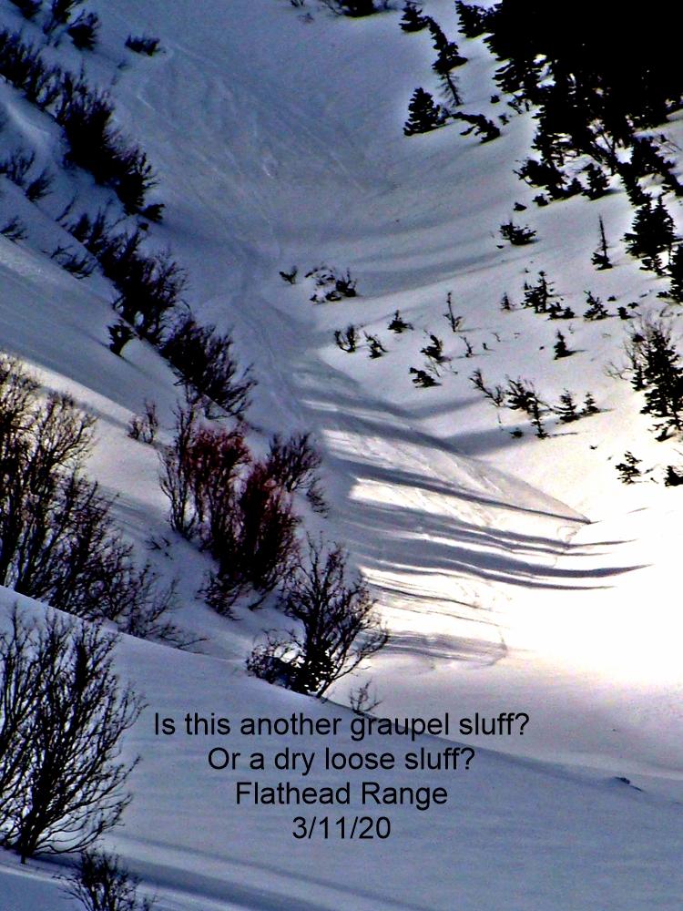
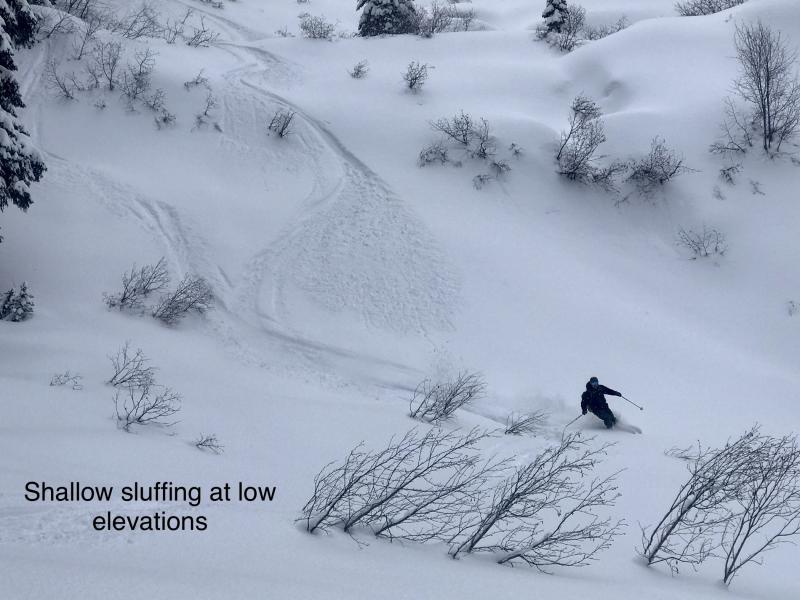
In sheltered areas unconsolidated storm snow from Friday/Saturday still exists. On steep aspects this snow was reported to be sluffing yesterday and we expect that this problem will continue today. These sluffs can start small, but rapidly entrain a substantial amount of snow and do a lot of damage. Particularly when traveling in or around terrain traps like narrow gullies, trees, and cliffs.
If the sun stays out for extended periods today look for rapidly deteriorating conditions on sun exposed slopes. Early indicators that the surface snow is becoming unstable are roller balls forming on steep cut banks, or the snow surface becoming moist. It is important to pay attention to these changing conditions and to move into more shaded terrain.
-
Type ?
-
Aspect/Elevation ?
-
Likelihood ?CertainVery LikelyLikelyPossible
 Unlikely
 -
Size ?HistoricVery LargeLargeSmall

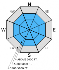
The Valentine's Day (2/14) rain crust now has 1.5-3 feet of snow sitting on top of it. In most recent observations we found a thin layer of facets above this crust. While it took hard force to initiate fracture, it propagated across the column in our stability tests on Thursday (video). Since this layer is relatively new and we added a recent heavy load it remains important to continue to treat this layer with caution on all slopes. Also keep in mind that small avalanches have the potential to stress this layer more than skiers or riders can. So a small avalanche could step down into this deeper layer. Dig into the snow to assess its reactivity. The slab above this crust will be much thicker in wind loaded areas.
Large cornices formed over the past few storm cycles may be weakened by the sun today. The rapid stress a falling cornice puts on these deeper weak layers can trigger deeper and more destructive avalanches.
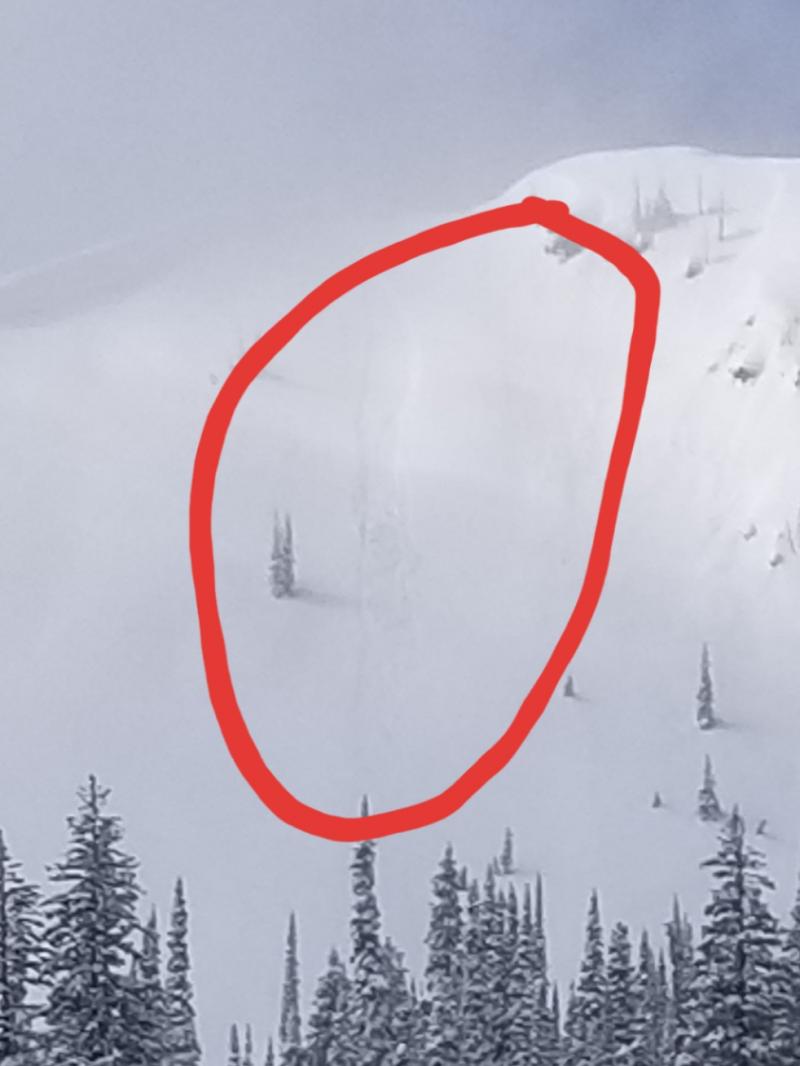
Cornice falls: The combination of recent snowfall and wind has created large cornices throughout our advisory area. These cornices will continue to grow today and be sensitive to a skier or rider. These cornices can fail naturally during development or during periods of warming. The weight of a cornice failure can trigger wind, storm or persistent slab avalanches on the slope below. A large avalanche in the Lost Johnny drainage of the northern Swan Range this weekend is a good example of this (see Recent Observations).
Sunday: Snowmobilers in the Lost Johnny drainage of the northern Swan Range noted a large natural slab avalanche that appears to have been triggered by a cornice fall (observation). Skiers in Spider Bowl in the northern Swan Range noted lots of sluffing of the new snow on steep upper elevation slopes, southerly aspects becoming sun affected as the day progressed and only minimal new snow on a crust at 5000 feet. Skiers in the Marion Lake area of the Flathead Range reported south facing slopes being sun affected with a 1/2 inch thick crust by late afternoon but good snow quality and no signs of instability while skiing north aspects.
Saturday: There were two close calls in the advisory area. A skier was caught in a thin slab avalanche adjacent to the Whitefish Mountain Resort boundary and was carried an estimated 500 feet. This individual triggered the slide 2 or 3 turns into their run from a ridgeline. Fortunately only minor injuries were sustained. A snowboarder in the Cascadilla Drainage in the Flathead Range triggered a slab avalanche and was able to ride out (observation).
Snowmobile observers were in the Skyland area in the Flathead Range and noted 10-12 inches of new snow. Wind was drifting the snow, but only building very soft slabs. They found the Valentine's (2/14) crust 1.5 feet from the surface that fractured and propagated with moderate force in stability tests. Additionally, there was a thick rain crust formed in late January with underlying weak snow that also fractured and propagated with hard force. Skiers on Baldhead Mountain in the Flathead Range found 16-18 inches of storm snow (observation). Skiers on Paola ridge reported steady moderate winds that drifted snow throughout the day and periods of heavy snowfall. On a few short test slopes they observed shooting cracks (observation). Skiers in Dickey Creek, also in the Flathead Range found 12 inches of new snow at upper elevations and noted sluffing and shooting cracks on their decscent. Skiers in the Marion Lake area observed wind drifting the snow along ridgelines and cross-loading mid-slopes. They also noted obvious signs of instability like shooting cracks (observation).
Visit our Observations page and our You Tube channel for more observations from the entire season.

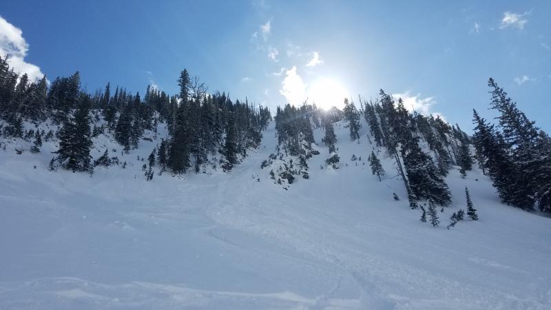
Soft slab potenitally triggered by cornice fall in Lost Johnny, Swan Range. Above photos courtesy of: Kilee Stevens
Thanks to everyone for submitting observations. They are extremely useful and could help save lives.
HOW TO SUBMIT OBSERVATIONS:
Email: [email protected]
Call and leave a message: 406.387.3821
You can also submit quick observations via text: 406.241.4571 (FAC mobile)
OR
Submit Snowpack Observations: http://www.flatheadavalanche.org/node/add/snowobs
Submit Avalanche Observations: http://www.flatheadavalanche.org/node/add/avyobs
Abundant sunshine, light winds and seasonal temperatures were over our area for most of the day yesterday. Last evening a weak disturbance ushered in mostly cloudy skies, very light precipitation and increasing wind speeds at all elevations. As of 5:00 a.m.temperatures above 6000 feet range from 18º-26º F, winds are out of the west-southwest at 7-17 mph gusting to 38 mph. Today should see mostly cloudy skies, light snow showers and temperatures warming to the upper 20s to low 30s. Winds will blow out of the west at 15-20 mph with strong gusts in the 30s mand 40s. Wind speeds and precipitation should diminish this evening before high pressure starts to build on Tuesday.
| 0600 temperature: | 18-26 deg. F. |
| Max. temperature in the last 24 hours: | 25-33 deg. F. |
| Average wind direction during the last 24 hours: | WSW |
| Average wind speed during the last 24 hours: | 5-15 mph |
| Maximum wind gust in the last 24 hours: | 23-38 mph |
| New snowfall in the last 24 hours: | 0-1 inches |
| Total snow depth: | 78-104 inches |
This advisory applies only to backcountry areas outside established ski area boundaries. This advisory describes general avalanche conditions and local variations always occur. This advisory expires at midnight on the posted day unless otherwise noted. The information in this advisory is provided by the USDA Forest Service who is solely responsible for its content.


