| Tuesday | Tuesday Night | Wednesday | |
|---|---|---|---|
| Cloud Cover: | Warm. | Continued clearing. | Not quite as warm. |
| Temperatures: | 39-48 deg. F. | 24-33 deg. F. | 35-44 deg. F. |
| Wind Direction: | SW | SW | S-SW |
| Wind Speed: | 4-5 | 5-6 gusts 16 | 5-10 gusts 28 |
| Snowfall: | 0 in. | 0 in. | 0 in. |
| Snow Line: |
Whitefish Range
Swan Range
Flathead Range and Glacier National Park
How to read the forecast
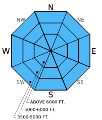
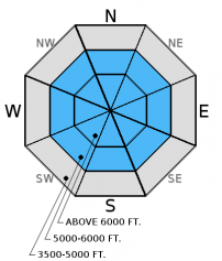
The avalanche danger will start as MODERATE but rise to CONSIDERABLE on sunny aspects above 5000 feet as the day progresses. The warmest upper elevation temperatures of the season, combined with solar input, will stress the surface snow with wet loose avalanches and cornice failures possible. Human triggered avalanches are likely today. Below 5000 feet the danger will start as LOW but rise to MODERATE as the snow surface warms.

3. Considerable
?
Above 6500 ft.
3. Considerable
?
5000-6500 ft.
2. Moderate
?
3500-5000 ft.
- 1. Low
- 2. Moderate
- 3. Considerable
- 4. High
- 5. Extreme
-
Type ?
-
Aspect/Elevation ?
-
Likelihood ?CertainVery LikelyLikelyPossible
 Unlikely
 -
Size ?HistoricVery LargeLargeSmall

Yesterday's warm temperatures stressed the relatively cool dry surface snow resulting in rollerballs/pinwheels at all elevations (observation). Rollerballs/pinwheels are the first sign of surface instability with wet snow. Today's temperatures will exceed what we saw yesterday, and combined with increaed solar input, will put our surface snow to the test. In areas that were warmed yesterday we will find a thin surface melt freeze crust capping moist snow this morning. This crust should break down quickly with warming temperatures and sunshine. Therefore expect instabilities to begin on sunny aspects and follow the sun as it warms other aspects. If the skiing and riding conditions start to deteriorate you have overstayed your welcome and it is time to head to a shaded aspect or call it a day. Even small wet loose slides are difficult to ski or ride out of due to their wet concrete like consistency. Wet loose slides can put a lot of stress (weight) on the snowpack and trigger deeper instabilities.
-
Type ?
-
Aspect/Elevation ?
-
Likelihood ?CertainVery LikelyLikelyPossible
 Unlikely
 -
Size ?HistoricVery LargeLargeSmall

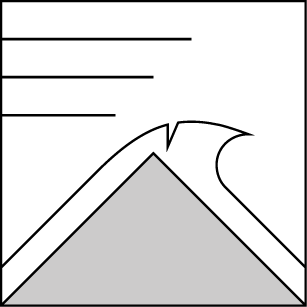
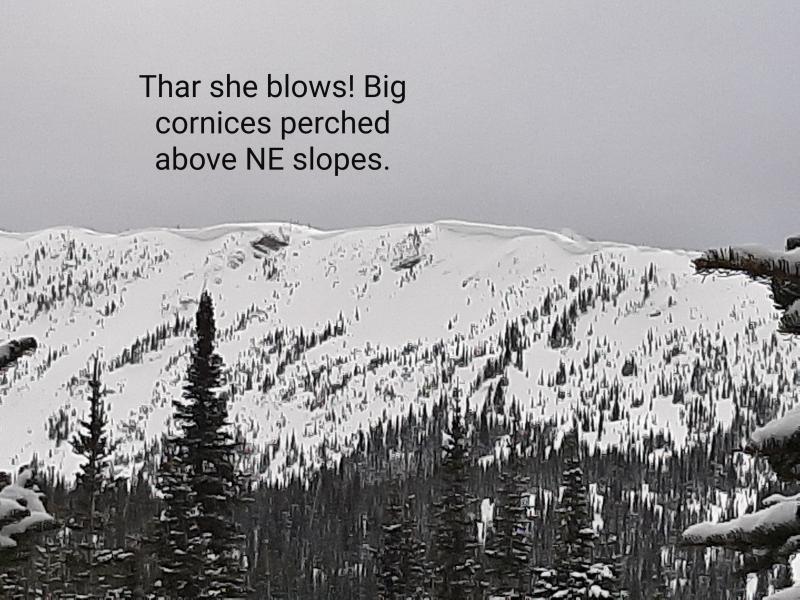
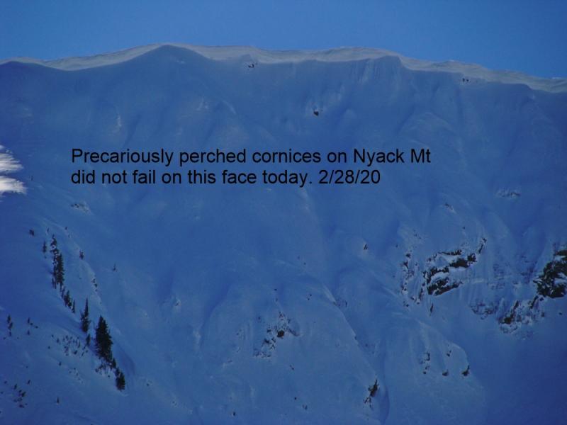
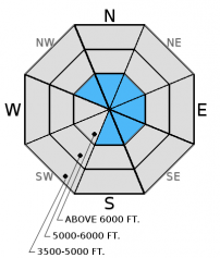
Recent strong winds created substantial cornice formation throughout our advisory area. Continued warm temperatures and potential solar radiation will weaken these cornices today and through the week. This is not the time to ride or ski on or below these features. Cornice falls have the ability to trigger avalanches on any layer of concern in the snowpack (e.g. surface wet loose, wind slabs, persistent slabs). Cornices are referred to as the "bombs of the backcountry" and this is the time to give them a wide berth. Cornice failures were observed in the Apgar Range in southern Glacier Park on Sunday (observation).
-
Type ?
-
Aspect/Elevation ?
-
Likelihood ?CertainVery LikelyLikelyPossible
 Unlikely
 -
Size ?HistoricVery LargeLargeSmall

Buried surface hoar now about 6 inches to a foot from the surface has produced the most recent activity, but is spotty in distribution. Deeper layers like the weak snow surrounding the the January 17 and January 28 rain crusts are buried 1.5-2.5 feet deep. Recent stability tests suggest that these deeper persistent slabs are gaining strength and are becoming more difficult to trigger. With that said it remains important to perform site specific snowpack evaluation. Dig in the snow and do a stability test, look for locally reactive slabs. Where they are present and there is any question about stability choose conservative terrain to ski or ride in. Avoid areas where you are more likely to affect these layers like in shallow snow and in steep, rocky areas.
Wind Slabs: The wind event our area experienced Friday/Saturday was possibly the most impressive of the season. Moderate to strong winds drifted recent snow and formed wind slabs on multiple aspects at both mid and upper elevations. Recent warm temperatures has initiated the strengthening process within these slabs. However, due to their thickness and wide distribution, lingering wind slabs reactive to a skier or rider remain a concern. In some areas these slabs formed over a recently buried layer of surface hoar (formed 2/3). In these areas instability will linger and avalanches have the potential to propagate far and wide. Look for obvious signs of instability like shooting cracks, whumpfing, and recent avalanche activity. Look for convex pillows of wind drifted snow on the lee sides of ridges and other cross-loaded terrain. Carefully evaluate all wind loaded terrain before traveling on or underneath the slope.
The final report for the 1/23/2016 avalanche fatality in Swede Creek in the Whitefish Range is complete and located here: http://www.flatheadavalanche.org/sites/default/files/20160124_swedecreekavalaccidentreport_final.pdf.
Monday: Guy and Austin rode into the Mission Mountains (outside our advisory area) and noted evidence of the recent wind event at all elevations. They found 2 layers of surface hoar in a north facing pit and also observed warm conditions and rollerballs/pinwheels at all elevations (observation).
Sunday: Skiers in the Apgar Range in southern Glacier Park noted numerous cornice failures along with possible wet slide debris at lower elevations. Wind slabs varied between non reactive to somewhat reactive. Skiing at lower elevations was "heavy and sloppy" (observation). The Patrol Fund Level 1 avalanche course at WMR in the southern Whitefish Range were able to get failure below the late January crust in compression tests with hard force. They also noted new surface hoar growth overnight (observation).
Saturday: Snowmobilers in the Stahl Peak area in the northern Whitefish Range observed recent natural avalanche activity. They noted wind drifting the snow at all elevations. While side hilling on a road cut they experienced cracking in the windslab 10-20cm deep (observation). We were in the Red Meadow area also in the northern Whitefish Range. Wind was drifting snow and forming wind slabs at all elevations (photo, video), and large cornices were developing along leeward ridgelines. We found weak snow around the January 28 crust that fractured in stability tests without propagation (observation). Snowmobilers in the Lost Johnny area of the northern Swan Range found substantial top loading and cross loading along with a 3 inch thich rain crust 2+feet from the snow surface.
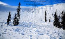
Friday: Skiers in Crystal Creek/Stanton Lake in the Flathead Range intentionally triggered a windslab from the ridgeline (photo). They also noted active windloading forming slabs thicker than 2 feet deep (observation). Skiers on Snowshed Mountain also in the Flathead Range observed light winds with minimal drifting due to scoured windward slopes. They did note evidence of recent wind loading as knee deep soft slabs had formed on leeward slopes. Stability tests produced fractures with hard force on weak snow surrounding crusts 1.5-2 feet deep. They did not observe recently formed buried surface hoar in this location (observation). Snowmobilers in the 6-Mile area in the Swan Range noted substantial recent windloading. They did not see recent avalanche activity, but did experience other obvious signs of instability like cracking and collapsing (whumphing).
Thursday: Erich and I rode into Doris Ck. yesterday and were a bit suprised to see how much wind affected snow existed at elevations below 5000 ft. While the slabs weren't terribly large (6-10 inches deep), this clearly shows that they are thicker at mid and upper elevations. We also observed shooting cracks on small test slopes less than 35 degrees (observation, video). Skiers in the Essex Creek area of the Flathead Range also reported strong to extreme (>38 mph) winds with loose snow sluffs and shallow slabs on steep slopes as well (observation). Skiers in the Wahoo/Cascadilla area in the Flathead Range observed widespread cracking, shallow slabs at lower elevations, and signs of instability at all elevations as well.
Wednesday: Erich toured in Skookoleel and Lakalaho Creeks in the southern Whitefish Range yesterday where they found variable results in our numerous stability tests in a number of different pit locations (video, observation). They also found 3-5 mm surface hoar that formed Tuesday night. Skiers in the Middle Fork of the Flathead Range also observed surface hoar and a few layers in the upper snowpack that produced fracture in their stability tests (observation).
Visit our Observations page and our You Tube channel for more observations from the entire season.
Thanks to everyone for submitting observations. They are extremely useful and could help save lives.
HOW TO SUBMIT OBSERVATIONS:
Email: [email protected]
Call and leave a message: 406.387.3821
You can also submit quick observations via text: 406.241.4571 (FAC mobile)
OR
Submit Snowpack Observations: http://www.flatheadavalanche.org/node/add/snowobs
Submit Avalanche Observations: http://www.flatheadavalanche.org/node/add/avyobs
High pressure continued to strengthen across our area through the day yesterday and overnight. A high level layer of stratus clouds kept the solar radiation to a minimun but temperatures were still able to rise above freezing at most high elevation weather stations. The valley floor Fielding weather station, at 4641 feet in southern Glacier Park, topped out at a balmy 48° F! Today expect temperatures to climb above freezing at all elevations with possible readings into the 40°s at ridgeline heights. This morning temps currently range from the upper 20°s to low 30°s F with light winds and clear skies.
| 0600 temperature: | 22-38 deg. F. |
| Max. temperature in the last 24 hours: | 31-42 deg. F. |
| Average wind direction during the last 24 hours: | SW |
| Average wind speed during the last 24 hours: | 5-15 mph |
| Maximum wind gust in the last 24 hours: | 10-25 mph |
| New snowfall in the last 24 hours: | 0 inches |
| Total snow depth: | 62-93 inches |
This advisory applies only to backcountry areas outside established ski area boundaries. This advisory describes general avalanche conditions and local variations always occur. This advisory expires at midnight on the posted day unless otherwise noted. The information in this advisory is provided by the USDA Forest Service who is solely responsible for its content.


