| Monday | Monday Night | Tuesday | |
|---|---|---|---|
| Cloud Cover: | Snow showers. | Snow showers. | light lingering snow showers. |
| Temperatures: | 22-30 deg. F. | 9-17 deg. F. | 22-30 deg. F. |
| Wind Direction: | SW | SW | W-SW |
| Wind Speed: | 3-4 | 4-5 | 5-7 |
| Snowfall: | 1-3 in. | 1-2 in. | 0-2 in. |
| Snow Line: |
Whitefish Range
Swan Range
Flathead Range and Glacier National Park
How to read the forecast
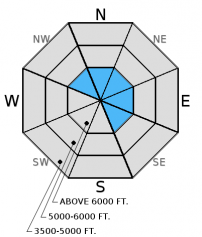
The wind speeds have moderated, but the recently drifted snow needs a chance to settle and strengthen. The avalanche danger is CONSIDERABLE on wind loaded slopes above 6000 feet. Human triggered avalanches are likely in these wind loaded areas. All other slopes have a MODERATE danger. Human triggered avalanches are possible. Isolated areas with reactive persistent slabs and lingering storm instabilities warrant careful snowpack evaluation and conservative terrain choices.

3. Considerable
?
Above 6500 ft.
2. Moderate
?
5000-6500 ft.
2. Moderate
?
3500-5000 ft.
- 1. Low
- 2. Moderate
- 3. Considerable
- 4. High
- 5. Extreme
-
Type ?
-
Aspect/Elevation ?
-
Likelihood ?CertainVery LikelyLikelyPossible
 Unlikely
 -
Size ?HistoricVery LargeLargeSmall

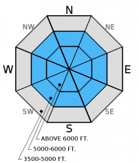
Don't be fooled by the light winds expected today. Windslabs can take up to a week to gain strength. In some areas expect to find fresh windslabs 2-3 feet thick that will remain sensitive to human triggers. Wind loaded slopes are easy to identify. Look for smooth, rounded features and convex pillows on leeward slopes. Also, keep in mind that cross-loading can form slabs mid slope and far below the ridgelines. Carefully evaluate wind loaded terrain before committing to a slope.
-
Type ?
-
Aspect/Elevation ?
-
Likelihood ?CertainVery LikelyLikelyPossible
 Unlikely
 -
Size ?HistoricVery LargeLargeSmall

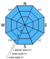
Persistent slabs including those sitting on weak snow below the January 12 rain crust and around the January 17 rain crust are getting more difficult to affect in stability tests that suggests that they are gaining strength. But in some areas they continue to fracture and propagate in these tests illustrating that it is still possible to trigger an avalanche on these layers. As these layers get buried deeper and the probability of triggering an avalanche on one of them lowers the consequence remains severe. The only way to know if these layers are present and reactive is to dig into the snow and perform stability tests. Where these weak layers exist consider how you may trigger them like in areas with shallow snow where they are closer to the surface, and in steep, rocky terrain. A rapid stress to these layers like cornice fall, smaller avalanches, or multiple machines on a slope could also awaken them.
-
Type ?
-
Aspect/Elevation ?
-
Likelihood ?CertainVery LikelyLikelyPossible
 Unlikely
 -
Size ?HistoricVery LargeLargeSmall

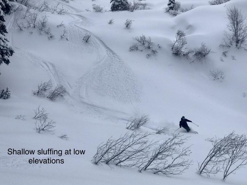
In locations where recent snow remains unconsolidated, loose snow avalanches may still be triggered in steep terrain. These avalanches could entrain a lot of snow and pack a big punch. Remember that even small avalanches can have severe consequences if you are caught while traveling in or around terrain traps like narrow gullies, trees, or cliffs.
Though not wide spread across the advisory area, there are locations where large cornices have been observed (and failed). If you encounter large cornices give them a wide buffer as they are likely recently formed and sensitive. Remember that cornices can pull out behind the ridgeline and take you with them. Aside from the danger of being hit by a large mass of consolidated snow they are the "bombs of the backcountry" and can trigger deep and dangerous avalanches.
The final report for the 1/23/2016 avalanche fatality in Swede Creek in the Whitefish Range is complete and located here: http://www.flatheadavalanche.org/sites/default/files/20160124_swedecreekavalaccidentreport_final.pdf.
A skier triggered avalanche was reported in Noisy Basin in the Swan Range yesterday. There were no other details, but no one was caught.
Yesterday a party of snowbikers and snowmobilers were in McGinnis Creek in the southern Whitefish Range and triggered a small windslab (observation). Skiers in the Ghoulie Point area in the southern Whitefish Range dug a snow pit and found a crust buried buried 20 inches deep with weak, faceted snow on top. Stability tests produced fractures on top of this crust that did not propagate and fractures below the recent storm snow (observation).
Saturday, snowmobilers reported natural avalanche activity in McGinnis Creek in southern Whitefish Range.
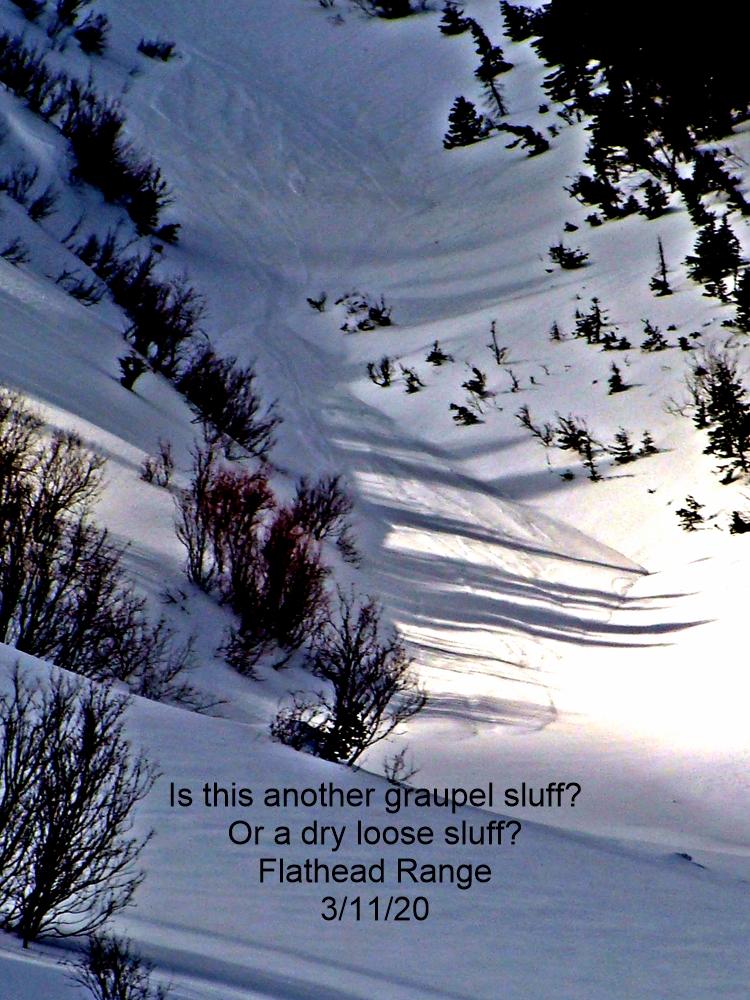
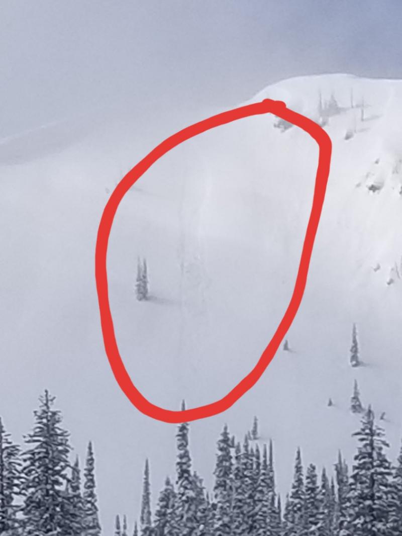
Mark was in the Skyland area in the Flathead Range. He observed a recent natural avalanche thought to be a wind slab triggered by loose snow (photo). He noted wind drifting the snow on the ridgelines, as well as mid slope level.
BNSF Avalanche Safety reported a large cornice failure in their program area that occured on January 29. The debris slid an estimated 800 vertical feet (photo *observed 1/30).
Skiers in the Swan Range on Saturday noted poor bonds in the recent storm snow, active wind drifting, and small, sensitive slabs (observation). Skiers in Cascade Creek in the Flathead Range found 10 inches of new snow that easily slid on steep rollovers. Extended column tests revealed several layers that fractured with moderate to hard force but did not propagate (Observation). Another party of skiers in the Ghoulie Point area in the southern Whitefish Range skied low angle slopes without any obvious signs of instability and also noted active wind drifting snow on ridges and signs of cross-loading in the mid-slopes (observation).
Friday we were on Elk Mountain in southern Glacier Park where a surface crust extended up to about 6300 feet. Winds were light out of the west, but there was evidence of recent wind drifted snow. We found a shallow snowpack and got variable results in stability tests. Recent, thin wind slabs (1 foot thick) fractured and propagated in extended column tests (video). Deeper layers like weak snow near the January 17th crust and January 12 crust fractured but did not propagate.
For more information on the recent avalanche fatality in Swede Creek, Whitefish Range (1/23/2016) please view the final report here.
Visit our Observations page and our You Tube channel for more observations from the entire season.
Thanks to everyone for submitting observations. They are extremely useful and could help save lives.
HOW TO SUBMIT OBSERVATIONS:
Email: [email protected]
Call and leave a message: 406.387.3821
You can also submit quick observations via text: 406.241.4571 (FAC mobile)
OR
Submit Snowpack Observations: http://www.flatheadavalanche.org/node/add/snowobs
Submit Avalanche Observations: http://www.flatheadavalanche.org/node/add/avyobs
Another round of snow showers moved through the area yesterday. The most notable snowfall was in the Swan Range where Noisy Basin SNOTEL recorded 6 inches in the past 24 hours. Light winds blew out of the west and southwest. Currently, temperatures range from 11º-19º F, and winds are 1-6 mph out of the southwest. Today temperatures will rise to the low to mid 20s. Winds will continue out of the southwest at 5-10 mph. We could see a few snow showers today that are similar to the past couple of days.
| 0600 temperature: | 11-19 deg. F. |
| Max. temperature in the last 24 hours: | 21-24 deg. F. |
| Average wind direction during the last 24 hours: | SW |
| Average wind speed during the last 24 hours: | 4-8 mph |
| Maximum wind gust in the last 24 hours: | 5-19 mph |
| New snowfall in the last 24 hours: | 0-6 inches |
| Total snow depth: | 67-96 inches |
This advisory applies only to backcountry areas outside established ski area boundaries. This advisory describes general avalanche conditions and local variations always occur. This advisory expires at midnight on the posted day unless otherwise noted. The information in this advisory is provided by the USDA Forest Service who is solely responsible for its content.


