| Wednesday | Wednesday Night | Thursday | |
|---|---|---|---|
| Cloud Cover: | Scattered light precipitation | Very light precipitation | Warm wet system enters our area |
| Temperatures: | 34-41 deg. F. | 28-34 deg. F. | 34-45 deg. F. |
| Wind Direction: | W-SW | W-SW | W-SW |
| Wind Speed: | 7-10 gusts 23 | 8-10 gusts 23 | 14-18 gusts 33-40 |
| Snowfall: | 0 in. | 0 in. | 0-3 in. |
| Snow Line: |
Whitefish Range
Swan Range
Flathead Range and Glacier National Park
How to read the forecast
Human triggered and natural avalanches were reported Saturday and Sunday. Natural activity appears to have ceased but human triggered avalanches are still likely. Our current snowpack is widely variable and backcountry travel is tricky and dangerous. The avalanche danger is CONSIDERABLE above 5000 feet and MODERATE below 5000 feet. Careful snowpack evaluation, cautious route-finding, and conservative decision making are essential. For more information on the recent avalanche fatality please visit our observations page (observation).

3. Considerable
?
Above 6500 ft.
3. Considerable
?
5000-6500 ft.
2. Moderate
?
3500-5000 ft.
- 1. Low
- 2. Moderate
- 3. Considerable
- 4. High
- 5. Extreme
-
Type ?
-
Aspect/Elevation ?
-
Likelihood ?CertainVery LikelyLikelyPossible
 Unlikely
 -
Size ?HistoricVery LargeLargeSmall

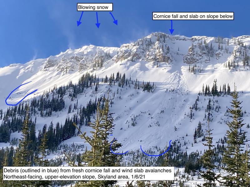
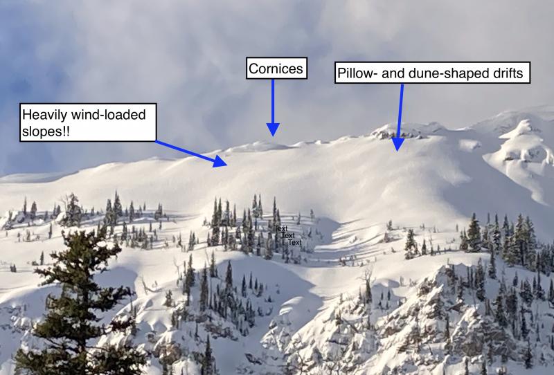
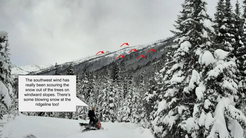
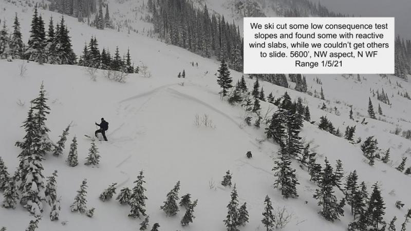
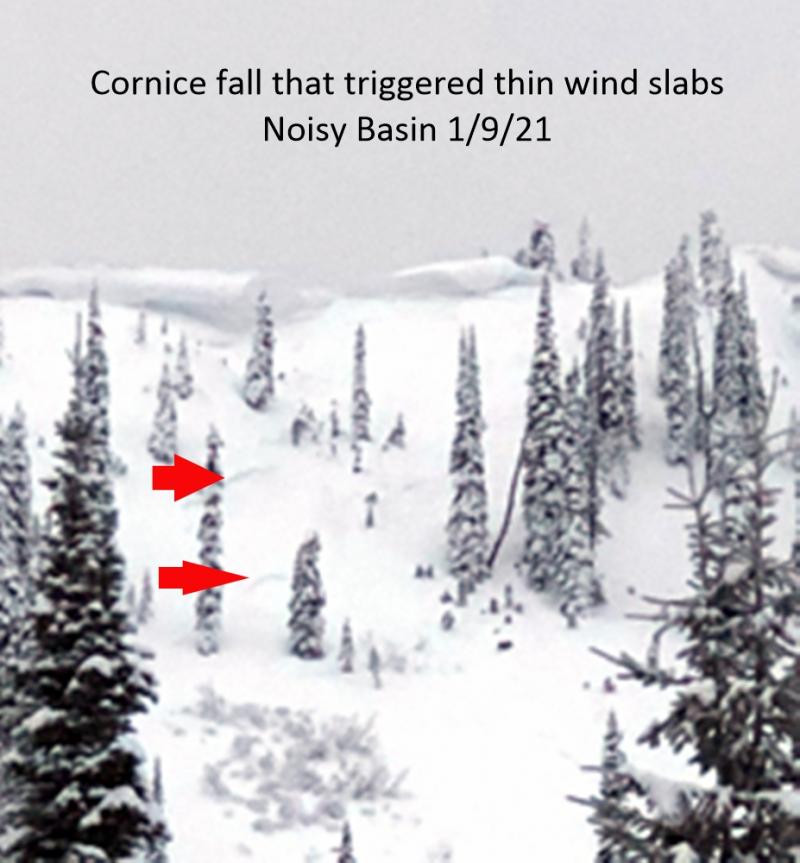
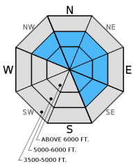
Over the past 24 hours favored locations recorded wind speeds strong enough to move snow. This trend will continue today into tomorrow with Thursdays forecast wind speeds being higher than what we have seen in some time. The combination of recent new snow and moderate to strong wind gusts has formed fresh wind slabs at mid and upper elevations. Predominate southwest flow has top loaded north through east aspects and cross-loaded northwest and southeast aspects. Wind slabs that formed on smooth crusts may take longer to strengthen. Additionally, wind drifted snow adds weight to the snowpack just like new snow, and can stress existing weak layers that may fail deeper and propagate wider. Look for smooth, rounded features on the snow surface or deeper looking pillows. Carefully evaluate recently wind loaded terrain before committing to a slope.
-
Type ?
-
Aspect/Elevation ?
-
Likelihood ?CertainVery LikelyLikelyPossible
 Unlikely
 -
Size ?HistoricVery LargeLargeSmall

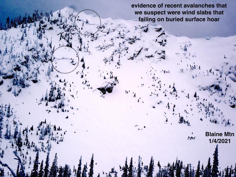
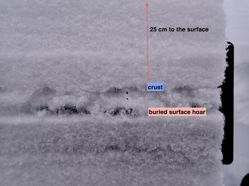
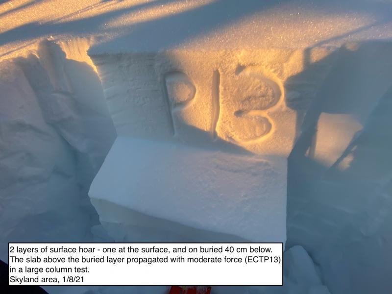
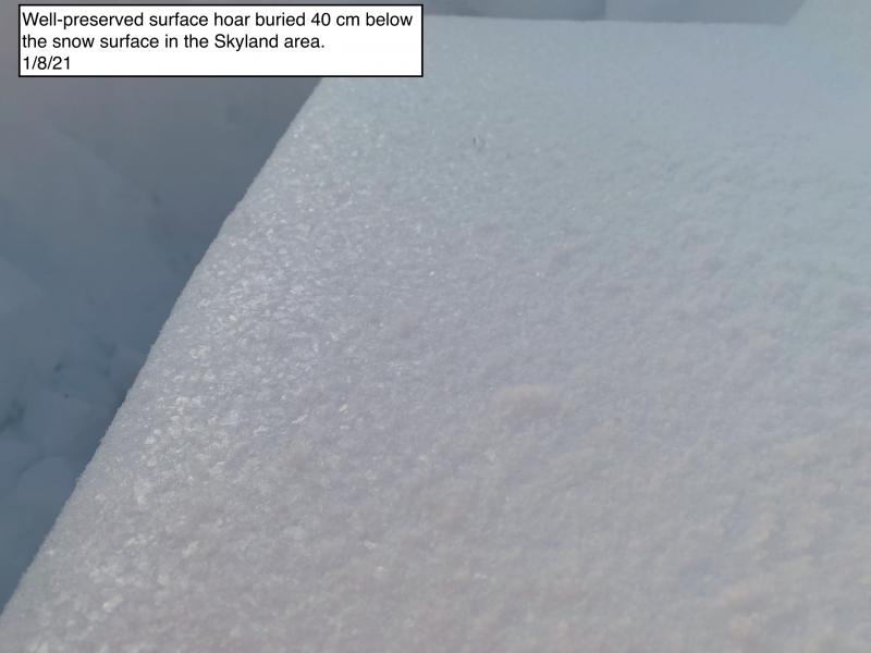
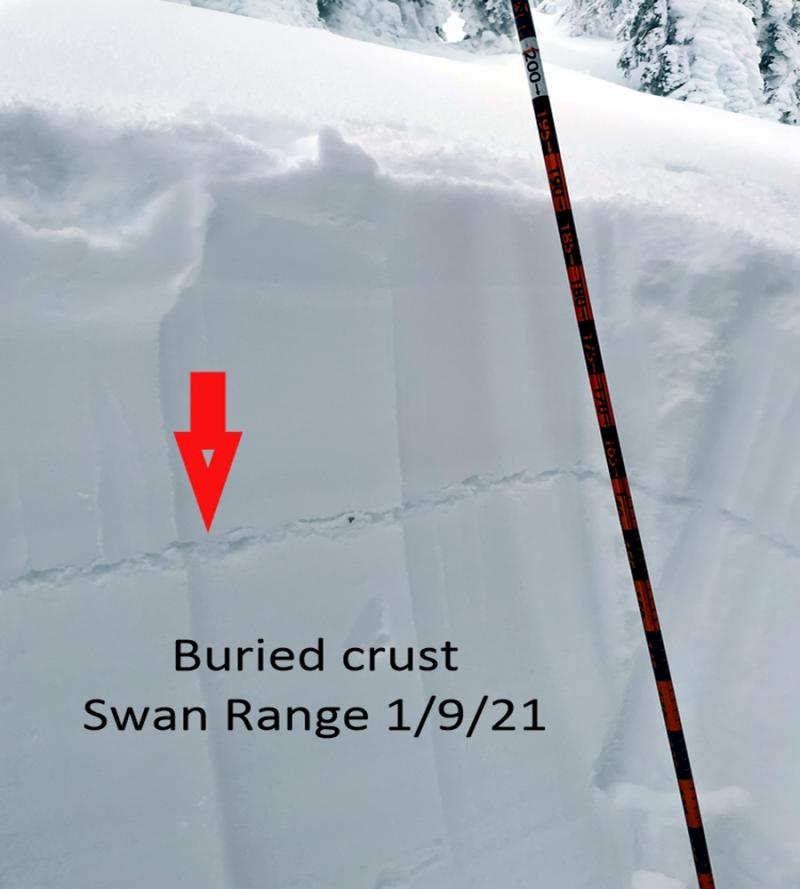
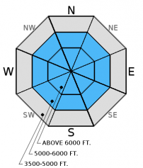
Unfortunately, we are currently stuck with this DIFFICULT problem in our snowpack. There is a lot of variability across the advisory area with this problem that warrants careful snowpack evaluation and cautious route-finding. Yesterday in the southern Whitefish Range my stability tests showed no results on layers deeper in the snowpack but BNSF avalanche safety had repeated results in their pit locations. Buried surface hoar and weak faceted snow exist in all ranges, but you won't find them on all slopes and they vary in reactivity. Weak snow beneath the January 12 rain crust was the failure layer in the fatal avalanche on Saturday. It is taking more force to get this layer to fail, and in some locations we are seeing no results on this layer, but obviously it is still a layer of concern. The January 17 rain crust continues to be reactive in stability tests. This layer is potentially the culprit of several recent natural avalanches. Where this crust does not exist there is likely a density change in the snowpack that has been reactive in stability tests. These weak layers are now 2 to 4.5 feet deep after the recent series of storms. The obvious signs of instability have mostly diminished, but that does not imply stability. Given the tricky distribution of these persistent slabs it would be wise to avoid steep, open slopes and convexities. The only way to know if these layers are reactive is to dig into the snow and perform stability tests.
There have been 10 avalanche fatalities in the United States since January 16, including one in the Whitefish Range in our advisory area on Saturday. This is not good, and our thoughts are with all of those involved. We have a tricky and dangerous snowpack in our area right now! We've seen recent, small natural and small to medium sized human triggered avalanches over the past 3 days. Now is not the time to push it into steep terrain, and also be aware of terrain traps below steep slopes. Choose low angled slopes and carefully evaluate the snowpack at any time. With deeper instabilities, the only way to know if the layer exists is to dig into the snow, and sometimes stability tests don't even work. This is the reason choosing conservative terrain (slopes less than 33 degrees) for a while is absolutely essential.
For more information on the recent avalanche fatality please visit our observations page (observation).
Yesterday, my partner and I investigated recent avalanche activity in the WMR backcountry. We found the storm snow that was responsible for the recent natural and skier triggered avalanches to have settled out and was not reactive in stability tests or with ski cutting. Our snowpit revealed the January 12 rain crust but stability tests showed no results on this layer (photo, photo, observation).
Also on Tuesday, BNSF avalanche safety reported fracture and propagation with moderate force in their stability tests. Failure layer was decomposing surface hoar and facets that were sitting on top of a melt freeze crust formed during the high pressure event of early January. This crust was only 20 inches from the snow surface which confirms the limited snowfall that has occurred in John F. Stevens Canyon in January. They also reported a collapse in the snowpack at an upper elevation during their tour (video, observation).
Sunday, experienced skiers in the southern Whitefish Range reported a natural avalanche on a northerly aspect in Canyon Creek at an upper elevation. They also reported remotely triggering the Half Moon slide path, east of the ski area, from 80-100 feet above the starting zone. The same party noted mid elevation natural avalanche activity in this same area. The failure layer appears to have been the storm slab deposited Saturday night/Sunday morning. Crown depths were reported to be in the 8-10 inch range.
Sunday, Ted Steiner (BNSF Avalanche Safety) and I traveled to Swede Creek in the northern Whitefish Range. Above 6000 feet we found 8-10 inches of new snow that exhibited slab like characteristics along with recently cross loaded southeasterly aspects. The January 17 crust was not present in this area but stability tests produced fracturing and propagation with moderate force that resulted in quality 1 shears at a density change possibly related to the January 17 event. With hard force we were able to get the weak snow below the January 12 rain crust to fracture and propagate with a quality 1- shear.
Also on Sunday a party of climbers/skiers in the Snyder Lake area of Glacier National Park triggered a 6 inch thick soft slab that slid on top of the rain crust that formed Saturday. The slide was 50-100 feet wide and 1 member of the group was carried 100 feet but did not sustain injuries. They also reported sluffing of the new snow and shooting cracks.
Saturday, the groomer for the Canyon Creek snowmobile trails reported several slab avalanches that occurred late afternoon in the Skook Chutes/Fiberglass Hill area of the Southern Whitefish Range. 2 of these reached the Canyon Creek snowmobile trail with one depositing debris 10 feet deep covering 30 feet of the trail.
A pilot flying over the area Saturday reported a large avalanche that likely occurred Friday on a south facing slope near McGinnis Creek in the southern Whitefish Range.
On Saturday, Erich was instructing a level 1 class in the southern Whitefish Range. They observed 4 recent avalanches in Canyon Creek (2 of them size D-2 and 2 were D 1-1.5) also thought to have slid on Friday. They noted variable results in stability tests on east, south, and west aspects. With hard force the January 17 crust fractured and propagated. They also were able to get the January 12 crust to fracture with hard force in compression tests. They noted clean, quality 1 shears on this layer. No other obvious signs of instability were observed. Guy and I were in the Wahoo drainage in the Flathead Range and found a new breakable crust on the surface. The January 17 rain crust was not present in this location (observation).
Visit our Observations page and our You Tube channel for more observations from the entire season.
Thanks to everyone for submitting observations. They are extremely useful and could help save lives.
HOW TO SUBMIT OBSERVATIONS:
Email: [email protected]
Call and leave a message: 406.387.3821
You can also submit quick observations via text: 406.241.4571 (FAC mobile)
OR
Submit Snowpack Observations: http://www.flatheadavalanche.org/node/add/snowobs
Submit Avalanche Observations: http://www.flatheadavalanche.org/node/add/avyobs
Temperatures rose throughout the day and overnight with temps this morning being the maximum over the past 24 hours. Very light precipitation fell across our area with light to moderate winds accompanied by moderate to strong gusts. Currently, temperatures above 6000 feet range from 27º-34º F and winds are west-southwest at 7-18 mph with gusts from 11-27 mph. For today, expect above seasonal temperatures with very light precipitation. Temperatures will rise to the mid 30s - low 40s, and winds will move out of the west and southwest at 7-15 mph with moderate to strong ridge top gusts up to 33 mph.
| 0600 temperature: | 27-34 deg. F. |
| Max. temperature in the last 24 hours: | 27-34 deg. F. |
| Average wind direction during the last 24 hours: | WSW |
| Average wind speed during the last 24 hours: | 5-20 mph |
| Maximum wind gust in the last 24 hours: | 10-38 mph |
| New snowfall in the last 24 hours: | 0 inches |
| Total snow depth: | 60-88 inches |
This advisory applies only to backcountry areas outside established ski area boundaries. This advisory describes general avalanche conditions and local variations always occur. This advisory expires at midnight on the posted day unless otherwise noted. The information in this advisory is provided by the USDA Forest Service who is solely responsible for its content.


