Forecaster Observation - Canyon Creek, Whitefish Range

Location Name: 
Forecaster Observation - Canyon Creek, Whitefish Range
Region: 
Whitefish Range - Southern (south of Coal Creek)
Date and time of avalanche (best estimate if unknown): 
Sat, 01/16/2016 - 12:00
Location Map: 


Red Flags: 
Recent avalanche activity
Recent loading by new snow, wind, or rain
Obvious avalanche path

Observation made by: Forecaster
Avalanche Observations
Avalanche Type: 
Dry
Slab
Slope: 
36degrees
Trigger type: 
Skier
Crown Height: 
Less than 1 ft
Aspect: 
East
Weak Layer: 
Within storm snow
Avalanche Width: 
100ft.
Terrain: 
Near Treeline
Elevation: 
6 500ft.
Bed Surface: 
Storm Snow
Avalanche Length: 
200ft.
More detailed information about the avalanche: 

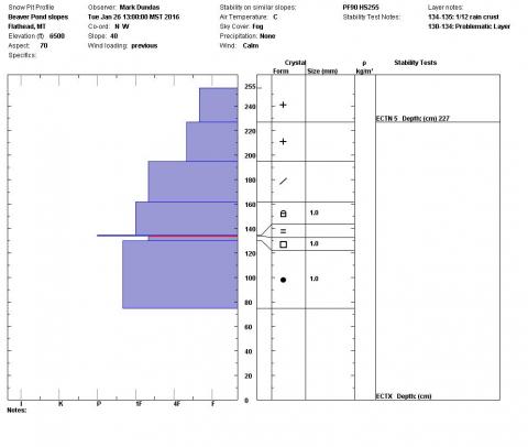
We received a number of reports of natural and human triggered avalanches in the southern Whitefish Range that occurred over the weekend of January 23 and 24.  We investigated 2 of these that were within a few hundred yards of Flower Point.  Both avalanches were east facing, just below ridge line elevation, failed in the recent storm snow and had crown depths of 8-10".  One avalanche was a natural and the other was triggered by a skier.  Despite being relatively small in size both had the power to knock a rider off their feet which would then make them susceptible to being pushed into large trees and tree wells.  

Snowpit or crown profile photo or graph: 
Avalanche Photos: 
Weather Observations
Cloud Cover: 
100% of the sky covered by clouds
Air temperature: 
Below Freezing
Precipitation: 
None
Air temperature trend: 
Static
Accumulation rate: 
None
Activity: 
Skiing