| Saturday | Saturday Night | Sunday | |
|---|---|---|---|
| Cloud Cover: | Sunny. Warming mountain temperatures. | Clear. | Partly cloudy. |
| Temperatures: | 24-34 deg. F. | -2-11 deg. F. | 21-31 deg. F. |
| Wind Direction: | NE-SE | SE | S-E |
| Wind Speed: | 3-5 | 5 | 5 |
| Snowfall: | 0 in. | 0 in. | 0 in. |
| Snow Line: |
Whitefish Range
Swan Range
Flathead Range and Glacier National Park
How to read the forecast
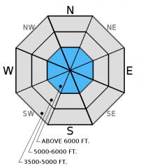
Recent winds, continued sunshine, and temperatures approaching the freezing mark will continue to form more cohesive slabs in previously unconsolidated surface snow. The avalanche danger above 5000 feet is MODERATE and human triggered avalanches are possible. Below 5000 feet the danger is LOW. Carefully evaluate the snowpack before committing to a slope, particularly in recently wind loaded terrain. Pay attention to rising temperatures and the effect of sun exposure on the surface snow.

2. Moderate
?
Above 6500 ft.
2. Moderate
?
5000-6500 ft.
1. Low
?
3500-5000 ft.
- 1. Low
- 2. Moderate
- 3. Considerable
- 4. High
- 5. Extreme
-
Type ?
-
Aspect/Elevation ?
-
Likelihood ?CertainVery LikelyLikelyPossible
 Unlikely
 -
Size ?HistoricVery LargeLargeSmall

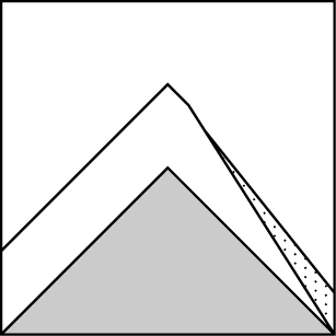
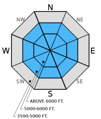
Given the variable wind direction over the past few days, look for recent wind slabs on any aspect in the upper elevations. Some of the wind slabs you encounter will be stiffer, older, and stronger while others will be new and more sensitive to human triggers. It would be wise to treat all wind loaded areas as suspect and carefully evaluate this terrain before skiing or riding in it. Look for smooth, rounded features on the slope or deeper deposition areas around features like tree islands or rocks. Remember, that even a small avalanche can have severe consequences if you trigger it in or around terrain traps.
-
Type ?
-
Aspect/Elevation ?
-
Likelihood ?CertainVery LikelyLikelyPossible
 Unlikely
 -
Size ?HistoricVery LargeLargeSmall

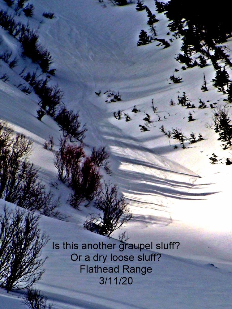
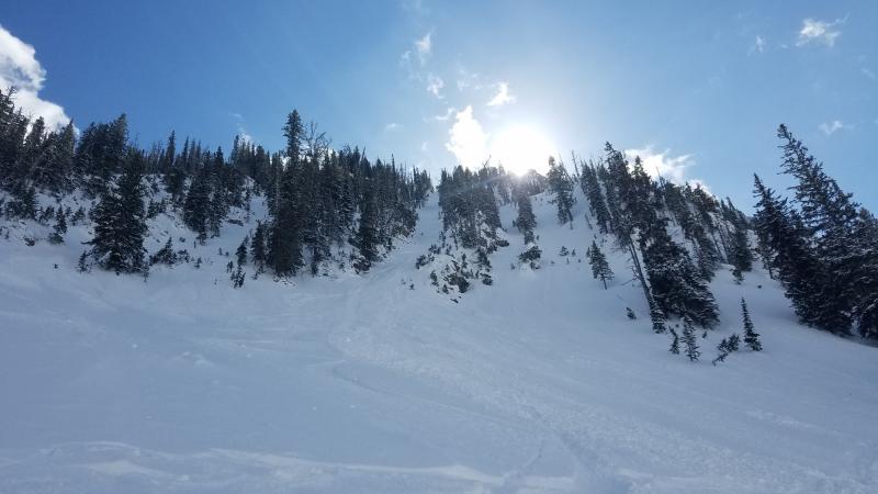
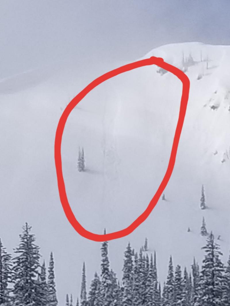
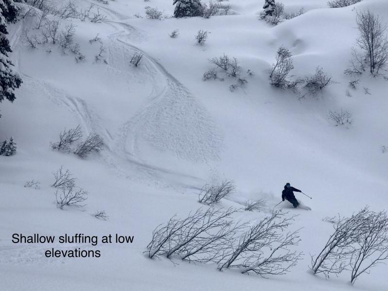
We observed natural, loose sluffs up to size D1.5 on Thursday and more were reported yesterday on steep, sunny slopes. This is the first period of sunshine with warming to near (and potentially above) freezing since the recent storm and the light, loose snow will continue to sluff on steep slopes today. Human triggered and natural sluffs are possible. Because it is a surface problem, it is easy to feel and recognize unconsolidated snow. On large slopes, they can entrain a substantial amount of snow and travel very fast. They are most dangerous when combined with terrain traps such as rocks, trees, cliffs, or a gully. Avoid traveling under steep slopes during intense sunshine today.
Changing Conditions and Changing Mindset: This last storm delivered low density snow that made for deep, excellent riding and skiing with pretty stable conditions. However, warming temps creeping near and above the freezing mark combined with ample sunshine today and tomorrow will create a more cohesive surface slab. This slab could become more susceptible to triggering. We currently don't have any major weak layers within the top part of the snowpack, but we could begin to see slab development on density changes in the upper part of the snowpack. Pay attention to changing conditions today and how the snow feels under your skis or sled. If it feels like the surface snow is becoming more "slabby" then reassess terrain choices.
There are currently two deeper layers in the snowpack that still pose concern, particularly in areas with a shallow snowpack. We haven't observed or received reports of avalanches on these layers (even during or after last week's storms) or reactiveness in stability tests, but they are easily identifiable and worthy of investigation in your snowpit due to their variablity.
1. In some locations throughout the advisory area we noted and have received observations of weak, sugary snow (facets) near the ground. This layer has not been reactive in stability tests in over three weeks, but in shallow areas (snowpack less than 3-4 feet deep) this layer may be more developed and could be more reactive. It is best to avoid areas of shallow snowpack where this layer exists (like steep, rocky slopes).
2. The December 9 rain crust still lurks throughout most of the advisory area. A layer of softer facets (weak, sugary snow) below the crust has shown no signs of instability (fracture or propagation) in our snowpits for two weeks, but it's still there. It is unlikely you'll trigger an avalanche on this layer, but not impossible. It is still worth taking the time to dig into the snow and see how it is reacting in the areas that you are skiing or riding.
Yesterday, skiers on Mt. Adams in the Essex Creek area of the Flathead Range noted thin, reactive slabs in the area and a thin crust near the surface on sunny slopes (Observation).
Thursday, Erich traveled to the Essex Creek and Marion Lake drainages in the Middle Fork of the Flathead Range (observation). They observed active wind transport near ridgelines (photo) and natural loose sluffs (photo) on steep slopes.
Mark toured with BNSF avalanche safety on Thursday in southern Glacier NP and observed wind transport with shallow wind slabs developing. He also reported shooting cracks within the new wind slab (photo and observation).
Skiers just south of Marias Pass also reported sensitive wind slabs (observation). Skiers in the Apgar Range Thursday also observed wind loading near ridgetops (observation), but no other obvious signs of instability.
This past week, two skiing parties (observation 1, observation 2) in the northern Apgar Range reported good skiing with minimal slab formation. One party, in their stability test, was able to initiate fracture with hard force on a layer about 2 feet from the surface (suspected wind slab near the ridge) that propagated across the column. Though, they could not repeat this result on subsequent tests. Another party Wednesday on Sub-Shields in southern Glacier Park reported a thin snowpack in their pit with weak snow near the ground and wind slabs on easterly aspects (observation).
Thanks to everyone for submitting observations. They are extremely useful for everyone.
Visit our Observations page and our You Tube channel for more observations from the entire season.
Please let us know what you are seeing out there. Your observations are important and valued.
HOW TO SUBMIT OBSERVATIONS:
Email: [email protected]
Call and leave a message: 406.387.3821
You can also submit quick observations via text: 406.241.4571 (FAC mobile)
OR
Submit Snowpack Observations: http://www.flatheadavalanche.org/node/add/snowobs
Submit Avalanche Observations: http://www.flatheadavalanche.org/node/add/avyobs
A ridge of high pressure remains parked over the region creating clear skies (above the low Stratus clouds) and mild mountain temperatures. Light to moderate winds shifted yesterday out of the north and northeast. Currently, mountain temperatures range from 16º-28º F and winds are 5-15 mph out of the north/northeast. Today, expect another sunny day in the mountains with temperatures rising to the low 30s and winds 5-10 mph out of the north and east.
| 0600 temperature: | 16-28 deg. F. |
| Max. temperature in the last 24 hours: | 16-31 deg. F. |
| Average wind direction during the last 24 hours: | N-NE |
| Average wind speed during the last 24 hours: | 5-15 mph |
| Maximum wind gust in the last 24 hours: | 8-22 mph |
| New snowfall in the last 24 hours: | 0 inches |
| Total snow depth: | 48-61 inches |
This advisory applies only to backcountry areas outside established ski area boundaries. This advisory describes general avalanche conditions and local variations always occur. This advisory expires at midnight on the posted day unless otherwise noted. The information in this advisory is provided by the USDA Forest Service who is solely responsible for its content.


