| Sunday | Sunday Night | Monday | |
|---|---|---|---|
| Cloud Cover: | Very light snow showers. | Increasing snow showers late. | Continued showers. |
| Temperatures: | 19-28 deg. F. | 11-18 deg. F. | 20-28 deg. F. |
| Wind Direction: | S-SW | SW | W-SW |
| Wind Speed: | 6-7 gusts 17 | 5-7 gusts 18 | 3-5 |
| Snowfall: | 0 in. | 0 in. | 1-2 in. |
| Snow Line: |
Whitefish Range
Swan Range
Flathead Range and Glacier National Park
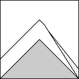
How to read the forecast
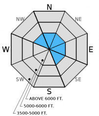
The avalanche danger above 6000 feet is CONSIDERABLE on wind loaded slopes steeper than 35º. Elsewhere, the danger is MODERATE. It won't take much wind to drift the light, cohesionless surface snow and form new wind slabs on leeward ridges, and cross-load mid slope features. Carefully evaluate wind loaded terrain today before skiing or riding a slope.

3. Considerable
?
Above 6500 ft.
2. Moderate
?
5000-6500 ft.
2. Moderate
?
3500-5000 ft.
- 1. Low
- 2. Moderate
- 3. Considerable
- 4. High
- 5. Extreme
-
Type ?
-
Aspect/Elevation ?
-
Likelihood ?CertainVery LikelyLikelyPossible
 Unlikely
 -
Size ?HistoricVery LargeLargeSmall

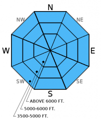
The recent series of storms that moved through the area came with suprisingly light winds. That said, it won't take much wind to drift the light, cohesionless surface snow and form soft wind slabs along leeward slopes and cross-load mid slope terrain features. In Noisy Basin yesterday we traveled on slopes that are typically scoured for most of the season, but in this case they still had most of last week's snow on them. As you approach the continental divide wind speeds increased. We received multiple reports of wind transporting snow along ridgelines. With visibility improving it is easy to identify these recent wind slabs. They will have a smooth, rounded appearance and the snow will look thicker than other areas. Be sure to carefully assess wind-loaded slopes before skiing or riding in them. In terrain that has not been affected by the wind the potential still exists to find lingering storm slab instabilities. A good indicator of storm slabs that did not settle out is surface snow that feels more firm and cohesive than underlying snow. Where these slabs are present choose more conservative terrrain.
-
Type ?
-
Aspect/Elevation ?
-
Likelihood ?CertainVery LikelyLikelyPossible
 Unlikely
 -
Size ?HistoricVery LargeLargeSmall

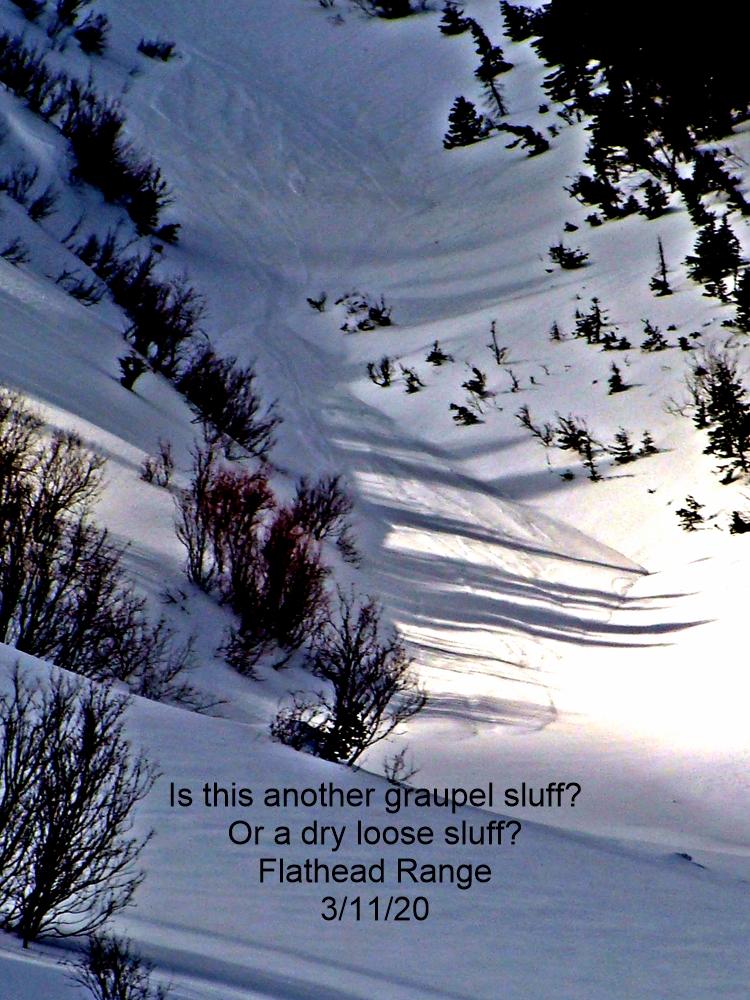
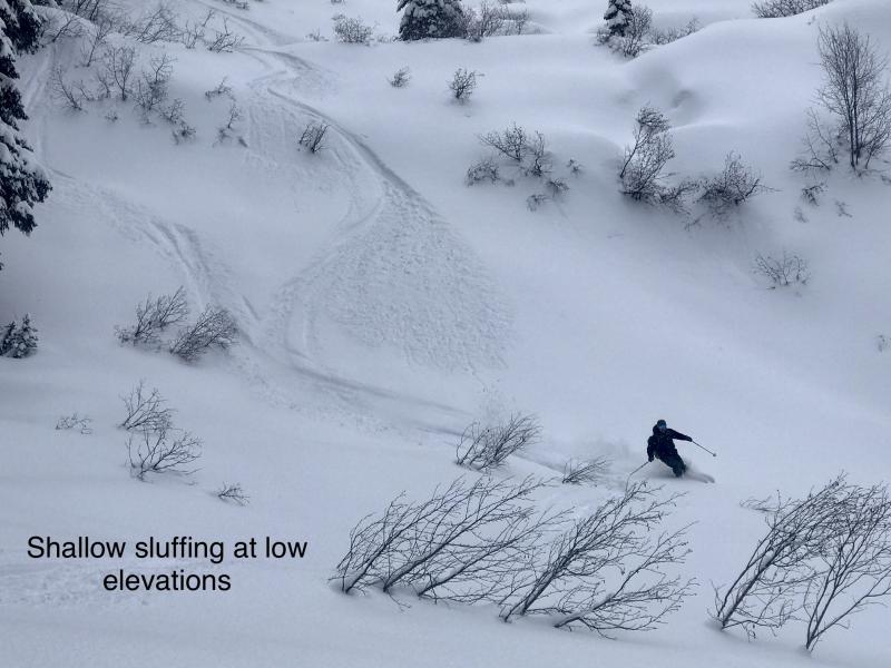
The abundant new snow over the past week came in light and cohesionless making excellent skiing and riding conditions. The same lack of consolidation will increase the potential to trigger loose, dry avalanches, particularly in steep terrain. This problem is easy to manage since, unlike slab avalanches, they don't release above you on a slope. If they catch you off guard they can have severe consequences like knocking you off your feet and into trees, rocks, and cliffs. If the runout is in a confined area like a narrow gully they could even bury a person.
Given the recent test in the form of a substantial load added to the weak snow above and below the the December 9 rain crust it is unlikely to trigger an avalanche on this layer, but not impossible. In many recent observations this layer is decomposing and not producing results in stabilty tests, however it is still worth taking the time to dig into the snow and see how it is reacting in the areas that you are skiing or riding. In some locations in the Flathead Range, Glacier Park, and parts of the Swan Range we noted and have received observations of weak, sugary snow near the ground. In some places it breaks and propagates across a column in stability tests, and sometimes it doesn't even break. Though it appears very isolated in distribution, it is worth mentioning that skiers in the southern Whitefish Range found buried surface hoar last Sunday which further illustrates the importance of digging in the snow to see what is going on below you.
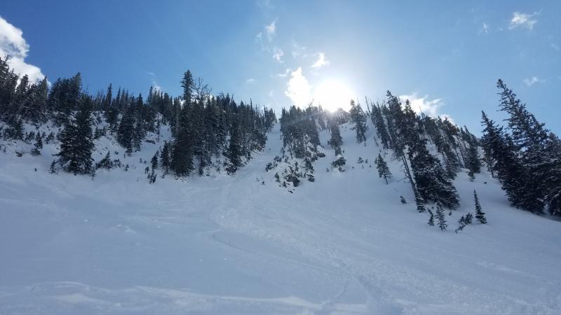
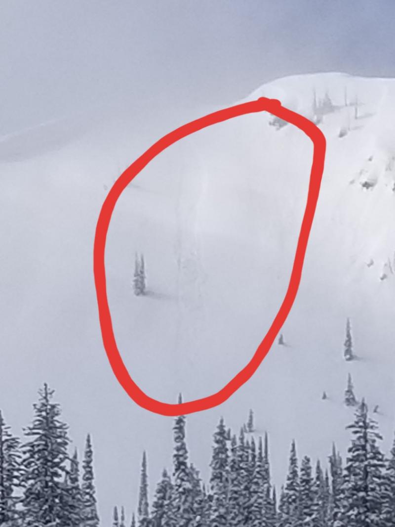
Yesterday, Mark and I headed into Noisy Basin in the Swan Range. The snow was deep and unconsolidated (photo). When there were breaks in the clouds, we observed several natural loose, dry avalanches that had recently occured in steep terrain. Very minimal, recent wind drifted snow on the ridge that we traveled, but evidence of recent wind-loading at higher elevations on surrounding peaks.
Skiers in Canyon Creek and Half Moon, both in the southern Whitefish Range found deep, unconsolidated snow with no obvious sign of instability. The party on Half Moon noted weak, faceted snow near the ground that did not react in stability testing.
Skiers on Elk Mountain in southern Glacier National Park noted wind transporting snow on surrounding peaks and ridge lines. The surface snow on sheltered aspects was unconsolidated. Snow depth at 6200 feet was 3.5 feet deep and they did not find the December 9 rain crust in this location. A seperate skier party on Elk Mountain also reported that there was no rain crust present. Stabililty tests produced failures but with out propagation within recent storm snow (observation).
On Thursday, experienced snowmobilers in the Lost Johnny area observed shooting cracks, which is an obvious sign of instability, in the recent storm snow. They reported a DEEP (3-5 feet) snowpack at lower elevations. This same party were also able to hear a large avalanche in the distance.
Visit our Observations page and our You Tube channel for more information from the entire season.
Please let us know what you are seeing out there. Your observations are important and valued.
HOW TO SUBMIT OBSERVATIONS:
Email: [email protected]
Call and leave a message: 406.387.3821
You can also submit quick observations via text: 406.241.4571 (FAC mobile)
OR
Submit Snowpack Observations: http://www.flatheadavalanche.org/node/add/snowobs
Submit Avalanche Observations: http://www.flatheadavalanche.org/node/add/avyobs
Yesterday was a fairly benign day for weather giving us a little sun to enjoy all the recent snow. In most locations wind was light out of the southwest. Near the divide and in the north part of the advisory area winds were a little more gusty with speeds in the mid-20s. Currently, temperatures above 6000 feet range from 10º-13º F and winds are out of the west and southwest at 5-8 mph with gusts up to 28 mph. Today, expect isolated light snow showers and temperatures rising to the mid 20s. Winds will blow out of the west and southwest at 5-10 mph with stronger gusts on the ridges.
| 0600 temperature: | 9-13 deg. F. |
| Max. temperature in the last 24 hours: | 10-18 deg. F. |
| Average wind direction during the last 24 hours: | W-SW |
| Average wind speed during the last 24 hours: | 5-9 mph |
| Maximum wind gust in the last 24 hours: | 15-25 mph |
| New snowfall in the last 24 hours: | 0-1 inches |
| Total snow depth: | 56-71 inches |
This advisory applies only to backcountry areas outside established ski area boundaries. This advisory describes general avalanche conditions and local variations always occur. This advisory expires at midnight on the posted day unless otherwise noted. The information in this advisory is provided by the USDA Forest Service who is solely responsible for its content.


