| Tuesday | Tuesday Night | Wednesday | |
|---|---|---|---|
| Cloud Cover: | Rain and snow with snow level rising to 7000' | Rain and snow with snow level rising to 7000' | More rain and more snow |
| Temperatures: | 36-46 deg. F. | 29-40 deg. F. | 33-43 deg. F. |
| Wind Direction: | southwest | southwest | southwest |
| Wind Speed: | 12-17 with gusts to 45 | 20-25 with gusts to 50 | 27-32 with gusts to 65 |
| Snowfall: | 0-3 in. | 0 in. | 0-2 in. |
| Snow Line: |
Whitefish Range
Swan Range
Flathead Range and Glacier National Park
How to read the forecast
Dangerous avalanche conditions exist today and will further deteriorate into tomorrow. The new snow and rain from this storm is falling on a weak snowpack. Heavy, wet snow, rising temperatures, and rain will cause the stability to decrease. We have very limited observations, but this storm is likely to tip the balance of our current weak snowpack. Human triggered avalanches are likely and natural avalanches are possible to likely today.

No Rating
?
Above 6500 ft.
No Rating
?
5000-6500 ft.
No Rating
?
3500-5000 ft.
-
Type ?
-
Aspect/Elevation ?

-
Likelihood ?CertainVery LikelyLikelyPossible
 Unlikely
 -
Size ?HistoricVery LargeLargeSmall

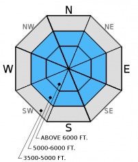
Todays main concern is the storm slab deposited over the past 36 hours. This slab was formed due to the warm air temps and moderate winds that accompanied this system. With air temps forecast to rise throughout the day this surface slab will continue to form. Wind slabs within the new snow will be found on leeward aspects which range from north to east. Cross loaded slopes will also be a concern. With winds forecast to continue throughout the day leeward slopes will continue to be loaded and stressed.
-
Type ?
-
Aspect/Elevation ?

-
Likelihood ?CertainVery LikelyLikelyPossible
 Unlikely
 -
Size ?HistoricVery LargeLargeSmall

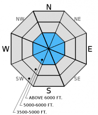
With rising air temps and snow transitioning to rain in the higher elevations wet loose avalanches are a concern in the surface snow. Rollerballs, or pinwheels, are the first warning sign of these wet loose slides.
-
Type ?
-
Aspect/Elevation ?

-
Likelihood ?CertainVery LikelyLikelyPossible
 Unlikely
 -
Size ?HistoricVery LargeLargeSmall

Our third concern today is the persistent slab found in the lower third of the snowpack. This slab consists of a strong thick rain crust that was deposited in mid-November and is sandwiched by weak faceted snow. The weight of the newly formed storm slab and/or a backcountry recreationalist could tip the balance. With minimal knowledge of how this persistent slab handles a substantional stress it is best to err on the side of caution today and give this problem a wide berth.
This is the first substantional storm of the season and it is falling on a shallow weak snowpack. Despite our hunger for powder pleasure it would be wise to err on the side of caution today and not recreate in avalanche terrain. Instead, today is a great day to practice safe travel techniques and enjoy low angle slopes. The lack of low elevation snow has made access into the alpine difficult and has limited our observations. For instance the Noisy Basin SNOTEL (6030 ft.) site is reporting a meager 21 inches of snow on the ground this morning.
We will begin issuing regular advisories with danger ratings once we collect and receive more observations/data. Please send us your observations.
HOW TO SUBMIT OBSERVATIONS:
Email: [email protected]
Call and leave a message: 406.387.3821
You can also submit quick observations via text: 406.241.4571 (FAC mobile)
OR
Submit Snowpack Observations: http://www.flatheadavalanche.org/node/add/snowobs
Submit Avalanche Observations: http://www.flatheadavalanche.org/node/add/avyobs
Yesterday we received a report from Skookoleel Ridge in the southern Whitefish Range (observation). Skiers reported mixed results in their stability tests but did note red flags within the new snow and from windloading. We also received an observation from Jewel/Noisy Basin in the Swan Range (observation) where skiers noted active wind loading along ridges. Last week we made a video from Red Meadow in the northern Whitefish Range that shows our weak snowpack.
A potent warm, wet and windy system has affected our entire advisory area over the past 36 hours. Favored areas included Noisy Basin in the Swan Range with 1.6 inches of snow water equivalent and the southern Whitefish Range where the Big Mt. Wx Station is reporting nine inches of new snow in the past 24 hours. Air temps are forecast to rise throughout the day with moderate to heavy precipitation continuing through Wednesday. The freezing level (RAIN!) will rise to 7000 feet by this evening.
| 0600 temperature: | 26-33 deg. F. |
| Max. temperature in the last 24 hours: | 27-33 deg. F. |
| Average wind direction during the last 24 hours: | west - southwest |
| Average wind speed during the last 24 hours: | 7-21 mph |
| Maximum wind gust in the last 24 hours: | 10-38 mph |
| New snowfall in the last 24 hours: | 3-11 inches |
| Total snow depth: | 20-37 inches |
This advisory applies only to backcountry areas outside established ski area boundaries. This advisory describes general avalanche conditions and local variations always occur. This advisory expires at midnight on the posted day unless otherwise noted. The information in this advisory is provided by the USDA Forest Service who is solely responsible for its content.


