| Saturday | Saturday Night | Sunday | |
|---|---|---|---|
| Cloud Cover: | Partly/mostly cloudy | Partly cloudy, light showers | Cooler, light snow showers |
| Temperatures: | 38-48 deg. F. | 23-31 deg. F. | 30-38 deg. F. |
| Wind Direction: | W/SW | W | W/NW |
| Wind Speed: | 5-6 gusts 15-20 | 3-5 | 3-5 |
| Snowfall: | 0 in. | 0-1 in. | 0-1 in. |
| Snow Line: |
Whitefish Range
Swan Range
Flathead Range and Glacier National Park
How to read the forecast
Increased cloud cover and slightly cooler temperatures will decrease the loose, wet avalanche hazard today. However, above freezing temperatures are still expected and human triggered avalanches remain possible. The hazard is MODERATE above 5000 feet. In isolated areas, surface hoar formed in late January still exists and has proven reactive. Continue to assess the snow pack for deeper instabilities and choose conservative terrain where present and reactive.

2. Moderate
?
Above 6500 ft.
2. Moderate
?
5000-6500 ft.
1. Low
?
3500-5000 ft.
- 1. Low
- 2. Moderate
- 3. Considerable
- 4. High
- 5. Extreme
-
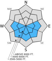
Type ?
-
Aspect/Elevation ?
-
Likelihood ?CertainVery LikelyLikelyPossible
 Unlikely
 -
Size ?HistoricVery LargeLargeSmall

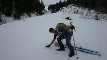
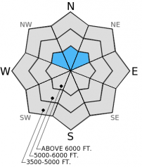
Recent heavy, wet snow sitting on surface hoar formed in late January that has survived warm temperatures and several wet weather systems has graduated into the persistent slab category. In many areas this layer was rounded, melted, and destroyed with ample water running through the snow pack in the past week. In isolated areas it remains intact and proves reactive. We have had very few recent observations, so it's best to play it safe and assume every slope has this weak layer. In areas where the buried surface hoar persists it should be a fairly obvious stripe in a snow pit wall (photo). Take a few minutes, dig into the snow and see whats going on before you commit to a slope. Choose more conservative terrain where this layer is present and reactive.
-
Type ?
-
Aspect/Elevation ?
-
Likelihood ?CertainVery LikelyLikelyPossible
 Unlikely
 -
Size ?HistoricVery LargeLargeSmall

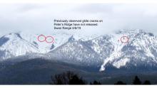
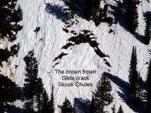
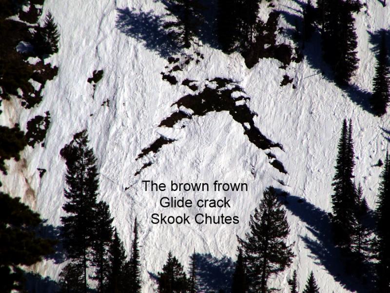
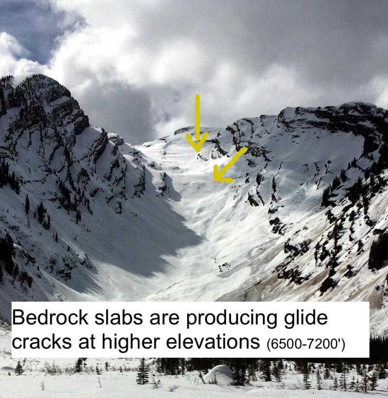
We observed a glide avalanche that likely released yesterday and many more glide cracks that were beginning to open. Glide avalanches have been known to release 24-48 hours after temperatures have dropped below freezing. Due to the uncertainty surrounding glide avalanches managing the problem is simple, avoid slopes where glide cracks are present.
Above freezing temperatures are expected to continue today. Cloud cover should decrease the loose, wet avalanche hazard, however, continue to pay attention to changing conditions. If we see prolonged breaks in the clouds and the snow surface becomes wet, it's time move to more shaded slopes.
Yesterday we observed small loose, wet avalanches in an area known as Big Slide in the Whitefish Range due warm temperatures and sun exposure. We also saw numerous glide cracks opening in the area (photo) and even a few recent glide avalanches, one that likely occured yesterday (photo). On a north aspect at 6300 feet we found large surface hoar buried nearly 2 feet deep (photo, video) that propagated fractures in extended column tests. This came as a bit of a surprise due to substantial precipitation in the past week with snow levels ranging from 6500-7000 feet in most locations.
Snowmobile observers, Lucas and Guy were in the Skyland area in the Flathead Range yesterday and noted a wet snow surface on sunny aspects. They did not find preserved buried surface hoar in this location.
Yesterday the skies were clear and sunny. Most weather stations in the area reported temperatures above 40º F. Currently, temperatures range from 33º-40º F with winds out of the southwest 5-10 mph. For today expect partly/mostly cloudy skies with winds out of the west and southwest 5-15 mph, stronger ridgetop gusts expected near the Continental Divide. Temperatures should be a few degrees cooler than yesterday and we could see a few isolated light showers by this afternoon.
| 0600 temperature: | 33-40 deg. F. |
| Max. temperature in the last 24 hours: | 37-44 deg. F. |
| Average wind direction during the last 24 hours: | SW |
| Average wind speed during the last 24 hours: | 5-10 mph |
| Maximum wind gust in the last 24 hours: | 10-20 mph |
| New snowfall in the last 24 hours: | 0 inches |
| Total snow depth: | 61-89 inches |
This advisory applies only to backcountry areas outside established ski area boundaries. This advisory describes general avalanche conditions and local variations always occur. This advisory expires at midnight on the posted day unless otherwise noted. The information in this advisory is provided by the USDA Forest Service who is solely responsible for its content.


