| Thursday | Thursday Night | Friday | |
|---|---|---|---|
| Cloud Cover: | Increasing clouds later today as a weak disturbance moves through the ridge of high pressure. | Mostly cloudy with a chance of very light snow. | Partly cloudy and warming. |
| Temperatures: | 27-32 deg. F. | 16-26 deg. F. | 32-40 deg. F. |
| Wind Direction: | Southwest | Southwest | Southwest |
| Wind Speed: | 5-15 mph with gusts to 35 mph (closer to ranges near the Continental Divide). | 5-10 mph with gusts to 25 mph. | 5-15 mph with gusts to 30 mph. |
| Snowfall: | 0 in. | 0-1 in. | 0 in. |
| Snow Line: |
Whitefish Range
Swan Range
Flathead Range and Glacier National Park
How to read the forecast
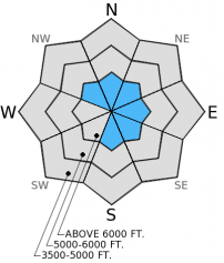
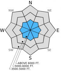
The hazard is CONSIDERABLE on wind loaded slopes steeper than 35 degrees above 6500 feet. The hazard is MODERATE on all other terrain above 5000 feet and LOW below 5000 feet. The Considerable hazard is mostly confined to steep, exposed terrain with hard wind slabs, but with two buried surface hoar layers on many slopes it is still possible to trigger an avalanche elsewhere. Persistent slab avalanches involving deeper weak layers have the potential to be large.

3. Considerable
?
Above 6500 ft.
2. Moderate
?
5000-6500 ft.
1. Low
?
3500-5000 ft.
- 1. Low
- 2. Moderate
- 3. Considerable
- 4. High
- 5. Extreme
-
Type ?
-
Aspect/Elevation ?
-
Likelihood ?CertainVery LikelyLikelyPossible
 Unlikely
 -
Size ?HistoricVery LargeLargeSmall

Lingering wind slabs from last weekend's storm with strong winds still exist. Most of these wind slabs are hard and are not as easily triggered as earlier in the week (photo). However, I expect these slabs to still be sensitive to human triggering in steep, exposed alpine terrain. These slabs are up to 2 feet thick and sit atop a variety of surfaces including crusts, surface hoar, and facets. Moderate to strong winds today could add more depth to these slabs or create fresh wind slabs. Give steep, exposed terrain with wind slabs a wide berth today and allow them a bit more time to settle.
-
Type ?
-
Aspect/Elevation ?
-
Likelihood ?CertainVery LikelyLikelyPossible
 Unlikely
 -
Size ?HistoricVery LargeLargeSmall

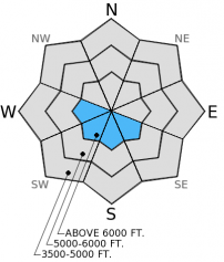
Right now there are primarily two layers of most concern within the snowpack that pose a persistent slab problem:1. A layer of buried surface hoar from mid-December about 3-4 feet deep in most locations.2. Another layer of buried surface hoar and facets from mid-January about 1-1.5 feet deep.
The deeper layer still propagates fractures in stability tests (video 1, video 2), and could produce a large avalanche. We haven't received reports of human triggered avalanches on this layer in almost three weeks, but the existing evidence is enough to show it is still possible to trigger an avalanche on this layer. This problem requires you to dig into the snow to determine if this layer is still reactive. If so, then stick to slopes less than 35 degrees.
The layer closer to the surface has not propagated fractures in stability tests.....yet. While this layer may not be as widespread or reactive, the potential still exists particularly in wind loaded areas with a thicker, more cohesive slab above it.
-
Type ?
-
Aspect/Elevation ?
-
Likelihood ?CertainVery LikelyLikelyPossible
 Unlikely
 -
Size ?HistoricVery LargeLargeSmall

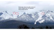
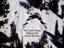
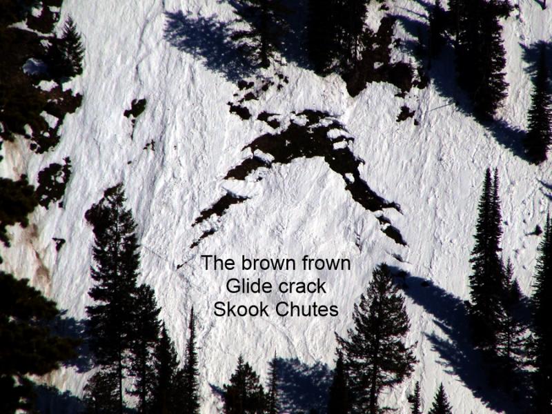
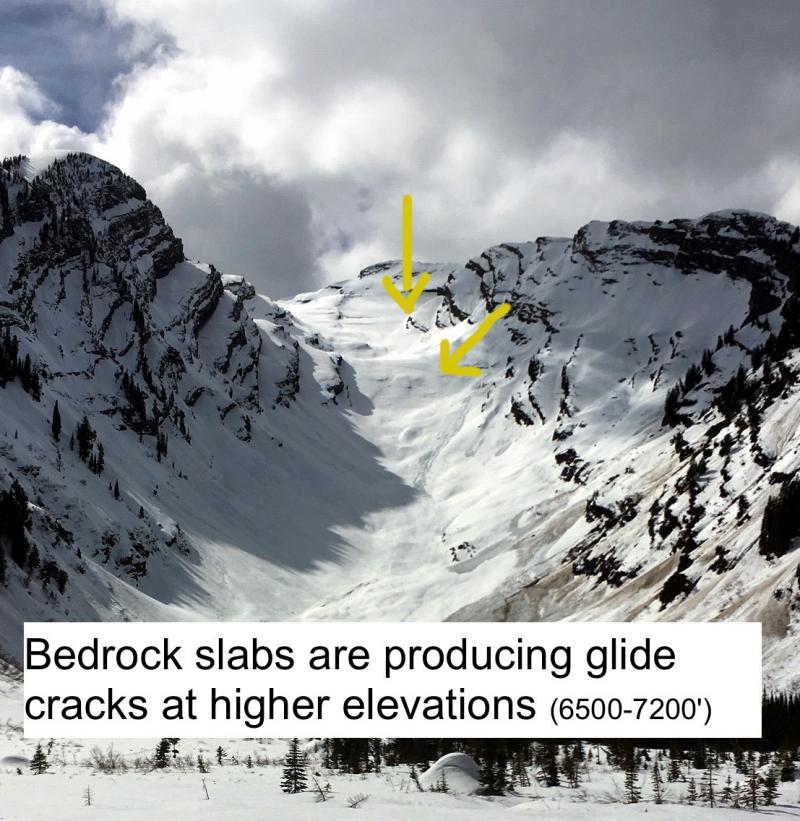
The first glide cracks and avalanches of the season were reported yesterday in the Swan Range. These are the only reports thus far of glide activity making it an isolated problem for now. However, with ample sunshine in the mountains and warming temperatures tomorrow and into the weekend glide cracks could begin to appear in more locations. Glide avalanches are notoriously difficult to predict, and the best way to manage this problem is to just avoid slopes with glide cracks on them. They typically exist on sunny aspects so it's simple.....just stay away. They don't exist on every slope and there are plenty of other slopes to recreate on.
The next regularly scheduled advisory will be issued Saturday, Jan. 24, 2015.
The wind sensor at the Big Mountain Summit weather station is still being repaired. We hope to have it back online within the next week. Thanks for your patience.
Your observations are extremely valuable to us! Let us know what you are seeing in the backcountry. Here is a good article written by our colleagues at the Gallatin National Forest Avalanche Center that discusses why avalanches should be reported.
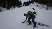
A cornucopia of skiing and snowmobiling conditions exists including soft surface snow to crunchy crusts across the advisory area. Yesterday in Kimmerly and Skookoleel Creeks in the southern Whitefish Range we saw more natural avalanche activity from last weekend (photo 1, photo 2). We also observed lingering wind slabs that sit atop a thin layer of facets and surface hoar from mid-January (photo). On Monday, these wind slabs were quite sensitive (photo). Deeper in the snowpack the surface hoar from mid-December still persists and propagates fractures in some, but not all, stability tests (video). BNSF Avalanche Safety professionals reported similar results on this layer in southern Glacier Park (observation). A layer of newly developed surface hoar (10-15 mm) formed on Jan. 21 and is not a problem now, but if it persists and gets buried could become a future problem....wait and see (photo).
Skiers nearby in the "Big Slide" area of the southern Whitefish Range reported triggering a small, hard wind slab avalanche in sub-alpine terrain yesterday. Skiers on Mt. Brown in Glacier Park reported fractures, but no propagation in their stability tests (observation).
In the Swan Range, an observer reported glide cracks and a glide avalanche yesterday (photo 1, photo 2).
A high pressure ridge currently sits over the region with only a few minor disturbances moving through it over the next few days. As of 4:00 a.m. remote mountain weather stations report temperatures ranging from 17º-21º F with winds moving out of the southwest at 5-15 mph and gusts to 25 mph. Today, mountain temperatures will reach the upper 20s to low 30s F and winds will be out of the southwest at 5-15 mph with gusts to 25 mph. The Flathead Range and southern Glacier Park will see gustier winds out of the southwest at 10-20 mph with gusts to 50 mph possible. Very light snow could occur overnight tonight.
| 0600 temperature: | 17-21 deg. F. |
| Max. temperature in the last 24 hours: | 27 deg. F. |
| Average wind direction during the last 24 hours: | Southwest |
| Average wind speed during the last 24 hours: | 5-15 mph |
| Maximum wind gust in the last 24 hours: | 24 mph |
| New snowfall in the last 24 hours: | 0 inches |
| Total snow depth: | 60-89 inches |
This advisory applies only to backcountry areas outside established ski area boundaries. This advisory describes general avalanche conditions and local variations always occur. This advisory expires at midnight on the posted day unless otherwise noted. The information in this advisory is provided by the USDA Forest Service who is solely responsible for its content.


