| Sunday | Sunday Night | Monday | |
|---|---|---|---|
| Cloud Cover: | Mostly Cloudy | Mostly Cloudy | Mostly Cloudy |
| Temperatures: | 22 to 28 deg. F. | 19 to 22 deg. F. | 25 to 32 deg. F. |
| Wind Direction: | West | Southwest | Southwest |
| Wind Speed: | 13G26 | 14 | 16G32 |
| Snowfall: | 0" in. | 0" in. | 0" in. |
| Snow Line: | 2500' | 3000' | 3000' |
Whitefish Range
How to read the forecast
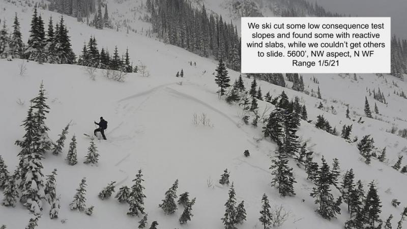
Wind slabs formed earlier in the week continue to strengthen, but deserve your attention. You can get into trouble if you impact a buried weak layer 1-4’ beneath the surface. Look and feel for stiff, dense snow with cracking the sign of a reactive slab. Choose terrain to minimize your risk from the high consequence of a Persistent Slab. Planar slopes with a deep uniform snowpack are a wiser choice than rollovers and thin snow cover areas.

2. Moderate
?
Above 6500 ft.
1. Low
?
5000-6500 ft.
1. Low
?
3500-5000 ft.
- 1. Low
- 2. Moderate
- 3. Considerable
- 4. High
- 5. Extreme
-
Type ?
-
Aspect/Elevation ?
-
Likelihood ?CertainVery LikelyLikelyPossible
 Unlikely
 -
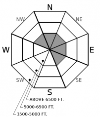
Size ?HistoricVery LargeLargeSmall

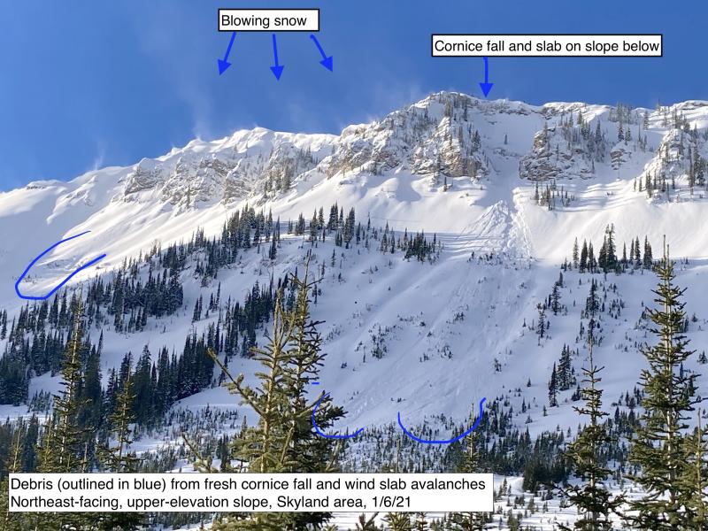
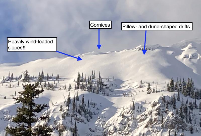
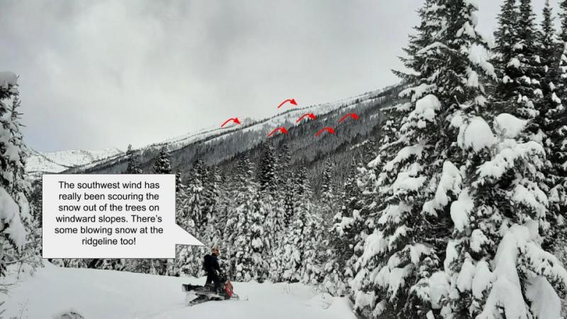
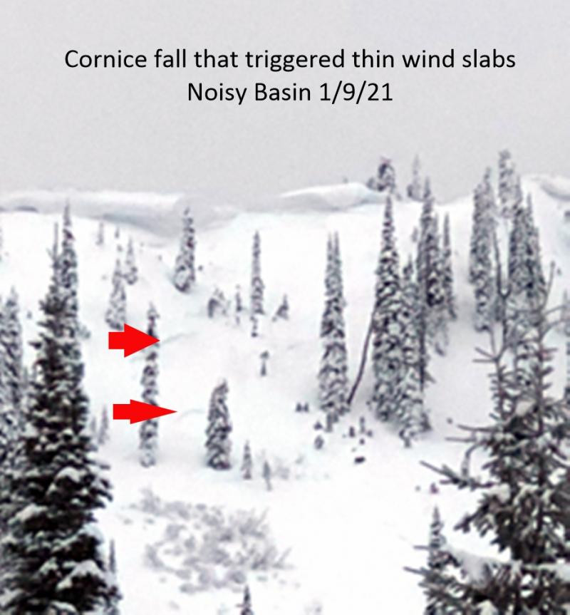
Benign weather is aiding the strengthening of multi-generations of wind slabs formed earlier in the week. Since Tuesday, there has not been a report of a triggered wind slab avalanche with the last natural Monday. Increasing winds overnight may have moved a bit of snow around, but fresh slabs should be small and inconsequential. At upper elevations, you may encounter slabs downwind of saddles, beneath corniced ridgelines, and on the sidewalls of gullies. Look for scalloped or etched snow and choose a more sheltered slope if you find cracking beneath your skis or machine.
-
Type ?
-
Aspect/Elevation ?
-
Likelihood ?CertainVery LikelyLikelyPossible
 Unlikely
 -
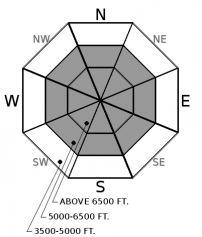
Size ?HistoricVery LargeLargeSmall

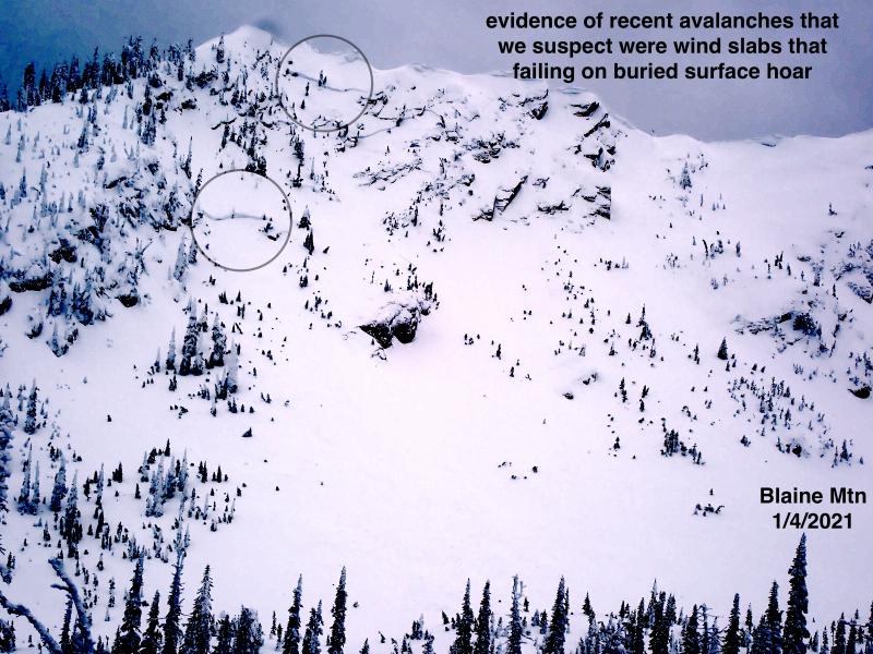
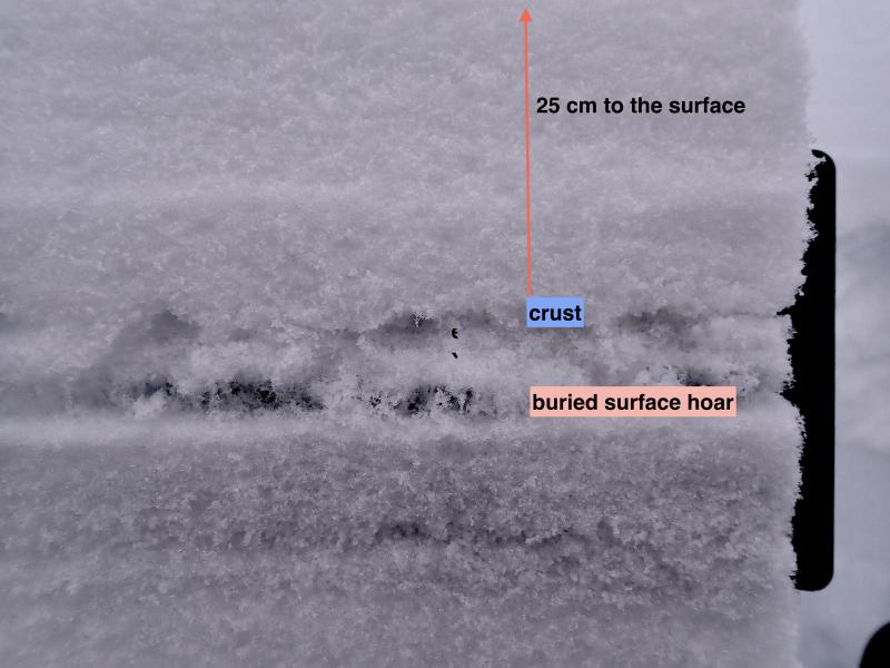
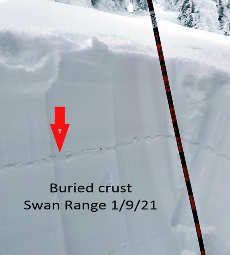
So many buried weak layers and crusts, so hard to keep them straight. Faceted crusts and buried surface hoar 1-4’ deep are susceptible to triggering from you or your machine. The most recent concern is a layer of surface hoar 15-25” beneath the surface. We are still determining the distribution of this layer. The only confirmation of this layer in the Whitefish Range is around Red Meadow Pass, where it may have been the sliding layer for two avalanches spotted Tuesday. The surface hoar appears to be more widespread in the Flathead and the Swan Ranges. Terrain selection is the easiest and stress-free way to deal with this challenging problem. Steering around convexities in favor of planar slopes is an excellent choice. Choosing slopes with a deep, uniform snow cover is always wise. And lastly, defaulting to lower angle terrain can’t be beaten.
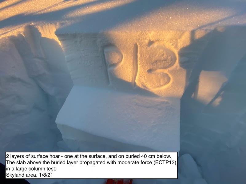
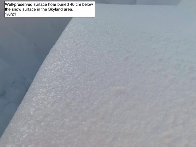
Saturday, we moved Persistent Slab to the #1 spot on the problem list in the Flathead, the Swan, and Glacier Park. Reports of buried surface hoar reactive in snowpack tests are trickling in. Since Friday, the Flathead Range is the current hot spot with positive feedback from Skyland, Marion Lake, and Rescue Creek. These locations span a 25-mile section of the range that parallels Highway 2. We assume other areas in the Flathead harbor this layer, but observations are sparse due to the impressive alder fields that generally limit access until mid-winter.
Reactive stability test results include propagation in large column tests (ECTP), propagation with the block popping out into the lap of the observer (Yikes), to no propagation but the block sliding off with a gentle shovel shear (Ooooh). The latter shows the benefit of using an old-school test that identifies a shear plane. There were no collapses (whumphing) or avalanches nearby but this bulls-eye data allowed each party to adjust their terrain selection.
As if the above was not enough doom and gloom, observers report widespread surface hoar growth on the surface at the above locations and Paola, Sub-Shields in southern Glacier, and Noisy Basin in the Swan Range. Although this doesn't affect the avalanche danger today, this layer will increase the threat of slides when moisture returns Tuesday.
Thank you to all who responded with observations from your outings Saturday. The information you share with us helps to make our product higher quality and more accurate. Please submit your name and email so that we can contact you for additional details if needed. Don’t worry; your names are never published. If you prefer to keep your stash secret, you can choose not to share the observation publicly.
Are you new to submitting observations and unsure what information to document? No problem, here are a few tips for Sunday and Monday. With recent benign weather, focus on the surface. Is there a crust, and if so, how thick is it? Supportable to you on skis or boots? What aspects and elevations? Did you find any soft snow? Again, what aspects, elevations, and how much? Did you notice any surface hoar on the surface? Was this widespread or only found in areas sheltered from the wind? How was the riding? With a storm forecast to impact our area Tuesday into Wednesday, information about the surface is invaluable. Please submit your information on our web page or call or text an observation to 40666AVYOB. Thank you for your support.
A weak disturbance brings a few flurries, cloudy conditions, and stratus in the valleys. Precipitation looks to return Tuesday.
This forecast applies only to backcountry areas outside established ski area boundaries. The forecast describes general avalanche conditions and local variations always occur. This forecast expires at midnight on the posted day unless otherwise noted. The information in this forecast is provided by the USDA Forest Service who is solely responsible for its content.


