| Thursday | Thursday Night | Friday | |
|---|---|---|---|
| Cloud Cover: | Mostly Cloudy | Mostly Cloudy | Mostly Cloudy |
| Temperatures: | 27 to 32 deg. F. | 17 to 21 deg. F. | 23 to 30 deg. F. |
| Wind Direction: | North | East | Southeast |
| Wind Speed: | 7 | 10 | 10 |
| Snowfall: | 0 to 1" in. | 0" in. | 0" in. |
| Snow Line: | 4000' | 3000' | 2500' |
Whitefish Range
Swan Range
Flathead Range and Glacier National Park
How to read the forecast
Look for terrain sheltered from southwesterly winds. Riding conditions will be better and you're less likely to trigger recently-formed slabs of drifted snow. The past month's snowfall has buried several weak layers with slabs 1 to 4 feet thick. A sure-fire way to reduce your exposure to this lingering hazard is to stick to slopes less than about 35 degrees. Riding one at a time while keeping a close eye on each other can minimize the consequences of triggering slabs.

2. Moderate
?
Above 6500 ft.
2. Moderate
?
5000-6500 ft.
1. Low
?
3500-5000 ft.
- 1. Low
- 2. Moderate
- 3. Considerable
- 4. High
- 5. Extreme
-
Type ?
-
Aspect/Elevation ?
-
Likelihood ?CertainVery LikelyLikelyPossible
 Unlikely
 -
Size ?HistoricVery LargeLargeSmall

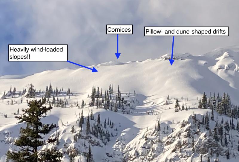
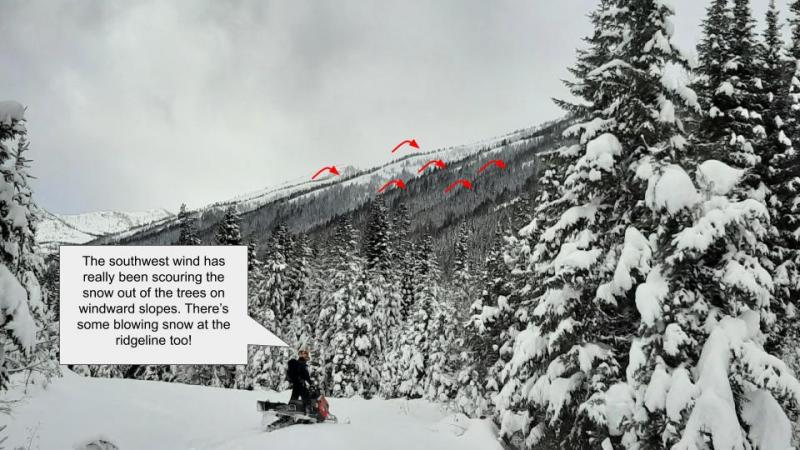
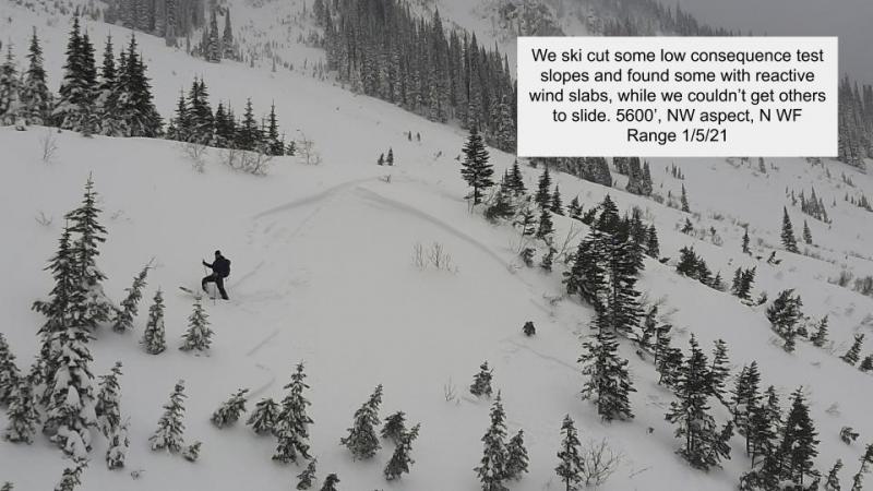
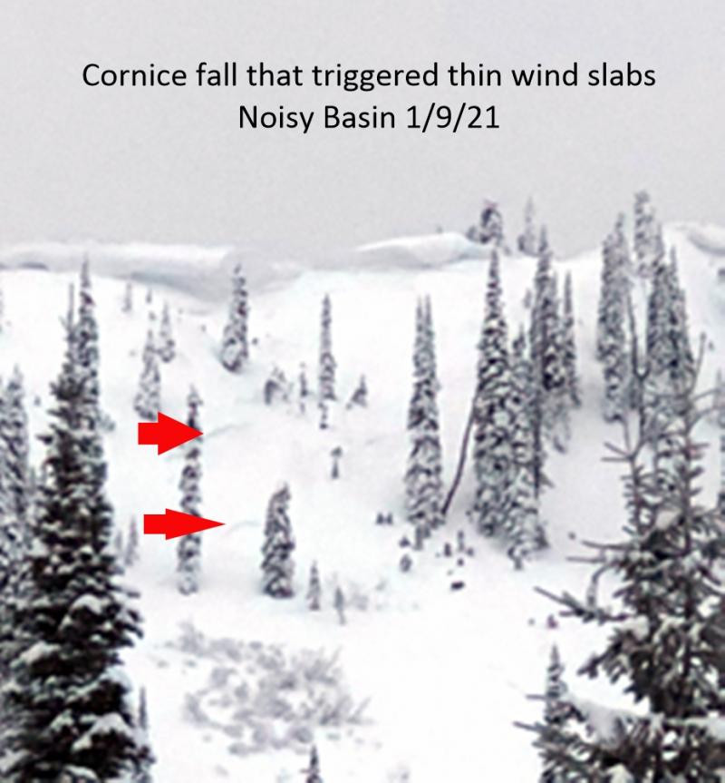
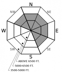
You can trigger dense slabs that break 1 to 3 feet deep on steep slopes that have collected blowing snow over the past few days. You'll find this hazard on the downwind sides of saddles in ridges, along the leeward sides of gullies, and behind rocky outcrops. The slabs may be further down slope than usual. They're easier to trigger from their edges, where the slabs are thinner. Older generations of these slabs may be harder and more unpredictable. Dunes and whale-shaped drifts are good visual clues to these slabs. The most reliable way to reduce your exposure to this hazard is to stay off steep slopes that harbor these slabs.
-
Type ?
-
Aspect/Elevation ?
-
Likelihood ?CertainVery LikelyLikelyPossible
 Unlikely
 -
Size ?HistoricVery LargeLargeSmall

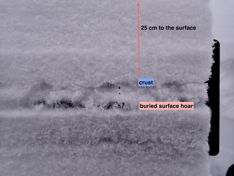
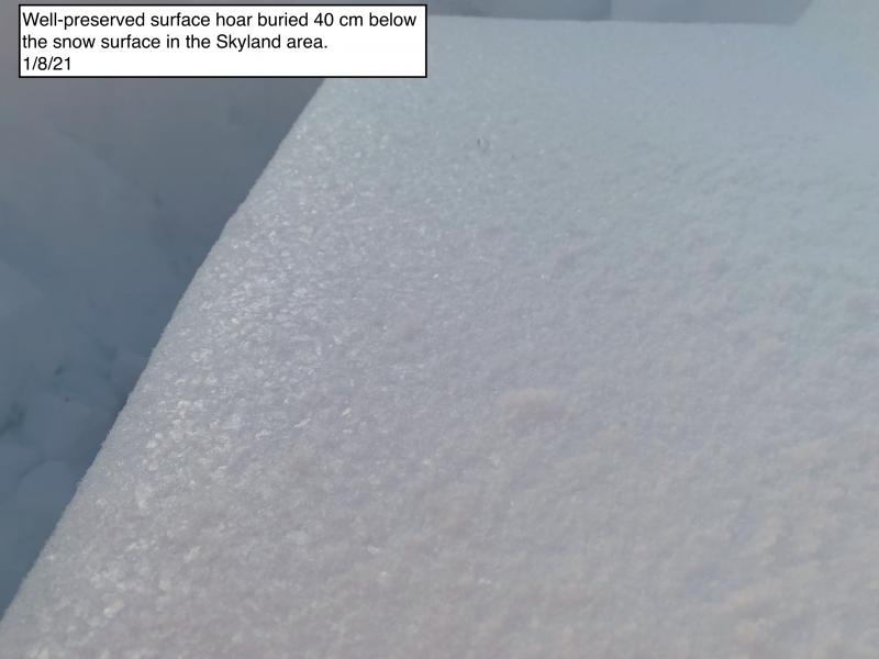
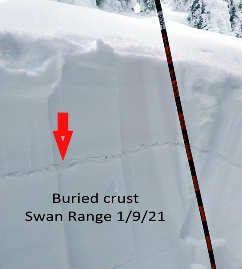
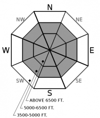
The likelihood of a person triggering slides that break on weak snow buried in the past month is diminishing. Diminishing, but not zero. You can diminish the chances you'll be the person to trigger a slide by sticking to slopes less than 35 degrees. If you do choose to ride steeper terrain, pick slopes that aren't above trees, rocks, or gullies, which can exaggerate the consiequences of an avalanche. Identify potential trigger points before committing to a slope, and weave around them. Potential trigger points are anywhere a weak layer is closer to the surface or more likely to be weak. Typical candidates are windward slopes with variable snow depths, convex roll overs, and slopes where talus is the summer ground cover.
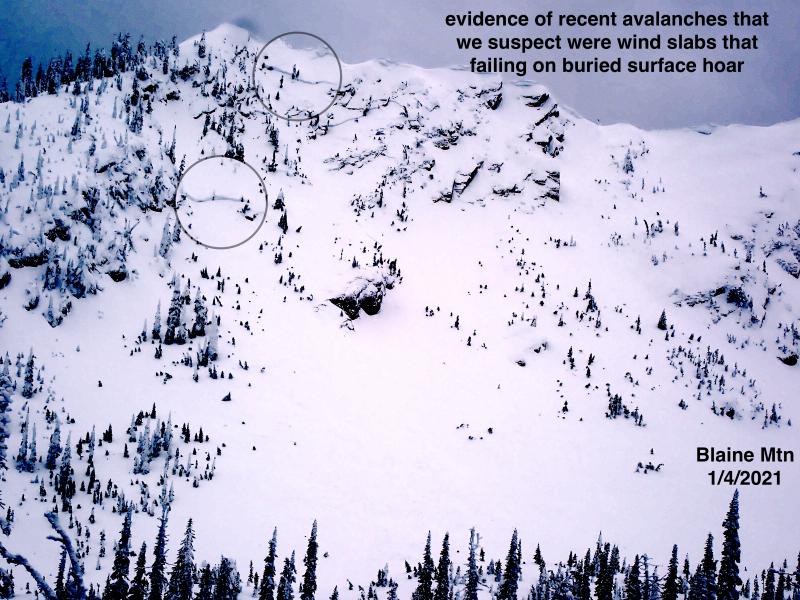
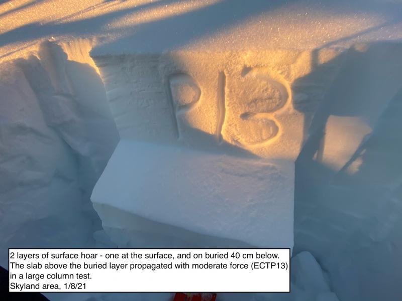
Let's start today from the premise that lack of evidence does not mean lack of problem. And we seem to be in a situation where we lack evidence that a person's weight can trigger slabs that break on old, weak snow buried 1 to 4 feet below the surface. In the past few days, observers have reported a few natural avalanches that failed on weak layers buried during or after the Solstice storm (nothern Swan Range, northern Whitefish Range). A week ago, riders reported unintentionally triggered slabs in the Flathead Range and northern Whitefish Range. Snowpit tests on a slope adjacent to one of the observed slides on the northern Whitefish Range did not produce propagation on the same layers.
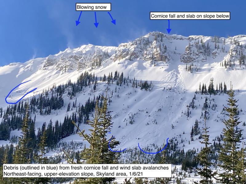
The Dec. 9 interface looks to be dormant; we've received no confirmed reports of slides breaking on that interface since the Solstice Storm. In the past few days, observers recorded one rumbling collapse and occasional propagation in snowpack tests. Van-sized chunks of cornce tumbling down a steep, open slope in Skyland did not release a slide on old snow.
That's not many avalanches, or many other signs of instability, given the size of our forecast region. From that, I have to conclude that it's unlikely a person or snowmachine would trigger a slab on these layers except on isolated slopes where the snowpack differs from nearly all others. And that's how I've listed the likelihood for the Persistent Slab avalanche problem today. The "but" is that we lack much evidence from steep terrain that's been incrementally loaded by drifted snow the past over the past week. People are, for good reason, staying off such slopes. We haven't had great visibility, and drifted snow may have obscured crowns and debris of slides that have run.
You can have great riding while accounting for this uncertainty, or while more evidence accumulates. Plan objectives and routes that minimze overhead hazard. Look for planar slopes that aren't above terrain traps. Assess the snowpack and potential consequences of a slide on individual slopes. Pick lines that weave around likely trigger points. Keep eyes on your partners from truly safe zones. Having fun on slope less than 35 degrees is the single most effective way to create a margin of error.
Snow showers this morning may lead to an inch or two more of new snow accumulations. A window of high pressure opens this afternoon, then closes tomorrow afternoon as weak weather system rolls through.
This forecast applies only to backcountry areas outside established ski area boundaries. The forecast describes general avalanche conditions and local variations always occur. This forecast expires at midnight on the posted day unless otherwise noted. The information in this forecast is provided by the USDA Forest Service who is solely responsible for its content.


