| Saturday | Saturday Night | Sunday | |
|---|---|---|---|
| Cloud Cover: | Mostly Cloudy | Mostly Cloudy | Mostly Cloudy |
| Temperatures: | 30 to 37 deg. F. | 25 to 30 deg. F. | 33 to 40 deg. F. |
| Wind Direction: | Southwest | Southwest | Southwest |
| Wind Speed: | 14G28 | 15G26 | 15G30 |
| Snowfall: | 1" to 5" in. | 1" to 2" in. | 2" to 3" in. |
| Snow Line: | 4000' | 4500' | 5000' |
Swan Range
Flathead Range and Glacier National Park
How to read the forecast
Watch for storm snow instabilities today and be extra cautious around the leeward side of ridges where winds built thicker slabs. Avoid fresh wind slabs by sticking to wind sheltered terrain and manage loose snow avalanche hazards, especially near terrain traps.

2. Moderate
?
Above 6500 ft.
2. Moderate
?
5000-6500 ft.
1. Low
?
3500-5000 ft.
- 1. Low
- 2. Moderate
- 3. Considerable
- 4. High
- 5. Extreme
-
Type ?
-
Aspect/Elevation ?
-
Likelihood ?CertainVery LikelyLikelyPossible
 Unlikely
 -
Size ?HistoricVery LargeLargeSmall

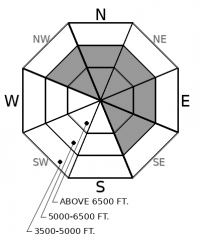
Expect to find a couple flavors of wind slabs today with some large enough to bury or injure you. The first one is reactive, obvious and formed overnight. These will likely be sitting on top of the second: a deeper, more stubborn slab that formed this past week. Slabs will be most common on leeward slopes below ridgelines and cross-loaded terrain features like gullies and sub ridges further downslope. Avoid wind loaded terrain where even a small slide could drag you over a cliff, or through a stand of trees. Look and feel for cracking and be cautious of hollow drifts as they are clues to seek wind-sheltered terrain.
-
Type ?
-
Aspect/Elevation ?

-
Likelihood ?CertainVery LikelyLikelyPossible
 Unlikely
 -
Size ?HistoricVery LargeLargeSmall

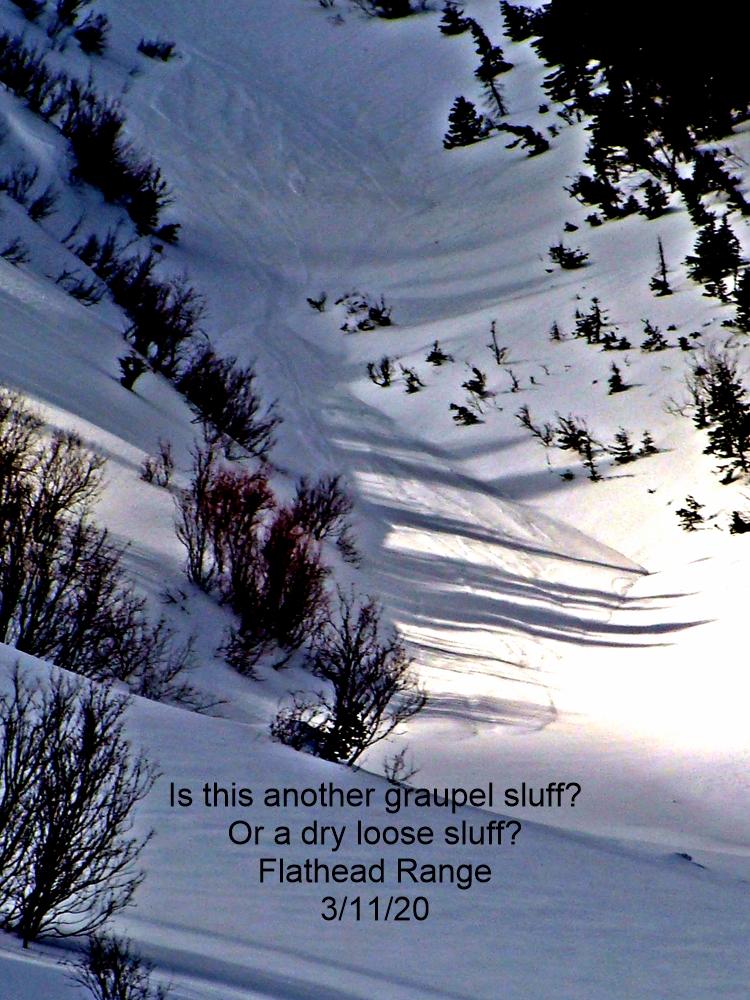
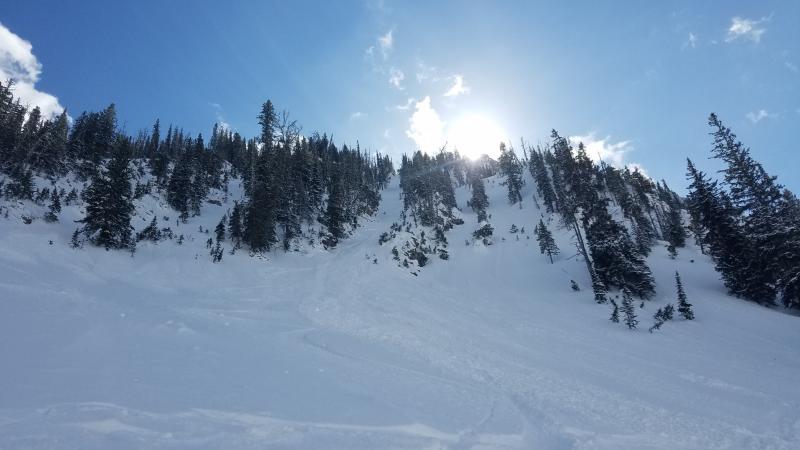
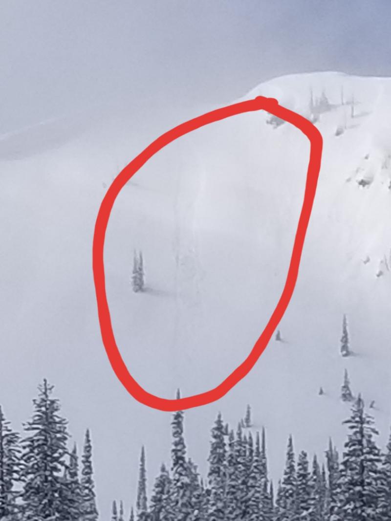
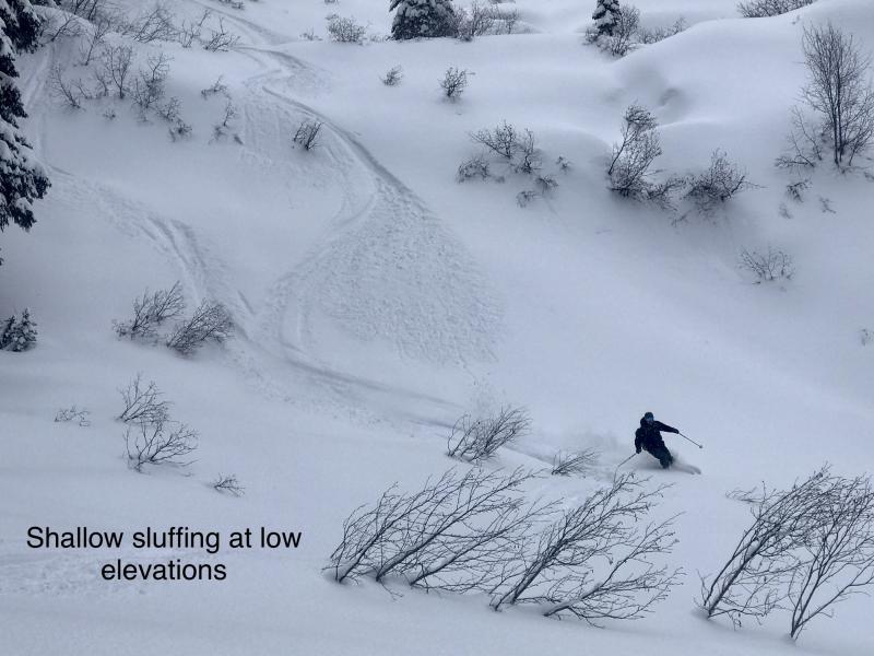
New snow will sluff easily in steep, wind sheltered locations. Sluffs will be easy to trigger - use defensive riding techniques to manage your sluffs, or move towards lower angle slopes to avoid them. As temperatures warm, expect surfaces to moisten causing wetter and denser avalanches by day’s end. Loose snow avalanches pose the biggest hazard above terrain traps, such as cliff bands, or in gullies where snow gets funneled and can run long distances. Larger and steeper terrain features entrain more snow on the way down causing a larger, more dangerous avalanche.
In the past 24 hours, remote weather stations are generally reading between 2" to 6" of new snow. The Swan Range is currently winning the race and will likely see another 3" to 5" today in favored areas. We expect the Flathead Range to have snow totals just shy of the Swans. The Whitefish Range is showing 2" to 3" of new snow with a hopeful inch expected for today.
New and recent snow mostly sits overtop melt freeze crusts and wind board (as Clancy describes in the helpful video below). These are not persistent weak layers, but will make for short-lived storm instabilities. Manage sluffs in steep, wind sheltered terrain. Sluffs will run further and faster on south aspects where they sit over a melt freeze crust. On northerly aspects, they can entrain larger amounts of soft snow that has been accumulating all week. Be cautious as you work your way onto the leeward side of ridges where new snow is being drifted and forming soft slabs above an older, stiffer wind slab. This setup might lead to a smaller avalanche stepping down, causing a larger, more destructive avalanche. We expect most avalanche activity today to be small, but in larger terrain features or areas that see favored storm totals, they could be large enough to bury you.
Temperatures are forecast to creep above freezing at roughly 5500 feet. This, along with new snow may wet the surface and cause loose wet avalanches. Loose wet avalanches are continuously working their way around the compass due to higher sun angles and warming temperatures. Northerly aspects, where the temperature gets above freezing, will have the most snow available to wet and become reactive. Take a look at this helpful diagram that illustrates the trend of wet avalanche activity as we work our way through spring.
COVID 19 Updates:
The Montana Governor's Stay at Home Directive goes into effect today. The order allows for outdoor activities to continue (as long as you keep the mandated 6 feet of social distancing). However, "Montanans are discouraged from outdoor recreation activities that pose enhanced risks of injury or could otherwise stress the ability of local first responders to address the COVID-19 emergency (e.g., backcountry skiing in a manner inconsistent with avalanche recommendations or in closed terrain)." Please re-evaluate your level of acceptable risk during this time. Any backcountry accidents will put additional strain on an already stressed medical system.
Glacier National Park has temporarily closed to visitors. The Flathead Avalanche Center will suspend fieldwork and forecasting for areas within Glacier National Park's boundaries. This includes the Apgar Range, the Lake McDonald area, and John F Stevens Canyon area north of Highway 2. The polygons on our forecast region map do not reflect these changes. The Flathead National Forest remains open to public use and the FAC will continue daily operations for the Whitefish, Swan, and Flathead Ranges under current guidance.
Today we will see snow showers produce accumulations between 1” to 5” with the Swan Range likely picking up the higher end. Winds will be light gusting into the mid 20s. The freezing line will creep its way back up to roughly 5500’.
This forecast applies only to backcountry areas outside established ski area boundaries. The forecast describes general avalanche conditions and local variations always occur. This forecast expires at midnight on the posted day unless otherwise noted. The information in this forecast is provided by the USDA Forest Service who is solely responsible for its content.


