| Tuesday | Tuesday Night | Wednesday | |
|---|---|---|---|
| Cloud Cover: | Mostly Cloudy | Mostly Cloudy | Mostly Cloudy |
| Temperatures: | 25 to 32 deg. F. | 23 to 27 deg. F. | 27 to 34 deg. F. |
| Wind Direction: | Southwest | Southwest | West |
| Wind Speed: | 15G40 | 23G41 | 17G36 |
| Snowfall: | 0" in. | 2" to 3" in. | 4" to 5" in. |
| Snow Line: | 1500' | 3500' | 3000' |
Flathead Range and Glacier National Park
How to read the forecast
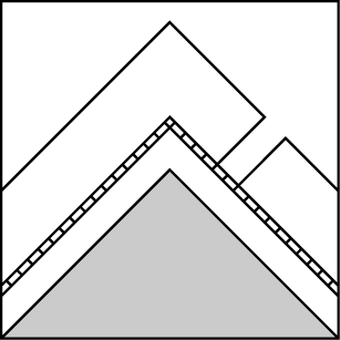
Enjoy generally stable avalanche conditions today. Assess recent wind loading before jumping into more consequential terrain at upper elevations. Reduce your likelihood of triggering a small wind slab by looking for areas of blowing snow and steering around the dense, rounded drifts.

1. Low
?
Above 6500 ft.
1. Low
?
5000-6500 ft.
1. Low
?
3500-5000 ft.
- 1. Low
- 2. Moderate
- 3. Considerable
- 4. High
- 5. Extreme
-
Type ?
-
Aspect/Elevation ?

-
Likelihood ?CertainVery LikelyLikelyPossible
 Unlikely
 -
Size ?HistoricVery LargeLargeSmall

Southwest winds were stronger than forecast yesterday. Winds drifted snow into shallow slabs beneath ridgelines and on crossloaded terrain features further downslope. Although we expect wind slabs to be relatively small in size, they are more of a concern the higher you travel and the closer you are to the Divide where more snow fell this past weekend. Look for blowing snow and steer around dense, pillowy drifts to reduce the possibility of being caught and dragged through a stand of trees or over a cliff.
-
Type ?
-
Aspect/Elevation ?
-
Likelihood ?CertainVery LikelyLikelyPossible
 Unlikely
 -
Size ?HistoricVery LargeLargeSmall

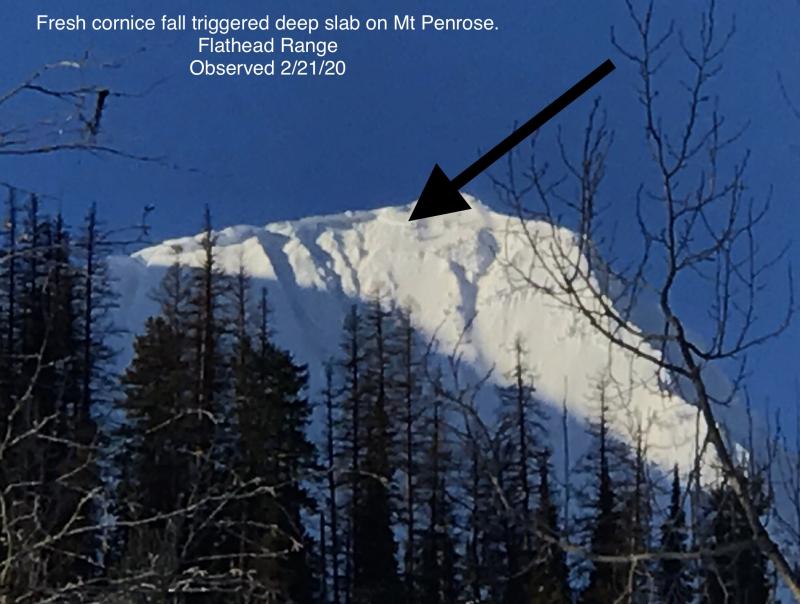
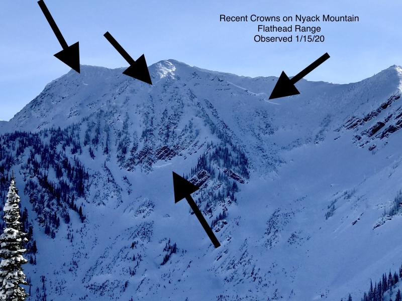
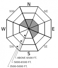
Although slides breaking on weak layers near the ground have become increasingly difficult to trigger, the consequences are unsurvivable. The pattern of deep slabs avalanches this winter has been confined to high alpine bowls and faces in the Flathead Range and Glacier Park on northerly and easterly aspects. Cornice falls are the most likely triggers. Choose routes that reduce your exposure to overhead hazards, including runout zones, and be cautious of alpine slopes with thin or variable snow coverage.
Yesterday winds far exceeded forecast speeds. Both Blase and Clancy reported large plumes of drifting snow off peaks in the Flathead Range and Glacier National Park where roughly 5 inches of snow fell this past weekend. Blase found shallow and mostly unreactive wind slabs in the southern end of Glacier National Park. Expect slabs to be thicker and denser as you gain elevation, especially above the town of Essex where it seems more snow fell. The Whitefish Range and the Swan Range received a trace to an inch of snow this past weekend. Despite strong winds, we don’t expect wind slabs to be much of a concern in these ranges.
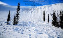
Continue to be cautious on ridgelines and move quickly out from underneath looming cornices. Spontaneous cornice fall is a concern for the remainder of the season. Despite a strong refreeze overnight, you certainly won’t catch me dawdling around below ridgelines that host these massive chunks of snow. Be more alert as temperatures warm throughout the day. Cornice fall is more likely when the sun beats down on them and the temperatures rise to near and above freezing, especially for prolonged periods of time. Be suspicious of the kind of terrain they lurk over, specifically in the Flathead Range and Glacier National Park where cornice fall has triggered very large, Deep Slab avalanches in the past few weeks. For example, take a look at observations from the Bob Marshal Wilderness and Mt. Penrose for reminders of their destructive capabilities.
Mostly clear skies and warming temperatures will settle in before a short pulse of snow this evening and tomorrow. Expect moderate winds with gusts as strong as 40 mph out of the west today with freezing levels hovering around 4500 feet.
This forecast applies only to backcountry areas outside established ski area boundaries. The forecast describes general avalanche conditions and local variations always occur. This forecast expires at midnight on the posted day unless otherwise noted. The information in this forecast is provided by the USDA Forest Service who is solely responsible for its content.


