| Sunday | Sunday Night | Monday | |
|---|---|---|---|
| Cloud Cover: | Mostly Cloudy | Mostly Cloudy | Partly Cloudy |
| Temperatures: | 22 to 27 deg. F. | 12 to 17 deg. F. | 20 to 25 deg. F. |
| Wind Direction: | West | Southwest | West |
| Wind Speed: | 5 to 10, gusting to 25 | 5 to 10, gusting to 25 | 5 to 10, gusting to 25 |
| Snowfall: | 0" to 2" in. | 0 to 2" in. | 0" in. |
| Snow Line: | 2000' | 2500' | 1000' |
Flathead Range and Glacier National Park
How to read the forecast
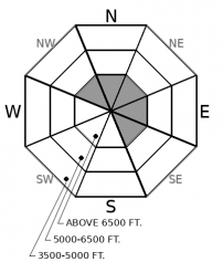
Avoid the isolated slopes where small dry and wet snow avalanche hazards linger: steep, leeward and cross-loaded slopes with hard slabs of drifted snow that refuse to stabilize. And steep, low-elevation slopes where near-surface snow hasn't completely refrozen, or crusts break down during sunny periods this afternoon. A large natural slide Friday reinforces the need to minimize your time below avalanche paths with northerly and easterly start zones, especially those where large cornices loom.

2. Moderate
?
Above 6500 ft.
1. Low
?
5000-6500 ft.
1. Low
?
3500-5000 ft.
- 1. Low
- 2. Moderate
- 3. Considerable
- 4. High
- 5. Extreme
-
Type ?
-
Aspect/Elevation ?
-
Likelihood ?CertainVery LikelyLikelyPossible
 Unlikely
 -
Size ?HistoricVery LargeLargeSmall

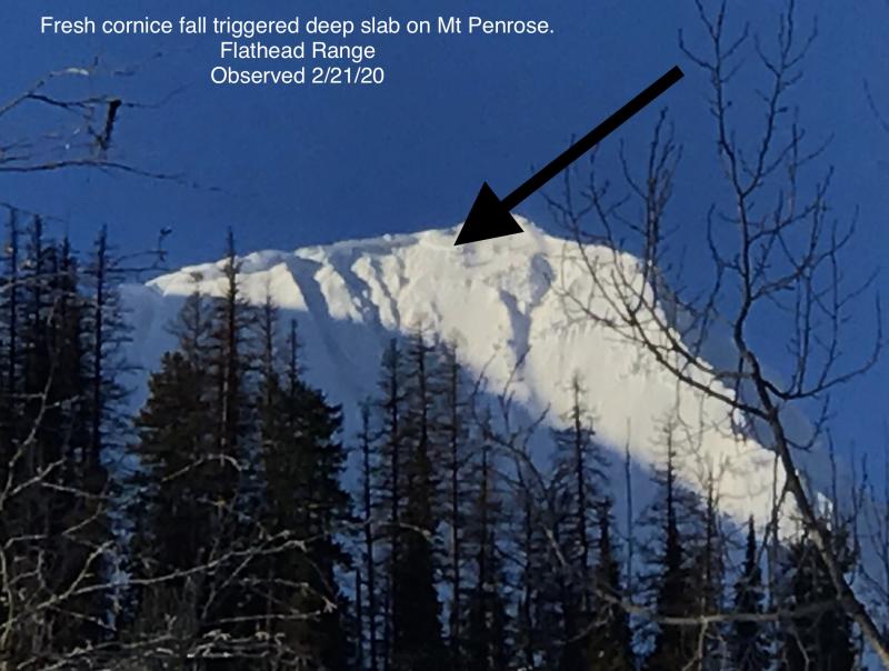
A large natural avalanche that likely ran Friday is the latest in a string of hard slabs that have failed on weak layers near the ground in the past few weeks (Example A, Example B). While it's taken falling cornices to trigger these slides, it's clear the hazard lingers in and below high alpine bowls and steep faces in the Flathead Range and Glacier National Park. Though infrequent, these large slides are pretty much unsurvivable, so it’s good policy to limit your time under steep northerly and easterly start zones, especially those where large cornices loom.
The few inches of snow forecast for Saturday didn't materialize, except at Goat Haunt and north of the border. The cold front did arrive, and temperatures have dropped 8 to 20 degrees since Saturday afternoon, with nearly all stations recording below freezing temperatures this morning. Today's forecast calls for snow showers and continued cool temperatures, with maybe some breaks in the clouds this afternoon. Unless new snow accumulations exceed the forecast, that weather leaves us with only small, isolated dry and wet snow avalanches hazards, except...And it's a big except.
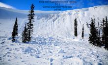
Cam spotted a large (D3) natural avalanche on the northeast face of Cameahwait yesterday that appears to have run Friday, triggered by a falling cornice. A larger avalanche ran on this same slope during the February 1 rain and warming event. That slide looked to have failed on a facet/ crust combination near the ground. Cam estimated the crown of the new slide at 4-5 feet, about the amount of new and drifted snow that's accumulated since February 1. That suggests the original weak layer is still intact, despite the high-elevation rain that day. Perhaps the original slide ran after the rain, preventing rain from destroying the weak layer.
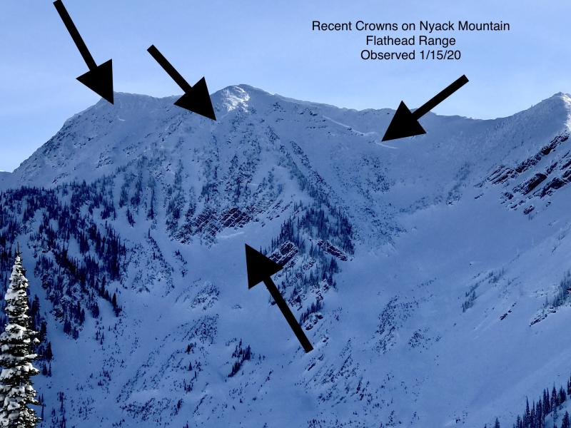
So an outbreak of the Corniced-19/20 virus. Not a pandemic, or even an epidemic. But it does call for strict maintenance of healthy overhead hazard hygiene. The dozen or so very large destructive avalanches that have run this winter in the Flathead Range and Glacier National Park have occurred during periods of prolonged warming and rain, or after prolonged snowfall and very cold tempertures, with falling cornices a typical trigger. This image illustrates the distribution of the slides as of late January, before the February 1 rain event. It doesn't include a few subsequent slides, including Friday's, though they all have failed on northeast-facing upper elevation slopes as well.
Friday's slide is a critical reminder to stay vigilant about what's above you and not to linger below slopes similar to those that have produced these tree-snapping slides. And the slopes themselves; Friday's slide suggests that previous slides don't make a slope immune to more slides. Scoot out from under steep, shaded faces near the crest of the Flathead Range that are capped by large cornices. I'd do the same in Glacier National Park, though we've had fewer observations of destructive slides from there.
Snow showers are possible this morning, with accumulations of a few inches at most. Temperatures will remain cool, with highs in the 20s at mid elevations. Expect colder temperatures near the Continental Divide. This morning's overcast skies may give way to broken skies or scattered clouds this afternoon, particularly near the Continental Divide. Winds should be light with moderate gusts from the southwest.
This forecast applies only to backcountry areas outside established ski area boundaries. The forecast describes general avalanche conditions and local variations always occur. This forecast expires at midnight on the posted day unless otherwise noted. The information in this forecast is provided by the USDA Forest Service who is solely responsible for its content.


