| Wednesday | Wednesday Night | Thursday | |
|---|---|---|---|
| Cloud Cover: | Partly Cloudy | Mostly Cloudy | Mostly Cloudy |
| Temperatures: | 20 to 26 deg. F. | 12 to 16 deg. F. | 24 to 31 deg. F. |
| Wind Direction: | Northeast | Southwest | Southwest |
| Wind Speed: | 9G21 | 14G24 | 20G39 |
| Snowfall: | 0" in. | 0" in. | 0" in. |
| Snow Line: | 0' | 500' | 1000' |
Flathead Range and Glacier National Park
How to read the forecast
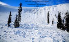
Several parties triggered stiff slabs of drifted snow during yesterday's wind loading event. Wind slabs a foot or more in thickness remain a lingering concern for the Swan and the Flathead Range, as well as Glacier National Park. Avoid pillowy looking surfaces that formed below ridgelines and on cross-loaded terrain features at mid and upper elevations. Give corniced ridgelines a wide berth since these still can be triggered by the weight of a person.

2. Moderate
?
Above 6500 ft.
2. Moderate
?
5000-6500 ft.
1. Low
?
3500-5000 ft.
- 1. Low
- 2. Moderate
- 3. Considerable
- 4. High
- 5. Extreme
-
Type ?
-
Aspect/Elevation ?
-
Likelihood ?CertainVery LikelyLikelyPossible
 Unlikely
 -
Size ?HistoricVery LargeLargeSmall

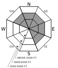
New and recent snow coupled with yesterday's sustained moderate wind speeds out of the southwest has drifted snow onto leeward aspects. Although recently formed wind slabs will be more difficult to trigger today, they have grown large enough to injure or bury you in some terrain features. Avoid dense, pillowy slabs of drifted snow by sticking to terrain that was sheltered by the wind. Be aware that winds have shifted to the north overnight. Though much of the snow has been transported and speeds decreased, there is a possibility that pockets of drifted snow may be found in unusual locations today, which can catch you off guard.
-
Type ?
-
Aspect/Elevation ?
-
Likelihood ?CertainVery LikelyLikelyPossible
 Unlikely
 -
Size ?HistoricVery LargeLargeSmall

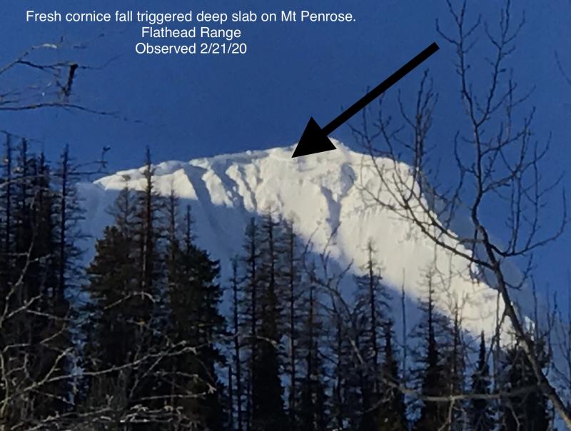
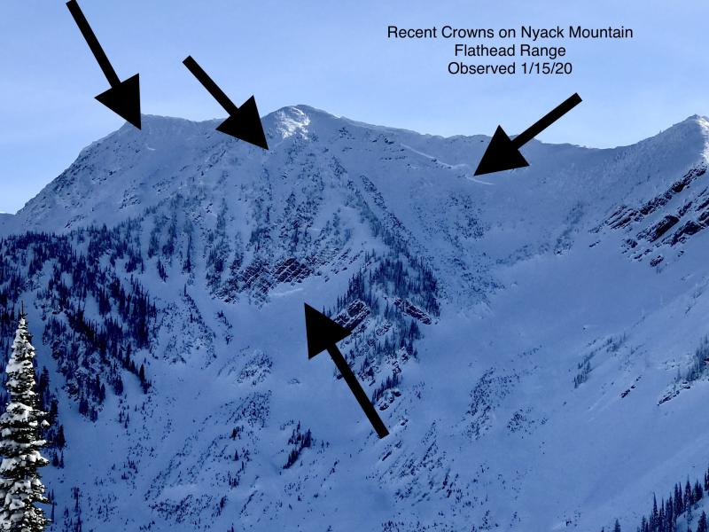
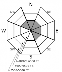
In the past few weeks, numerous very large avalanches broke on buried weak layers near the ground, producing crowns up to 20 feet deep. The destructive nature of deep slab avalanches keeps us leery of traveling into upper elevation, rocky, leeward terrain in the Flathead Range and Glacier National Park. The most likely trigger is a large cornice fall, or you triggering from a shallow or rocky part on the slope, where weak layers are closer to the surface. Be cautious since these trigger points are sometimes not obvious. Your safest bet managing this problem is to avoid this kind of terrain altogether.
Yesterday the Swan Range, Flathead Range, and Glacier National Park picked up 4 to 10 inches of new snow on top of 2 to 5 inches of snow on Sunday night. Sustained moderate southwest winds, with stronger gusts, built sensitive wind slabs 8 to 12+ inches thick. The Whitefish Range picked up 2 to 3 inches of new snow, leading to a much calmer day there, as described here. Observers around the forecast area found increasing avalanche danger, most notably in the Flathead Range and Glacier National Park Region (example 1, example 2). Forecaster, Blase Reardon said it well yesterday, it was "the kind of hazard you might manage. Or that might manage you."
Expect wind slabs formed yesterday to be the primary problem to manage today. A benign weather pattern today will make identifying wind slabs less obvious since we won't be watching active wind loading like we were yesterday. Instead, look for surface clues. Shooting cracks, pillowy surfaces, and recent cornice formations are all signs to seek out terrain that was sheltered by the wind. Be on the look out since winds shifted to the north overnight, creating a possibility of isolated pockets of wind slabs on atypical south and southwest aspects. These should be relatively small, but ones to look for since they will be in unusual locations. One uncertainty we have moving forward is if the additional wind loading has re-activated buried faceted crusts that were touchy this past weekend. If triggered, slides could step down 1 to 3 feet deep and have a more consequential outcome.
A weak weather system will move into the area today. Expect scattered snow showers with a possible trace of snow accumulation. Winds will be light gusting to moderate out of the northeast. We can expect mostly cloudy skies and temperatures in the upper twenties.
This forecast applies only to backcountry areas outside established ski area boundaries. The forecast describes general avalanche conditions and local variations always occur. This forecast expires at midnight on the posted day unless otherwise noted. The information in this forecast is provided by the USDA Forest Service who is solely responsible for its content.


