| Saturday | Saturday Night | Sunday | |
|---|---|---|---|
| Cloud Cover: | Overcast | Partly Cloudy | Partly Cloudy |
| Temperatures: | 21 to 27 deg. F. | 3 to 6 deg. F. | 19 to 25 deg. F. |
| Wind Direction: | West-northwest | Northeast | Southwest |
| Wind Speed: | 19G36 | 13G36 | 10G31 |
| Snowfall: | 6" to 10" in. | 0" in. | 0" in. |
| Snow Line: | 2000' | 0' | 0' |
Flathead Range and Glacier National Park
How to read the forecast
A storm favoring the Swan and Flathead Ranges is creating dangerous avalanche conditions. Be conservative and avoid steep slopes where soft slabs of new and drifted snow may be large enough to injure or bury you. In sheltered terrain, sluffs can entrain large amounts of snow and deep debris can pile up in terrain traps. Recent avalanches, blowing snow, and shooting cracks are red flags. Be cautions under slopes with overhead exposure to large avalanche paths with alpine start zones.

3. Considerable
?
Above 6500 ft.
2. Moderate
?
5000-6500 ft.
1. Low
?
3500-5000 ft.
- 1. Low
- 2. Moderate
- 3. Considerable
- 4. High
- 5. Extreme
-
Type ?
-
Aspect/Elevation ?

-
Likelihood ?CertainVery LikelyLikelyPossible
 Unlikely
 -
Size ?HistoricVery LargeLargeSmall

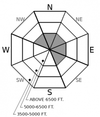
New snowfall will increase the avalanche danger in a variety of ways. Shifting winds will drift snow onto exposed slopes on all aspects. In sheltered terrain, enough snow may accumulate for soft slabs to develop. Where the surface remains unconsolidated, loose dry sluffs will run on very steep slopes. All these storm instabilities can create avalanches large enough to bury you today. Pay special attention where the most snow falls, in the windiest terrain, and above terrain traps. Watch for blowing snow at ridgelines. Track storm totals. The danger will increas as more new snow accumulates. Recent natural avalanches, long running sluffs, and shooting cracks in slabby snow are red flags. Conservative terrain choices that steer you away from slopes steeper than about 35 degrees are the safest bet today.
-
Type ?
-
Aspect/Elevation ?
-
Likelihood ?CertainVery LikelyLikelyPossible
 Unlikely
 -
Size ?HistoricVery LargeLargeSmall

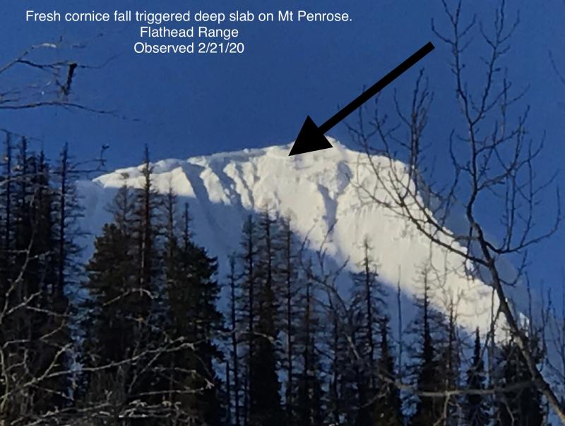
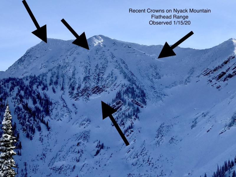
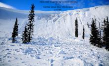
With avalanches leaving 20 foot crowns near Mt. Grant as recently as this past weekend, it remains critical to limit your exposure to steep, upper-elevation slopes that harbor weak facets and crusts near the ground. That means avoiding the runouts of these start zones, as well as choosing planar slopes with relatively uniform snow depths. I'd also avoid being under slopes like this that have large cornices cantilevered over them, as falling cornices may be a large enough load to trigger a slide that breaks near the ground and involves the entire season's snowpack.
Soft snow sluffed easily on crusts throughout the region yesterday, in some cases running long distances.
On Wednesday night, yet another freezing rain crust formed. Yes, another one. It is thickest in the Swan Range but observers found traces of it into the upper elevations in the Flathead and Whitefish Ranges. Even where the 2/5 crust is slight or absent from the upper snowpack, the thick, hard crust that formed just before Groundhog’s Day is widespread across the region. Several inches of low denisty snow fell with seasonably cold temperatures mid week. In some cases that newer snow has faceted above and below the crusts. On Thursday, Cam and Rob found a few patches of surface hoar and unreactive wind deposits in the northern Whitefish range. Crusts will act as slick sliding surfaces and low-cohesion snow can easily collapse under new slabs.
Winds increased yesterday afternoon and new snow began to fall overnight. Storm instabilities will run the gambit today. We can expect shifting winds to create sensitive drifts across the middle and upper elevation bands. Where the most precipitation accumulates, especially in the Swan and Flathead Ranges, storm slabs can form in more sheltered locations. Where slab formation is limited, loose dry sluffs can entrain large amounts of low density snow and run long distances.
In the Flathead range and near the Divide, deep persistent slabs are still a concern. The 2/1 crust does not extend into all alpine start zones, and it may not have shut down the potential for giant avalanches originating from up high. New loading from wind and snow will only add weight to weak layer at the bottom of the snowpack. With more snow in the tracks of large avalanche paths we have again increased the potential size of the problem. Though still unlikely, deep slab avalanches can run to lower elevations and destroy mature trees. An avalanche of that size would be unavailable. Large cornice fall is exactly the kind of trigger that could kick off another one of these monsters during a new loading event.
A few inches of snow have fallen already this morning and moderate snowfall will continue into the early afternoon. Precipitation favors the Swan Range with the Flathead Range close in second place. Gusty ridgetop winds will shift from west to northeast this afternoon after a mid day lull. The National Weather Service has issued a Winter Weather Advisory for our area through 5pm tonight. Winds and snowfall drop considerably going into tomorrow and early next week.
This forecast applies only to backcountry areas outside established ski area boundaries. The forecast describes general avalanche conditions and local variations always occur. This forecast expires at midnight on the posted day unless otherwise noted. The information in this forecast is provided by the USDA Forest Service who is solely responsible for its content.


