| Tuesday | Tuesday Night | Wednesday | |
|---|---|---|---|
| Cloud Cover: | Overcast | Mostly Cloudy | Mostly Cloudy |
| Temperatures: | 27 to 30 deg. F. | 20 to 23 deg. F. | 26 to 32 deg. F. |
| Wind Direction: | South | Southwest | Southwest |
| Wind Speed: | 14G25 | 10G20 | 16G32 |
| Snowfall: | 1" to 4" in. | 0" to 2" in. | 0 to 1" in. |
| Snow Line: | 3500' | 3000' | 2500' |
Flathead Range and Glacier National Park
How to read the forecast
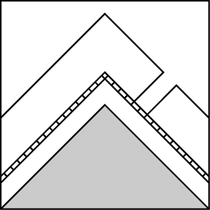
Snowfall in the past 24 hours will create slabs large enough to bury or injure you in larger terrain, or if caught above a terrain trap. If you see 8 inches of new snow stack up, or winds driving snow onto leeward slopes, seek out terrain with angles less than 35 degrees or terrain sheltered from the wind. Be wary of traveling on or below upper elevation, leeward faces where deep slab avalanches remain a concern.

2. Moderate
?
Above 6500 ft.
2. Moderate
?
5000-6500 ft.
1. Low
?
3500-5000 ft.
- 1. Low
- 2. Moderate
- 3. Considerable
- 4. High
- 5. Extreme
-
Type ?
-
Aspect/Elevation ?

-
Likelihood ?CertainVery LikelyLikelyPossible
 Unlikely
 -
Size ?HistoricVery LargeLargeSmall

If weather forecast verifies, expect a variety of new snow instabilities and rising avalanche danger. On Monday, 3” to 5” of new snow accumulated, with an additional 2” to 4” forecast today. Slabs large enough to bury or injure you may form in bigger terrain. Expect thicker, more dangerous slabs on the leeward side of ridgelines where winds have transported new snow in the past 24 hours. Seek terrain with slope angles less than 35 degrees if you see signs of cracking on steep test slopes.
-
Type ?
-
Aspect/Elevation ?
-
Likelihood ?CertainVery LikelyLikelyPossible
 Unlikely
 -
Size ?HistoricVery LargeLargeSmall

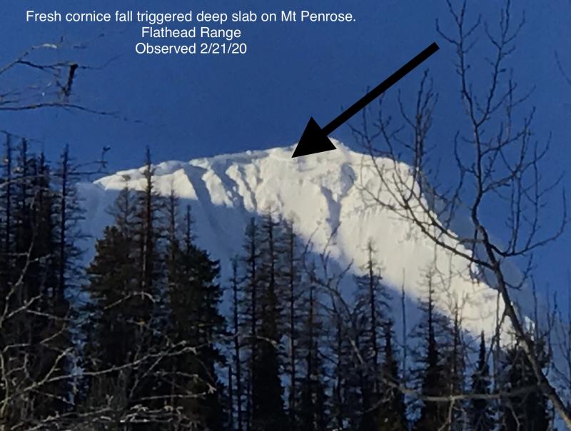
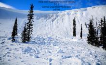
We remain concerned about the potential for very large avalanches that break on buried weak layers near the ground. You are most likely to trigger a deep slab from a shallow or rocky part of the slope, where the snowpack is thinner and these weak layers are closer to the surface. Avalanche activity like this has been concentrated in upper elevation, rocky, leeward terrain in the Flathead Range and Glacier National Park. If you venture into upper elevations, hedge your bets by sticking to terrain with uniform snow coverage while exposing only one person at a time.
Today's avalanche danger will hinge on the weather forecast, which calls for 2” to 7” of new snow. Weather models show that moderate wind speeds will reach the Swan and Flathead crest and then quickly dissipate beyond there. The combination of new snow and isolated drifting will create a hazard that should be easy to identify and manage. Utilize small test slopes and hand pits to assess how the new snow is bonding to old snow interfaces. The interface may be recent snow or a melt-freeze crust depending on your elevation and aspect. Snow will likely sluff of areas where it falls onto a melt freeze crust.
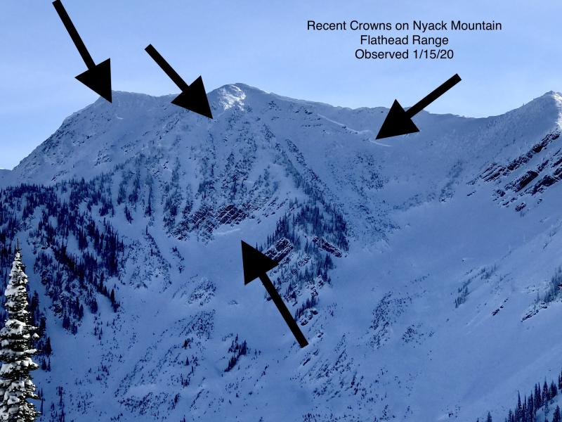
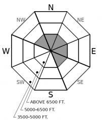
It may become easy to get caught up in paying attention to new snow instabilities or driven by the excitement of fresh snow, but keep in mind the dragon that lurks at the bottom of the snowpack in parts of the forecast region. Take a look at this diagram, which clearly illustrates the locations of recent natural avalanches that failed on persistent weak layers buried at the bottom of the snowpack. Deep Slab avalanches remain a concern in similar terrain: steep, upper-elevation slopes that face northwest to east to southeast in the Flathead Range and Glacier National Park.
Deep Slab avalanches are notoriously difficult to predict. They can propagate long distances, be remotely triggered, and are always destructive. This problem requires a healthy dose of patience. Safer riding conditions can still be found at upper elevations AWAY from leeward, rocky, alpine faces.
You will notice that we have removed the Deep Slab Avalanche problem from the Whitefish Range advisory. This decision resulted from a lack of avalanche activity and terrain characteristics. These avalanches have been failing on weak layers near the ground in upper elevation, craggy, alpine faces, like the ones found in the Flathead Range and Glacier National Park.
A stronger system impacts our region today, favoring the Swan Range. Snowfall heights will vary from 2” to 7”. Winds will be light gusting to moderate. The freezing line will hover around 3500 feet.
This forecast applies only to backcountry areas outside established ski area boundaries. The forecast describes general avalanche conditions and local variations always occur. This forecast expires at midnight on the posted day unless otherwise noted. The information in this forecast is provided by the USDA Forest Service who is solely responsible for its content.


