| Monday | Monday Night | Tuesday | |
|---|---|---|---|
| Cloud Cover: | Mostly Cloudy | Mostly Cloudy | Overcast |
| Temperatures: | 26 to 32 deg. F. | 18 to 22 deg. F. | 27 to 33 deg. F. |
| Wind Direction: | Southwest | Southwest | South |
| Wind Speed: | 20G35 | 20G35 | 16G30 |
| Snowfall: | 1" to 4" in. | 0" to 1" in. | 2" to 5" in. |
| Snow Line: | 3500' | 2500' | 3000' |
Flathead Range and Glacier National Park
How to read the forecast
New snow instabilities are increasing the avalanche danger today. Be cautious in areas that have received more than 8 inches of new snow, or near steep terrain where winds have transported snow into thicker, more dangerous slabs. The safest riding is in wind-sheltered terrain free of overhead hazards. Avoid being on or underneath upper elevation, complex alpine terrain where many very large avalanches have occurred in the past month.

2. Moderate
?
Above 6500 ft.
2. Moderate
?
5000-6500 ft.
1. Low
?
3500-5000 ft.
- 1. Low
- 2. Moderate
- 3. Considerable
- 4. High
- 5. Extreme
-
Type ?
-
Aspect/Elevation ?
-
Likelihood ?CertainVery LikelyLikelyPossible
 Unlikely
 -
Size ?HistoricVery LargeLargeSmall

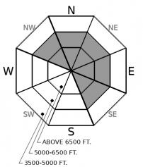
Southwesterly winds and a few inches of new snow will drift slabs onto leeward terrain features. Expect these slabs to be thickest and most dangerous near ridgelines and cross-loaded terrain features. Look for blowing snow and pillowy surface conditions as cues to seek wind-sheltered terrain with slope angles less than 35 degrees. Give ridgelines a wide berth as cornices continue to grow, making the edge not so obvious and more dangerous.
-
Type ?
-
Aspect/Elevation ?
-
Likelihood ?CertainVery LikelyLikelyPossible
 Unlikely
 -
Size ?HistoricVery LargeLargeSmall

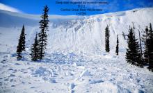
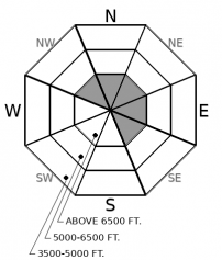
Deadly avalanches breaking on buried weak layers near the ground remains a concern. You are most likely to trigger a deep slab from a shallow or rocky part of the slope, where weak layers are closer to the surface. Upper elevation, rocky, leeward terrain in the Flathead Range and Glacier National Park has been the hotspot for this kind of activity. If you venture into upper elevations, hedge your bets on terrain with uniform snow coverage while traveling one at a time.
Across the region, the weather stations are showing a wide spread of overnight storm totals. The Swan Range picked up roughly a foot of new snow (1" of SWE), while the Whitefish Range, Flathead Range, and Glacier National Park sensors are showing only 2 to 3 inches. We are expecting another 2" to 10" today, favoring the Swan Range again. The new snow is accumulating on soft snow sitting on a rain crust. In areas that saw smaller storm totals, winds will be driving the primary instabilities today. Select your terrain to accommodate how winds are interacting with the new snow. If you see drifted snow with depths greater than 8 inches, seek wind-sheltered terrain. Slabs will be thicker and more widespread in the Swan Range, and can expand into wind protected terrain because of the larger storm totals. Warm temperatures and rain at low elevations will likely create rollerballs and the potential for small wet loose avalanches. Be careful on steep terrain above terrain traps at lower elevations to avoid being pushed around by some wet snow.
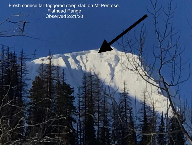
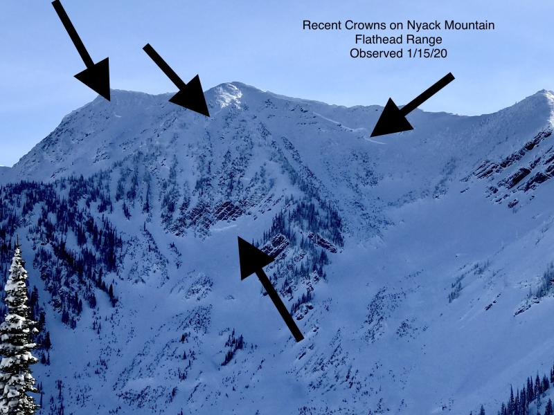
While new and windblown instabilities are today's primary concerns, we remain leery of deep instabilities, particularly in the Flathead Range. Very large, destructive avalanches have been the highlight of this month. Continuous snowfall, loading, and large temperature swings overburdened weak layers near the ground, causing numerous deep slab avalanches over the past few weeks. Shaded aspects in the uppermost elevations, like the ones found in the Flathead Range and Glacier National Park, are the areas that harbored the weakest snow. Here is a graphic that highlights activity failing on persistent weak layers near the ground. Deep slab avalanches are one of the most difficult avalanche problems to predict. This, along with their destructive nature, directs us to conservative terrain choices at that upper elevation band. Be patient and allow time for this problem to heal. We also received a second-hand report of an avalanche that occurred in the last few days, which crossed Red Meadow Road in the Northern Whitefish Range. If anyone travels into that zone today, we would love to get more information on the nature of that avalanche.
Lingering showers will taper off around noon today. Expect 1 to 4 inches of snow in the Whitefish Range, Flathead Range and Glacier Nation Park. The Swan is favored with a possibility of 5 to 10 inches of snow. Winds will be hovering around 15 MPH with gusts as strong as 30. Temperatures will be in the upper 20s and low 30s. An active weather pattern will persist through the week after a brief lul today.
This forecast applies only to backcountry areas outside established ski area boundaries. The forecast describes general avalanche conditions and local variations always occur. This forecast expires at midnight on the posted day unless otherwise noted. The information in this forecast is provided by the USDA Forest Service who is solely responsible for its content.


