| Sunday | Sunday Night | Monday | |
|---|---|---|---|
| Cloud Cover: | Mostly Cloudy | Mostly Cloudy | Mostly Cloudy |
| Temperatures: | 27 to 34 deg. F. | 22 to 26 deg. F. | 27 to 33 deg. F. |
| Wind Direction: | South | Southwest | Southwest |
| Wind Speed: | 2 to 12, G20 | 7 to 17, G30 | 10 to 20, G35 |
| Snowfall: | 1" to 2" in. | 0 to 2" in. | 1" to 2" in. |
| Snow Line: | 3500' | 3500' | 3000' |
Whitefish Range
How to read the forecast
Cool and calm weather is contributing to a generally stable snowpack today in the Whitefish Range. Take advantage of good stability to seek out steeper terrain objectives, but remain watchful for isolated exceptions in extreme or rocky terrain. Continue to carry rescue gear and travel one at a time in steep terrain. An increase in winds and more snow may raise the danger tomorrow; take heed if today's weather brings more wind or snow than forecasted.

1. Low
?
Above 6500 ft.
1. Low
?
5000-6500 ft.
1. Low
?
3500-5000 ft.
- 1. Low
- 2. Moderate
- 3. Considerable
- 4. High
- 5. Extreme
-
Type ?
-
Aspect/Elevation ?
-
Likelihood ?CertainVery LikelyLikelyPossible
 Unlikely
 -
Size ?HistoricVery LargeLargeSmall

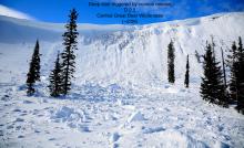
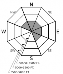
There have been a few avalanches in the past month that have failed on deeply buried weak layers in the Northern Whitefish Range. Triggering a deep slab has become very unlikely, but may not be impossible. The most likely trigger spot will be from a shallow or rocky part of the slope, where weak layers are closer to the surface. You can find that kind of variable snow cover on rocky, leeward, alpine terrain at the highest elevations in the Whitefish Range.
Several days of unseasonably warm temperatures have helped wind slabs from earlier in the week heal. Observations yesterday confirmed that Friday's rain event reached into upper elevations. The stout crust was observed to at least 6,800' in the Flathead Range, and likely higher in the Swan and Whitefish Ranges. Since Friday's crust formed, two to five inches of new snow has accumulated above it under light winds. The Swan Range has squeezed out the most new snow so far (.5" SWE), and we are expecting a couple of inches late this afternoon. You might be able to trigger shallow sluffs or find an isolated pocket of drifted snow, but these should all be harmless in size unless you are in extremely consequential terrain.
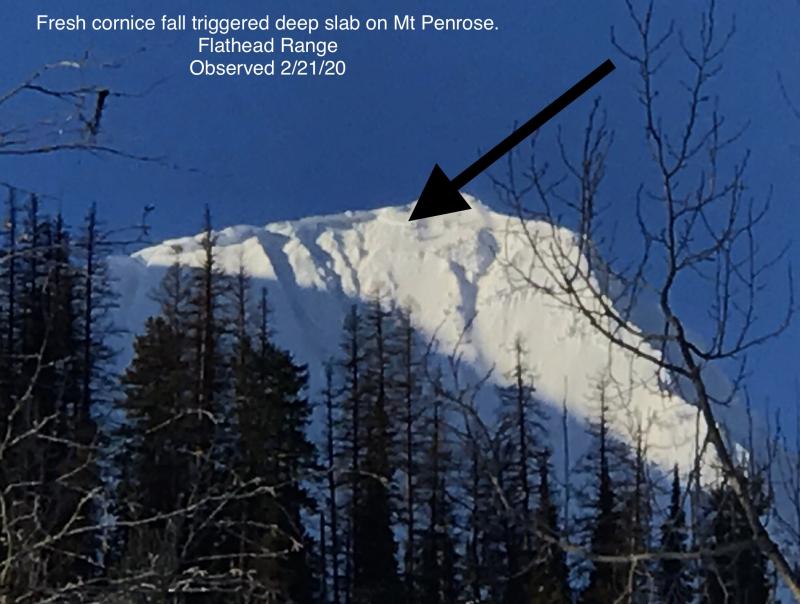
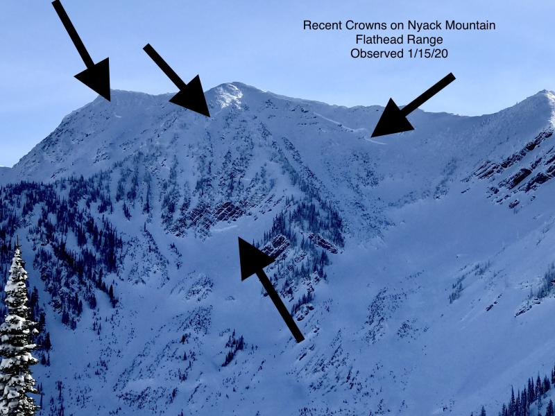
Deep instabilities are also continuing to adjust, although at a slower and more uncertain rate. It has been a wild month for the faceted crusts near the bottom of the snowpack. We saw continous loading with big storm totals during the first half of the month followed by a swing in temperatures from sub-zero in mid-January to spring-like weather for the past week. Loading events and temperature swings have all contributed to deep slab activity, almost entirely in the Flathead Range. Our Snowpack Tracker tool is a great resource for tracking weather and avalanche activity. Deep slab activity peaked in mid-January, during the tail of a continuous loading event (Example A, Example B). Above-freezing temperatures in the past week further shocked the snowpack, causing a few more deep slab releases. The most recent ran on Friday off of Nyack Mountain during a light rain event (See observation). Mid-pack weak layers - the small-grained facets and broken surface hoar grains surrounding crusts - were less developed than our basal weak layers and tend to gain strength quicker when they are in the middle of a thick snowpack. As surface instabilities and mid-pack weak layers are generally healing up under our current weather pattern, the danger remains higher in the Flathead Range because of our lingering concerns for deep slabs. With the much higher frequency of deep slabs in the Flathead Range, careful terrain selection is important at upper elevations today. In the northern portion of the Swan Range that we forecast for, we have yet to observe any deep slab avalanches this month. It has been a different case in the Southern Swan, near Seeley Lake. In the Whitefish Range, the problem is very hard to find: we've seen only a few avalanches break on mid-pack weak layers and one near the ground in the past month from the Northern Whitefish Range. This graphic highlights the pattern quite well. High elevation, northerly and easterly facing terrain in the Flathead Range worries us the most. Elsewhere, the snowpack is generally stable today.
Another quiet day is in store as a weak and fast-moving high-pressure ridge moves over the region. Mountain temperatures are in the upper 20's to low 30's this morning. Winds are calm to light around the forecast area. Snow showers return later this afternoon and continue into the work week, with an uptick in southwest wind speeds tomorrow. The pattern of modest snowfall and unseasonably warm temperatures continues through the rest of the month. Don't give up on winter yet, there looks to be a pattern change towards colder weather right around the time that Punxsutawney Phil emerges from his hole. That rascal.
This forecast applies only to backcountry areas outside established ski area boundaries. The forecast describes general avalanche conditions and local variations always occur. This forecast expires at midnight on the posted day unless otherwise noted. The information in this forecast is provided by the USDA Forest Service who is solely responsible for its content.


