| Saturday | Saturday Night | Sunday | |
|---|---|---|---|
| Cloud Cover: | Overcast | Overcast | Mostly Cloudy |
| Temperatures: | 27 to 32 deg. F. | 21 to 25 deg. F. | 29 to 34 deg. F. |
| Wind Direction: | Southwest | Southwest | Southwest |
| Wind Speed: | 5 to 15, G25 | 2 to 12, G15, increasing PM | 10 to 20, G35 |
| Snowfall: | 0 to 1" in. | 0" in. | 2" to 3" in. |
| Snow Line: | 3500' | 3500' | 3000' |
Whitefish Range
How to read the forecast
The avalanche danger has trended down with today's cooler and quieter weather. Human triggered avalanches are possible on high elevation, leeward slopes. Slabs breaking in recently drifted snow pose a more common threat, while the lingering potential for huge avalanches to fail on old layers near the ground are a rare but much scarier threat. Below yesterday’s rain line, the snowpack is generally stable as long as surfaces remain frozen through the day.

2. Moderate
?
Above 6500 ft.
1. Low
?
5000-6500 ft.
1. Low
?
3500-5000 ft.
- 1. Low
- 2. Moderate
- 3. Considerable
- 4. High
- 5. Extreme
-
Type ?
-
Aspect/Elevation ?
-
Likelihood ?CertainVery LikelyLikelyPossible
 Unlikely
 -
Size ?HistoricVery LargeLargeSmall

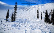
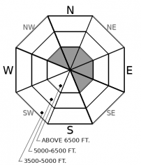
Where recent precipitation fell as snow at upper elevations, southwest winds have drifted it into thicker slabs in leeward and cross-loaded terrain. Observers have reported triggered and natural slabs large enough to injure or bury you during the last few days (example). Because recent wind slabs formed on top of breakable ice crusts, they may be slower to heal than normal (video). Look for and avoid recent drifts below corniced ridgelines. If slabs are capped by a stout surface crust, triggering them is unlikely.
-
Type ?
-
Aspect/Elevation ?

-
Likelihood ?CertainVery LikelyLikelyPossible
 Unlikely
 -
Size ?HistoricVery LargeLargeSmall

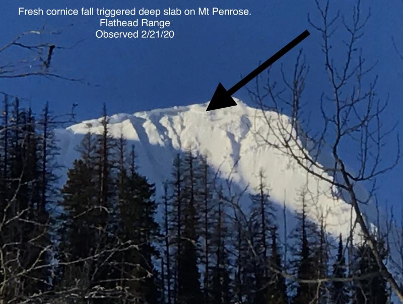
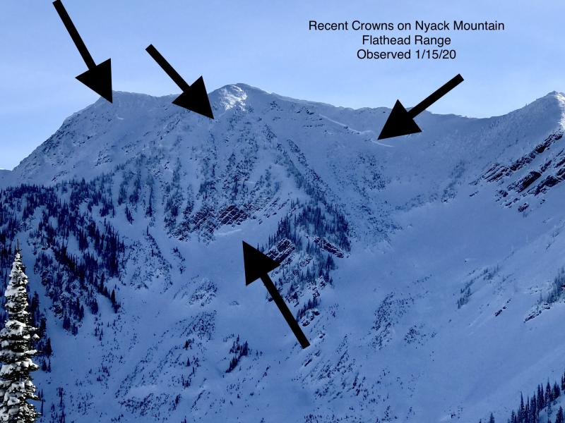
Deeply buried weak layers remain a rare but deadly concern. You might still be able to trigger a deep slab from a shallow or rocky part of the slope, where weak layers are closer to the surface. You can find that kind of variable snow cover on rocky, leeward, alpine terrain, most commonly in the higher peaks of the Flathead Range and Glacier Park. There have been substantially fewer of these destructive slides observed in the Whitefish Range, and none observed in the Swan Range, during the past month. At upper elevations, choose terrain carefully to stay on slopes with uniform snow coverage. Minimize your time in the runouts of suspect slopes just in case a random cornice fall acts as a trigger.
The past week of warm temperatures and rain on snow has had mixed blessings on our snowpack. The good news is that the snowpack continues to consolidate and grow stronger; mid-pack weak layers (the December crusts) are becoming less of a concern and it is becoming increasingly harder to impact weak layers near the ground. The snowpack will be generally stable at mid and lower elevations where surface crusts remain frozen today. Unfortunately, the rain on snow has also narrowed the distribution of soft snow, forcing powder hounds to higher elevations. These are the elevations where the brunt of deep slab avalanche activity has been. The Flathead Range has been the problem child, perhaps because it holds more alpine terrain that harbored early-season faceted crusts. So while we can advertise that the snowpack is stable at low and mid-elevation locations today, we know everyone be hunting for that soft snow up high, right? If that’s the case, choose your terrain carefully. Recently drifted wind slabs should be apparent and relatively easy to avoid with a good eye for surface clues. They'll be obvious from lense-shaped pillows and thicker feeling snow near ridgelines or crossloaded features. Deep slabs don’t give surface clues, nor do I trust a single point stability test when dealing with deep weak layers near the ground. Terrain selection is your best weapon. The flurry of thick, hard slabs that failed in the Flathead Range this month (Example A, Example B), and the few that were observed in the Northern Whitefish Range, have almost all been on leeward, craggy or alpine-looking faces with rocks and variable snow coverage littering their start zones. Shallow spots on the slope, or trigger points, aren’t always obvious or easy to avoid. Although Thursday’s triggered deep slab near Choteau is outside of our forecast area, the photos highlight how the thickness of deep slabs varies across slopes in ways that aren’t readily obvious from the surface. While the odds of triggering one of these slabs is low, stay off of that type of terrain if you don’t want to play a high-stakes game of Russian Roulette. Professional observers yesterday near John F. Stevens Canyon were targeting deep slab instabilities with their stability tests and demonstrated that faceted crusts near the ground can still propagate failures if you collapse the layer from a thin spot. Choose slopes with uniform snow depths, absent of rock bands. There’s still plenty of terrain like that to enjoy the high elevation freshies before scratching your way through the low elevation crusties. Spoiler alert: the atmosphere had the ingredients for another freezing rain event last night at upper elevations, which may jeopardize the potential for soft snow up high. Let us know what you find.
Mountain temperatures have gracefully dropped below freezing last night into the upper 20's. Freezing levels today should hover near 3,500 to 4,000'. Light snowfall and decreasing southwesterly winds are on the menu today. The pattern of unseasonably warm southwest flow continues into next week.
This forecast applies only to backcountry areas outside established ski area boundaries. The forecast describes general avalanche conditions and local variations always occur. This forecast expires at midnight on the posted day unless otherwise noted. The information in this forecast is provided by the USDA Forest Service who is solely responsible for its content.


