| Saturday | Saturday Night | Sunday | |
|---|---|---|---|
| Cloud Cover: | Mostly Cloudy | Mostly Cloudy | Mostly Cloudy |
| Temperatures: | 27 to 32 deg. F. | 16 to 20 deg. F. | 21 to 27 deg. F. |
| Wind Direction: | Southwest | Southwest | Southwest |
| Wind Speed: | 39G74 | 31G68 | 21G39 |
| Snowfall: | 3" to 4" in. | 2" to 3" in. | 1" to 2" in. |
| Snow Line: | 2000' | 1500' | 1000' |
Flathead Range and Glacier National Park
How to read the forecast
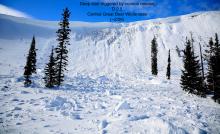
As new snow and winds add stress to the snowpack, concern remains for dangerous avalanches to break 1 to 2 feet deep. As you gain elevation, this problem will become more likely to trigger. Seek wind-sheltered, low angle terrain if you experience blowing snow at ridgelines or collapses and shooting cracks underfoot.

3. Considerable
?
Above 6500 ft.
2. Moderate
?
5000-6500 ft.
1. Low
?
3500-5000 ft.
- 1. Low
- 2. Moderate
- 3. Considerable
- 4. High
- 5. Extreme
-
Type ?
-
Aspect/Elevation ?

-
Likelihood ?CertainVery LikelyLikelyPossible
 Unlikely
 -
Size ?HistoricVery LargeLargeSmall

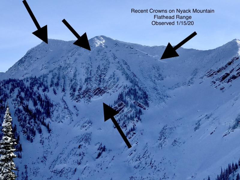
Since the turn of the new year, 12 to 16 inches of snow fell on an array of crusts and persistent weak layers of surface hoar and near surface facets. Slabs 1 to 2 feet thick remain possible to trigger on all aspects, commonly 6000’ and above. Expect these slabs to be thicker and firmer on north through east aspects from wind drifted snow. Evidence of shooting cracks, whumphing collapses, and recent avalanches are all signs to seek terrain less than 35 degrees and to steer clear of being underneath large avalanche paths.
-
Type ?
-
Aspect/Elevation ?
-
Likelihood ?CertainVery LikelyLikelyPossible
 Unlikely
 -
Size ?HistoricVery LargeLargeSmall

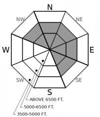
Expect new and drifting snow to build firm slabs up to 6 to 12 inches deep on leeward aspects. With winds gusting up to 70 mph, we can expect slabs to form near ridgelines as well as cross-loaded terrain features further downslope. Signs of drifting snow and pillowy surfaces are your cues to seek wind-sheltered terrain. While fresh wind slabs today should be relatively small, they could get you in trouble if they drag you into a terrain trap or step down to a larger persistent slab avalanche.
-
Type ?
-
Aspect/Elevation ?
-
Likelihood ?CertainVery LikelyLikelyPossible
 Unlikely
 -
Size ?HistoricVery LargeLargeSmall

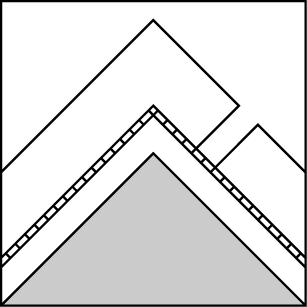
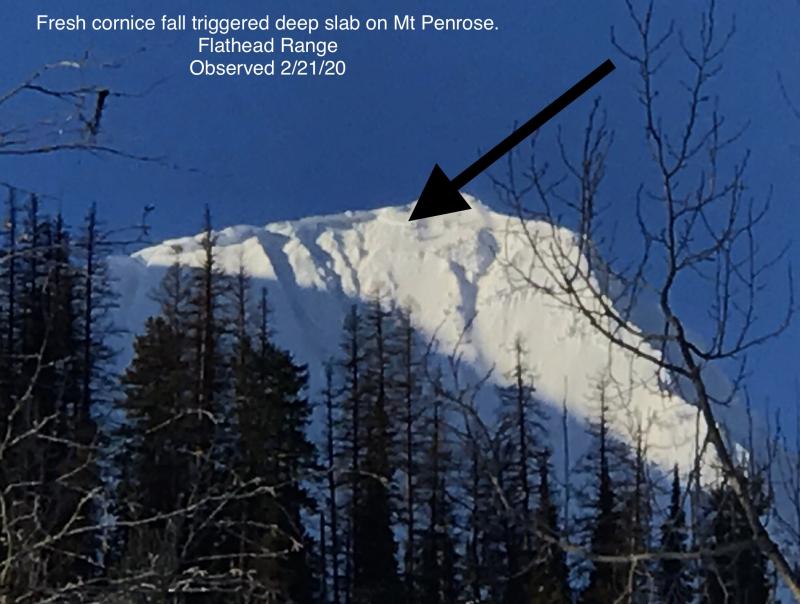
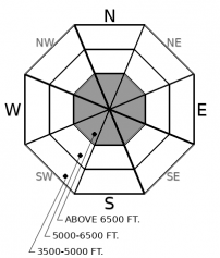
Though we have yet to see this beast show its face since December 20th, we remain nervous about the potential for deep slab avalanches in upper elevation, rocky terrain. Lack of visibility from suspect slopes this week has lowered our confidence on how active deep slabs were from the last loading event. Very large, hard slabs breaking 3 to 5 feet deep are unlikely, but not impossible. Recently, snowpit tests have suggested that some isolated areas still have the potential to propagate failures on deeply buried weak layers near the ground. If triggered, these avalanches would be difficult to impossible to survive. Give yourself a wide margin for error if your travels take you into the upper elevations of Flathead and Glacier National Park where deep persistent weak layers have been more reactive this season.
As winds gust up to 70 mph today, newly wind drifted snow will add more stress to a tricky snowpack that harbors well-developed persistent weak layers from Christmas Eve and New Year’s Eve. On January 1st, riders from around our region reported touchy avalanche conditions as they remotely and intentionally triggered slab avalanches breaking on surface hoar, near-surface facets, and crusts that developed over the holiday week. Yesterday, Zach was still able to trigger a few slabs on steep test slopes, highlighting that these issues are slow to heal (observation). Here is a list of observations based on location: Whitefish, Swan, Glacier National Park-Lake McDonald area, Glacier National Park-John F. Stevens Canyon. The surface hoar and near-surface facets act as a weak, collapsable layer, where crusts act as a slick bed surface. This is a dangerous combination that has the potential to stick around for weeks to months.
You may notice that we have moved Deep Persistent Slab to encompass only the Flathead Range and Glacier National Park. The Deep Persistent Slab problem is becoming increasingly isolated and more difficult to trigger but remains most concerning in the highest elevations in larger, alpine start zones. Our season history shows that avalanches involving deeply buried weak layers from October and November are more common in Flathead and Glacier National Park. The issue appears to be less of a concern in the Whitefish and Swan Ranges, but not completely out of the question.
If you want to get caught up in two minutes about what happened this week, here is a link to the weekly update.
Today expect new snow accumulations to reach up to 3 to 6 inches in areas of the Whitefish Range and 2 to 4 in the Swan, Flathead, and Glacier National Park. Winds will be strong out of the southwest with gusts as high as 75 mph. Temperatures will be hovering around freezing.
This forecast applies only to backcountry areas outside established ski area boundaries. The forecast describes general avalanche conditions and local variations always occur. This forecast expires at midnight on the posted day unless otherwise noted. The information in this forecast is provided by the USDA Forest Service who is solely responsible for its content.


