| Friday | Friday Night | Saturday | |
|---|---|---|---|
| Cloud Cover: | Mostly Cloudy | Mostly Cloudy | Mostly Cloudy |
| Temperatures: | 22 to 34 deg. F. | 13 to 22 deg. F. | 18 to 31 deg. F. |
| Wind Direction: | West | West | West |
| Wind Speed: | 14-20G40 | 8-12G29 | 5-9G24 |
| Snowfall: | 5" to 8" in. | 0" to 2" in. | 0" to 2" in. |
| Snow Line: | 2500' | 2000' | 1500' |
Flathead Range and Glacier National Park
How to read the forecast
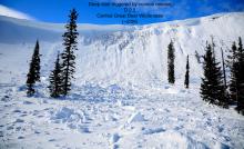
Very dangerous avalanche conditions have developed. Avoid riding on or under slopes steeper than about 30 degrees. New and drifted snow are creating slabs 1 to 2 feet thick that can be easily triggered by a rider or can release naturally. The storm snow is also overloading weak layers buried deeper in the snowpack, so avalanches can break well below Wednesday's snow surface, creating the potential for large, long-running avalanches.

4. High
?
Above 6500 ft.
4. High
?
5000-6500 ft.
1. Low
?
3500-5000 ft.
- 1. Low
- 2. Moderate
- 3. Considerable
- 4. High
- 5. Extreme
-
Type ?
-
Aspect/Elevation ?

-
Likelihood ?CertainVery LikelyLikelyPossible
 Unlikely
 -
Size ?HistoricVery LargeLargeSmall

Intense snowfall and thick slabs of new and drifted snow have created dangerous avalanche conditions that will continue through today. Avoid being on or under slopes steeper than about 30 degrees. That includes the runouts of avalanche paths that start well above you, even if they're brushy. Terrain traps like steep-walled gullies will also be dangerous. Shooting cracks and natural avalanches are clear signs of today's danger.
-
Type ?
-
Aspect/Elevation ?

-
Likelihood ?CertainVery LikelyLikelyPossible
 Unlikely
 -
Size ?HistoricVery LargeLargeSmall

New and drifted snow are overloading weak layers buried deep in the snowpack, a foot or more below Wednesday's snow surface. Any avalanches that break on these layers will have crowns several fet thick and involve surprisingly large amounts of debris. You can trigger avalanches that break on these layers from long distances, and natural avalanches can run from upper elevation start zones near ridges to mid elevation runouts. Avoid avalanche terrain - any slope steeper than about 30 degrees, or any terrain below start zones that steep.
-
Type ?
-
Aspect/Elevation ?
-
Likelihood ?CertainVery LikelyLikelyPossible
 Unlikely
 -
Size ?HistoricVery LargeLargeSmall

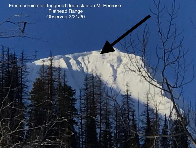
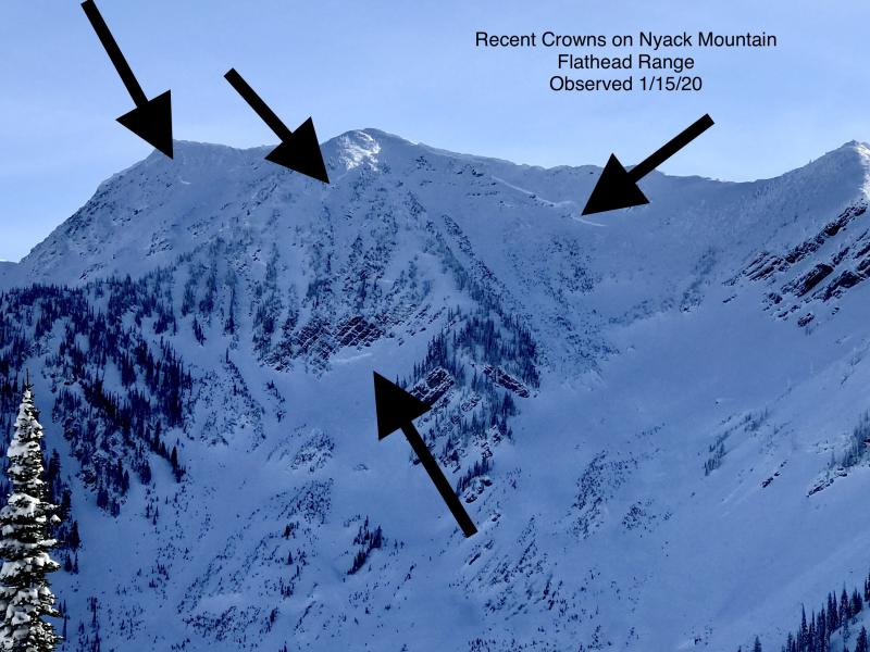
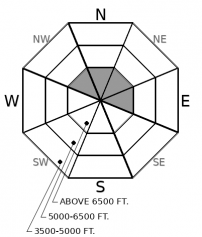
Ooof. The nightmare under the bed. Each significant storm of the past few weeks has produced large and very large avalanches that broke near the ground in the Lake McDonald area and possibly the higher parts of the Flathead range. Nothing suggests anything will be different this round. No one wants to meet a nightmare. Avoid their habitat: large avalanche paths and open bowls on the east side of the Flathead crest and below that peaks in the Lake McDonald area. That includes runouts well below upper elevation start zones, where it's possible to get hit by debris from slides starting near ridges.
Snowfall has favored the southern part of our forecast region so far, though we have little snowfall data for the Flathead Range and the Lake McDonald area areas. Mid and upper elevation areas have seen over an inch of Snow Water Equivalent since early Thursday, and 8-18" of new snow. Winds have been gusty out of the southwest, with average wind speeds in the low teens. They've been most sustained at or near ridgelines, with active loading and small triggered avalanches reported Thursday. Snowfall is forecast to continue into this afternoon before tapering off, with the southern parts of our forecast region still favored. Winds also look to be moderate to strong from the southwest before dimishing this afternoon. It looks as if wind speeds capable of significantly drifting snow will be confined to upper elevation terrain.
The accumulating new and drifted snow makes triggering avalanches today very likely at upper elevations throughout our forecast region, with natural avalanches likely in steep, leeward starting zones near ridges. These slides can break 1 to 2 feet deep at or near the old snow surface, which means they'll involve more than enough snow to bury or injure you or your friends. And they'll be enough debris from large avalanches that release near upper elevation ridges to run down into mid elevation tracks and runouts. To avoid triggering a slide involving recent storm snow, avoid being on or under slopes steeper than about 30 degrees. That includes the runouts of large avalanche paths that start well above you near ridgelines, particularly in the Swan and Flathead ranges, and the Lake McDonald area of Glacier National Park.
The accumulating new and drifted snow is also activating weak layers buried earlier this season, creating the potential for larger, more dangerous avalanches that propagate long distances and can be triggered from below or from adjacent slopes. The buried weak layers include surface hoar (buried 11/23), facets around crusts (a rain crust buried 11/19) and, in Glacier National Park and the Flathead Range, crusts buried in late October. Avalanches on these layers won't be as widespread, but their size and the fact that they can be triggered from long distances makes them especially dangerous. Avoid being in the runouts of large avalanche paths, even if they're full of brush and only a little snow. The debris from these slides can easily overrun these areas. Keep it simple; stay out from under steep slopes that can harbor the buried weak layers.
Snowfall will continue this morning before tapering off this afternoon. The storm will continue to favor the southern part of our forecast region. Winds will be moderate from the southwest with stronger gusts before diminishing later today. The strongest winds will be confined to upper elevation terrain, with occasional mixing to mid elevations.
This forecast applies only to backcountry areas outside established ski area boundaries. The forecast describes general avalanche conditions and local variations always occur. This forecast expires at midnight on the posted day unless otherwise noted. The information in this forecast is provided by the USDA Forest Service who is solely responsible for its content.


