| Thursday | Thursday Night | Friday | |
|---|---|---|---|
| Cloud Cover: | Mostly Cloudy | Mostly Cloudy | Overcast |
| Temperatures: | 26 to 33 deg. F. | 18 to 24 deg. F. | 22 to 28 deg. F. |
| Wind Direction: | Southwest | Southwest | Southwest |
| Wind Speed: | 20 to 25 gust to 50 | 15 to 20 gust to 40 | 15 to 20 gust to 35 |
| Snowfall: | 4" to 6" in. | 6" to 9" in. | 3" to 6" in. |
| Snow Line: | 3500' | 3000' | 2000' |
Flathead Range and Glacier National Park
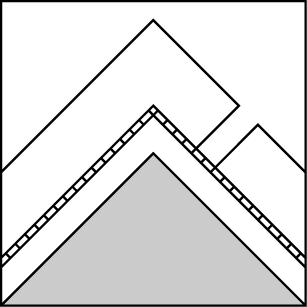
How to read the forecast
As new and wind-drifted snow accumulate today and tomorrow, the avalanche danger will rise. The danger will be two-fold: freshly-formed slabs that break at the old snow surface, and larger slides that break on deeply buried weak layers. Both dangers will be more widespread and more consequential at upper-elevations. Stick to slopes less than 30 degrees at mid-elevations to get good riding with less exposure to these dangers.

2. Moderate
?
Above 6500 ft.
2. Moderate
?
5000-6500 ft.
1. Low
?
3500-5000 ft.
- 1. Low
- 2. Moderate
- 3. Considerable
- 4. High
- 5. Extreme
-
Type ?
-
Aspect/Elevation ?
-
Likelihood ?CertainVery LikelyLikelyPossible
 Unlikely
 -
Size ?HistoricVery LargeLargeSmall

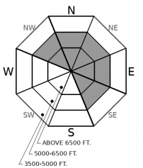
You can trigger slides large enough to bury or injure you on steep slopes where more than about 8 inches of new and drifted snow has accumulated. You'll find good riding with less danger on slopes that don't meet those conditions, so use that inclinometer and ruler diligently today. Cracking around your boards or machines indicates that the fresh snow has formed cohesive slabs that can break at the old snow surface. If your group rides steep slopes, keep your partners in sight from spots that aren't exposed to slides from above. Avoid being under start zones near ridgelines where you see blowing snow.
-
Type ?
-
Aspect/Elevation ?

-
Likelihood ?CertainVery LikelyLikelyPossible
 Unlikely
 -
Size ?HistoricVery LargeLargeSmall

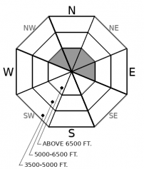
As new and drifted snow accumulates, it will up the chances of triggering slides that break several feet deep, propagate long distances, or release on nearby slopes. Whumpfing collapses are a no-doubt-about-it sign of this development. But since you may not get that warning, avoid being on or under steep slopes. It's the most reliable way to reduce your exposure to dangerous surprises. The buried weak layers of concern include surface hoar (buried 11/23) and facets above the mid-November rain crust (buried 11/19). Both of these layers are obvious if you dig into the snow. The first appears as a thin grey stripe; the second a hard icy crust.
-
Type ?
-
Aspect/Elevation ?
-
Likelihood ?CertainVery LikelyLikelyPossible
 Unlikely
 -
Size ?HistoricVery LargeLargeSmall

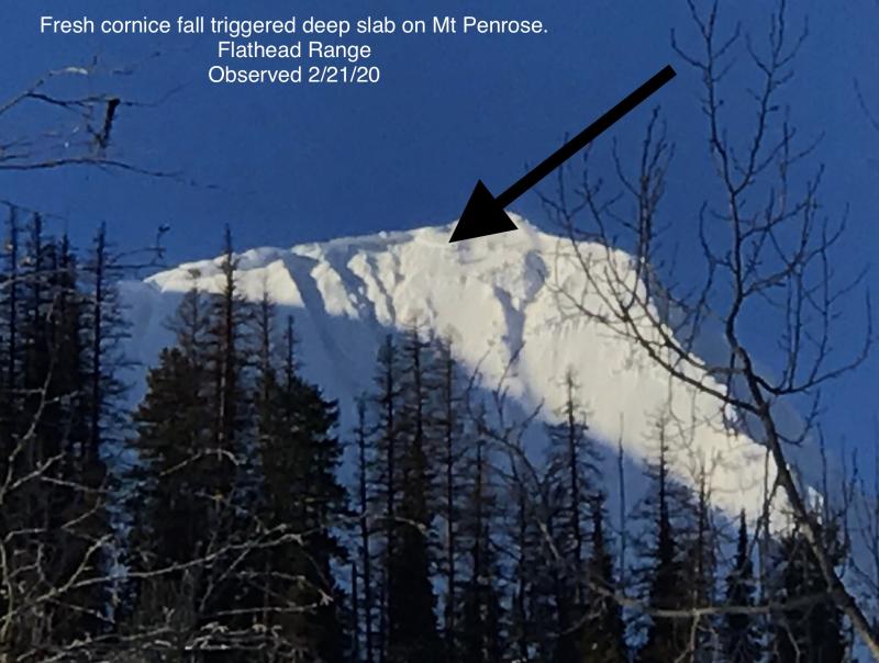
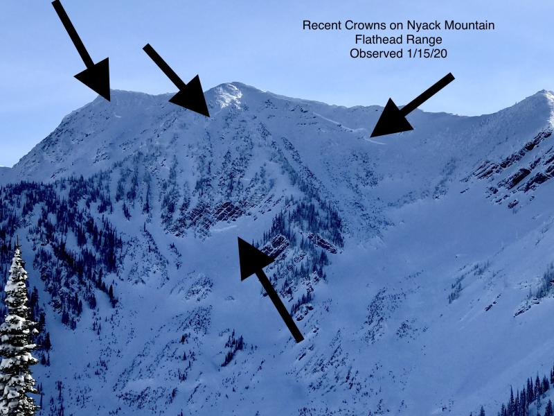
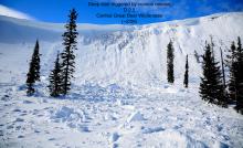
Approach steep, northerly slopes above treeline with a healthy dose of caution. Very large natural avalanches have run in this terrain as recently as Sunday. They've failed on a crust buried in late October. As new and drifted snow thicken the slabs above this crust, the likelihood of triggered and natural slides rises. These slides can run down to mid elevations, so avoid the bottoms of large, open bowls and avalanche paths with upper-elevation start zones.
Good news, bad news as we enter a few days with significant snow forecast for the mountains. The good news is the snow, which is much needed. The bad news is that as the new snow accumulates, the avalanche danger will rise, particularly on slopes where drifted snow helps form thicker, more cohesive slabs. The rising danger is two-fold. The immediate concern is newly-formed slabs that break at the interface with old snow. The second is the increasing likelihood of triggering avalanches that break deeper in the snowpack, on weak snow deposited in November or even October.
The first danger will be more immediate, more obvious, and easier to manage. Pay attention to new snow amounts; stop and assess when you encounter slopes steeper than about 30 degrees with more than about 8 inches of new and/ or drifted snow. If the snow is dense and cohesive and cracking around you as you travel, you've found reactive slabs. Short steep slopes that aren't above terrain traps can be safe spots to test how these slabs react to your weight or the weight of your snow machine. Fresh slides involving the recent snow are clear signs of instability and danger. This problem will develop first on leeward slopes at upper elevations - northerly and easterly slopes near ridgelines and summits. As new and drifted snow accumulate today, tonight, and tomorrow, the slabs will become more widespread, more sensitive to a rider's weight, and produce larger avalanches.
The danger of triggering slides that break on deeply buried weak layers will also increase as new and drifted snow accumulate. This danger will likely be less obvious, however. Whumpfing collapses on low-angled slopes are unambiguous evidence that you can trigger slides that break well below the old snow surface on steeper slopes. You may not, however, get such clear warnings, so the most straightforward way to reduce your exposure to this lurking danger is to avoid traveling on or under slopes steeper than about 30 degrees that face north through east. If your risk tolerance is higher, avoid slopes steeper than about 35 degrees with likely trigger points - convexities where the slopes steepens and rocky areas where slabs may be thinner and the buried weak layers closer to the surface. Keep in mind that you can trigger these slides from below or from adjacent slopes, so it'll take diligent attention to avoid exposing yourself and your friends to slides that break above you.
We recently installed a new wind and temperature station on Mt. Aeneas in the Swan Range. The link to the data is here, and we will be incorporating it into our weather station maps and tables soon. This is another great resource for trip planning and assessing avalanche conditions.
Expect several rounds of snow accompanied by moderate to strong ridgetop winds today and Friday. The most intense snowfall will be this morning and tonight. Gusty southwesterly winds will accompany the snowfall, though they may not mix down much below ridgetops. A cold front arriving tonight will lower snow levels tomorrow.
This forecast applies only to backcountry areas outside established ski area boundaries. The forecast describes general avalanche conditions and local variations always occur. This forecast expires at midnight on the posted day unless otherwise noted. The information in this forecast is provided by the USDA Forest Service who is solely responsible for its content.


